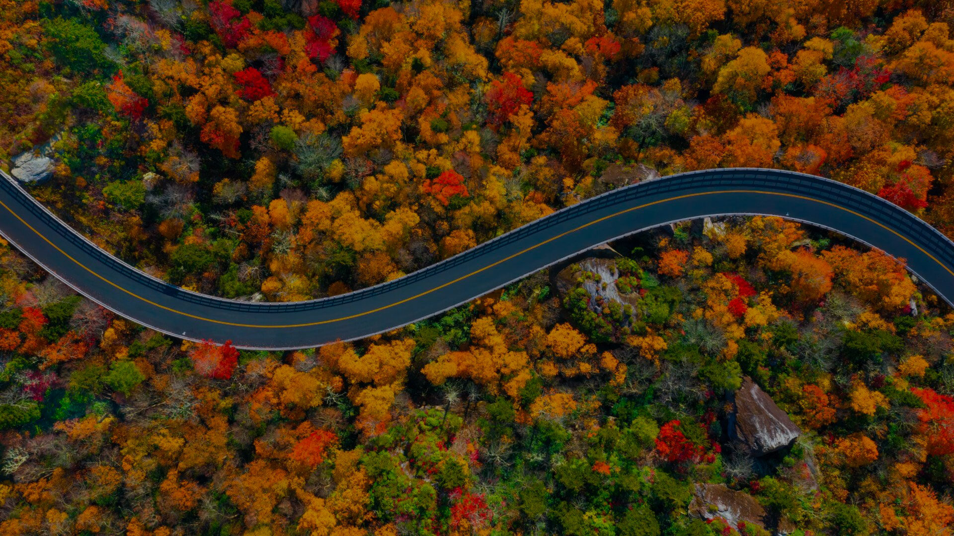
A drive on the Blue Ridge Parkway is equal parts journey and destination. Built on the spine of the Blue Ridge Mountains, the 469-mile-long road carries travelers between two of the United States’ most popular national parks—Shenandoah in the north and Great Smoky Mountains in the south—but it’s also an attraction in its own right. “America’s Favorite Drive” is also the nation’s favorite park, visited by more than 15 million people annually, most of whom take at least a few days to hike, camp, explore historic sites, and linger at hundreds of roadside scenic overlooks offering majestic views of mountains, valleys, rivers, and distant horizons.
Everything you need to know about a Blue Ridge Parkway road trip

Download the mobile app to plan on the go.

Share and plan trips with friends while discovering millions of places along your route.
Get the AppThe Blue Ridge Parkway can be a destination all its own or a critical link in a vacation that also takes in Shenandoah National Park and/or Great Smoky Mountains National Park. Driving the length of the parkway in either direction is often planned as a weeklong adventure, but it’s also relatively easy to experience it in segments if you have only a few days, or if your patience for driving on winding mountain roads is limited.
The park passes through two major cities, Roanoke, Virginia, and Asheville, North Carolina, which are popular intermediate starting points for visitors. There are literally hundreds of roads that intersect the parkway, including Interstate 64 (the north terminus); I-584/U.S. Route 220 in Roanoke; I-77 near Fancy Gap, Virginia; U.S. Route 221 near Blowing Rock, North Carolina; and I-40 and I-26 near Asheville. I-81 also runs parallel to the Blue Ridge Parkway for much of its length, with connections to numerous park access points.
Nine park visitor centers are situated along the course of the parkway, so you don’t usually have to drive more than an hour or so before you can stop to get information from park rangers and staff.
Our favorite attractions
Mabry Mill: Being old and quaint may make Mabry Mill the most photographed (and Instagrammed) place on the Blue Ridge Parkway, but it’s also an important reminder that people lived and worked in these mountains long before the tourists arrived. The pondside mill and blacksmith shop built in 1908 by Ed and Lizzy Mabry, just steps from the parkway at milepost 176, is the setting for popular mountain music performances; a neighboring restaurant serves down-home food and—appropriate to the setting—is known for its cornmeal pancakes.
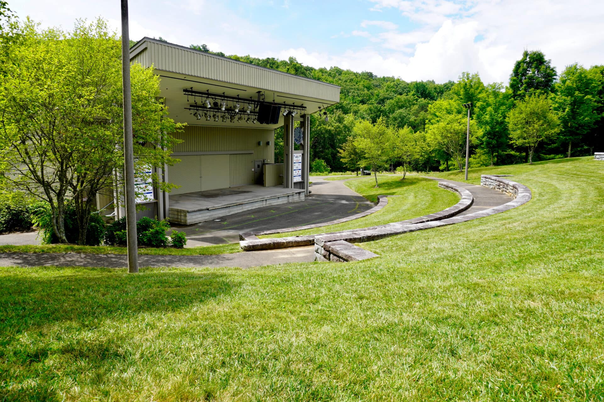
Blue Ridge Music Center: Bluegrass and rootsy Americana bands take the stage at this open-air music venue close to the Virginia–North Carolina border at milepost 213. Tickets are required for evening performances, held Memorial Day to Labor Day, but daily Midday Mountain Music shows are free. During intermission, check out the visitor center’s exhibit Roots of American Music, or take a hike on the 1.35-mile High Meadow Trail or the 2.25-mile Fisher Peak Loop, which both start here.
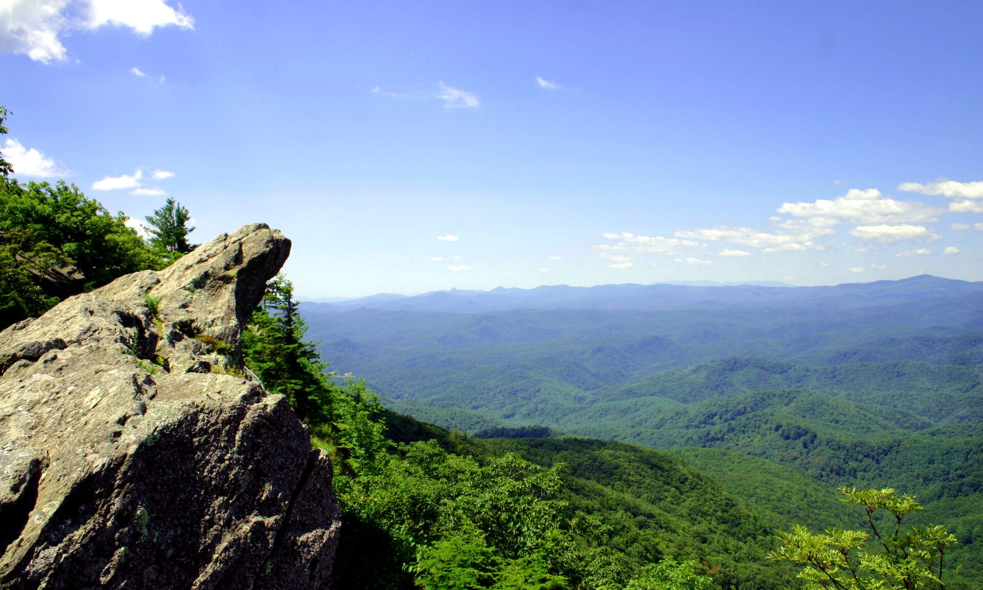
Blowing Rock: A site so spectacular it got an entire town in North Carolina named after it, Blowing Rock at milepost 290 is a Lion King–like ledge hanging more than 4,000 feet above John’s River Gorge. The breezy location has been a famous tourist attraction since the 19th century, delighting generations of visitors who attempt to throw light objects into the gorge, only to have them blown back into their faces. The town is less bizarre: Just 5 minutes from its namesake, Blowing Rock’s compact downtown is full of small shops and restaurants.
Linville Falls: The Linville Falls Visitor Center at milepost 316.4 is the gateway to a series of short trails ending in vantage points over Linville Falls, where cascading waterfalls drop into a deep gorge. Hiking less than 2 miles on the Linville Falls Trail gives visitors the opportunity to view the falls from several elevated angles, while the more challenging 1.75-mile Plunge Basin Trail leads to a natural pool at the base of the waterfall.
Folk Art Center: The Southern Highland Craft Guild’s Folk Art Center in Asheville, North Carolina, has an extensive gallery of Appalachian arts and crafts, including everything from woven textiles to wooden bowls, plus furniture and other home goods for sale made by guild members. Live craft demonstrations cover such diverse skills as quilting, woodturning, and broom making. Located at milepost 382.
Blue Ridge Parkway history
The Blue Ridge Parkway was originally conceived as a southern extension of Skyline Drive, which bisects Shenandoah National Park and was completed in 1933. It would take more than half a century to achieve the goal of building the park-to-park highway connecting Skyline Drive to the entrance of Great Smoky Mountains National Park; by the time it was completed, the Blue Ridge Parkway became an attraction that in many ways surpasses the popularity of the parks it connects.
The Blue Ridge Mountains run from Pennsylvania to Georgia and are part of the Appalachian Mountain chain. They’re named for the bluish haze that covers their summits, caused by trees releasing a gas called isoprene to protect themselves from the summer heat. The 500-million-year-old mountain chain has been worn down by time, but some peaks still rise dramatically from the landscape: The high point on the Blue Ridge Parkway, on Richland Balsam mountain, is 6,053 feet above sea level. Mount Mitchell, the highest peak in the eastern United States at 6,684 feet, is adjacent to the parkway in North Carolina’s Mount Mitchell State Park.
Work began on the Blue Ridge Parkway in 1935, when the first segment of road was laid out near Cumberland Knob, North Carolina—but as late as the 1950s the parkway was only half finished. A major campaign to complete construction got underway in the 1960s, when all but 7.7 miles of the planned route was opened.
Construction had withstood political pressure by Asheville officials, who successfully lobbied for the route to be shifted away from Tennessee to pass through their North Carolina mountain town; delicate negotiations with the Eastern Band of Cherokee Indians for a right-of-way through 15 miles of tribal land; and all the challenges of building a roadway across mountaintops.
The job wasn’t done until 1987, when the final segment of the road was completed at Grandfather Mountain in North Carolina, where the Linn Cove Viaduct was built to allow through traffic while protecting the local environment. When the Blue Ridge Parkway was finally completed, engineers had built 168 bridges, six viaducts, and 27 tunnels to bring the road up, over, and under the Blue Ridge Mountains from Virginia to North Carolina.
A Blue Ridge Parkway road trip by segments
Virginia: Ridge Region, milepost 0 to 106
The end of Shenandoah National Park’s Skyline Drive connects directly with the beginning of the Blue Ridge Parkway at milepost 0. Park visitors will almost immediately be distracted by some great hiking opportunities, starting with the long-distance views from Humpback Rocks at milepost 5.8, where there’s also a visitor center and museum about rural mountain farms. The combined George Washington and Jefferson National Forests include a beach, hiking, fishing, and camping at Sherando Lake at milepost 13.1, a popular stop for RVers.
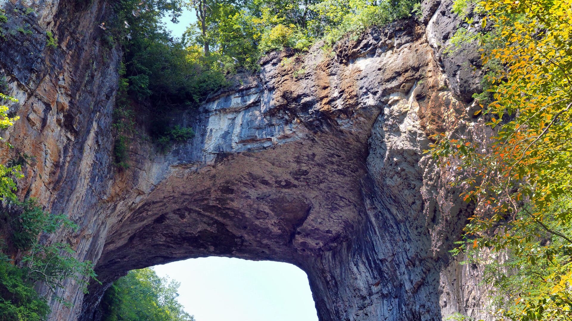
Thomas Jefferson once owned what’s now known as Natural Bridge State Park at milepost 61.6, whose namesake is a rather spectacular 90-foot-long, 215-foot-high limestone span over Cedar Creek. The Peaks of Otter (milepost 85.6) has a visitor center, a historic lakeside lodge and restaurant, a campground with RV hookups, and a nature center. The area serves as a base for six hiking trails, including the challenging but rewarding 1.5-mile climb to the summit of Sharp Top.
Virginia: Plateau Region, milepost 106 to 217
This segment of the Blue Ridge Parkway rises above Roanoke Valley, where you’ll find the Mill Mountain Star, an illuminated landmark perched atop a 1,000-foot peak that you can hike to. (Mill Mountain Parkway connects at milepost 115). This road also leads to Virginia’s Explore Park, a state-run recreation center with zip lines, a treetop aerial park, hiking, disc golf, and paddling; the park campground has primitive tent sites, cabins, yurts, and RV sites.
The Plateau Region includes the aforementioned Mabry Mill (milepost 176) and Blue Ridge Music Center (milepost 213). Before you reach the mill, however, you’ll pass through Rocky Knob Recreation Area (mileposts 167–174), a 4,800-acre natural area that offers exceptional hiking, like the Rock Castle Gorge National Recreation Trail, a 10.8-mile loop trail leading to a backcountry campground at the bottom of a deep gorge. The campground here has 81 tent and 28 trailer sites.
North Carolina: Highlands Region, milepost 217 to 340
Crossing over the North Carolina border you’ll come to Cumberland Knob (milepost 217.5), where the Blue Ridge Parkway began, the site of a picnic area and hikes to the top of 2,285-foot Cumberland Knob and to the cascades and waterfall on Gully Creek. At Doughton Park (milepost 238) you can stroll around the meadows surrounding the historic Brinegar log cabin, part of a farmstead dating to 1889, or get more of a workout on the 30 miles of hiking trails in the area. The rustic campground at Cumberland Knob has been around since the 1930s and has tent and RV sites; The Bluffs Restaurant is nearly as old, and serves fried chicken and other homestyle favorites at a long, diner-style counter.
The town of Blowing Rock, with its blustery scenic overlooks and village-like commercial district full of art galleries and local eateries, is right on the parkway at milepost 290; take U.S. Route 221 north from here to reach Boone, a mountain town that plays up its frontier heritage—it was named after Daniel Boone. After crossing the 1,243-foot Linn Cove Viaduct (the final piece of the parkway to be finished), you’ll pass Linville Falls (milepost 305), one of our favorite sites on the parkway, before pulling into the tiny town of Little Switzerland. This historic summer colony has its main street on the parkway at milepost 334, including a friendly General Store and Switzerland Cafe (known for barbecue, not fondue). Switzerland Inn has been welcoming guests with chalet-style lodging since 1910.
North Carolina: Pisgah Region, milepost 340 to 469
When the rhododendrons are in their spring bloom there’s no more beautiful place on the parkway to be than Craggy Gardens, which has flower-strewn trails to rugged crags and the top of 5,892-foot Craggy Pinnacle. The visitor center is at milepost 364.5. Mount Mitchell is even higher: At 6,684 feet above sea level, it’s the loftiest peak east of the Mississippi River. Mount Mitchell State Park is at milepost 355.4; the park has climbing routes to the summit, but visitors can also drive to within a quarter mile of the top.
The Folk Art Center at milepost 382 is just one of the highlights of Asheville, a diverse city with a lively arts district and food scene that’s about equally known for art deco architecture and breweries. The Parkway Visitor Center (milepost 384) provides comprehensive information on the Blue Ridge Parkway and other regional attractions, like the half-million-acre Pisgah National Forest, a vast landscape of hardwood forest. At milepost 384.7, a wooden walkway leads to the top of Chimney Rock, a 1,200-foot monolith offering endless views of Hickory Nut Gorge, Lake Lurie, and the mountains.
Brevard, at milepost 411.8, is set in the center of Transylvania County; it’s known not for bloodsuckers but waterfalls (the county has more than 250 of them). Use the same exit to get to Mount Pisgah, where hiking trails follow old hunting paths used by rich friends of the Vanderbilts, who built the opulent Biltmore Estate in Asheville. The lodge here is the only one on the parkway in North Carolina. After passing the highest point on the Blue Ridge Parkway at Richland Balsam, you’ll reach Waterrock Knob (milepost 451.2), which has the park’s highest-elevation campground. Get up early to watch the sun rise over the mountains before checking out the town of Sylva, a popular spot for fly fishing.
Milepost 469 and the Oconaluftee Visitor Center mark the end of the Blue Ridge Parkway (or the beginning, depending on which way you’re going). The visitor center actually serves Great Smoky Mountain National Park, which lies south of this point on Newfound Gap Road. Be sure to put aside some time to explore the nearby town of Cherokee, located on the lands of the Eastern Band of the Cherokee Nation. Attractions include the Qualla Arts and Crafts Mutual, the Oconaluftee Indian Village, and summer productions of Unto These Hills, an outdoor drama that tells the story of the Cherokee people.
Frequently asked questions
Where does the Blue Ridge Parkway begin and end?
The north end of the parkway begins in Rockfish Gap near Waynesboro, Virginia, where it intersects with I-64 as well as Skyline Drive, which follows the ridgeline of the Blue Ridge Mountains another 105 miles north into Shenandoah National Park. The parkway ends at milepost 469 near Cherokee, North Carolina, where it connects with Newfound Gap Road (U.S. Route 441), the main southern entrance to Great Smoky Mountains National Park.
How long does it take to drive the Blue Ridge Parkway?
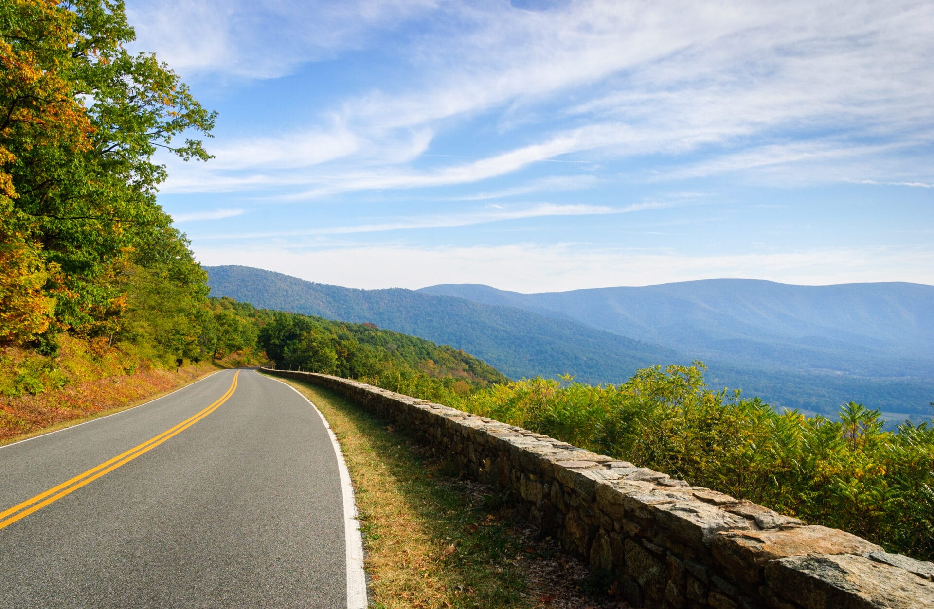
Driving the Blue Ridge Parkway is an experience to be savored, not sped through. The speed limit on the parkway is 45 mph, and drops to 25 or 35 mph in more twisting and turning stretches, which are many. In theory, you could drive the parkway in a day, but that’s only if you’re not tempted to pull over at any of the more than 280 scenic overlooks along the way. Most visitors take their time to stop and take it all in, spending three days to a week to complete the journey.
How much does the Blue Ridge Parkway cost?
There are no tolls or entrance fees to drive the Blue Ridge Parkway. However, fees are charged for visitors who want to stay in any of the eight campgrounds along the parkway.
How many miles is the Blue Ridge Parkway?
The parkway is 469 miles long, running generally northeast to southwest through western Virginia and North Carolina.
What is the best way to travel the Blue Ridge Parkway?
Most visitors to Blue Ridge Parkway travel by automobile, though the road is also popular among motorcyclists. RVs are permitted on the parkway, though inexperienced drivers may find the twisty, two-lane road and steep uphills and downhills a challenge.
Bicyclists who are up for a challenge can also ride the Blue Ridge Parkway, but be aware that there are no designated bike lanes, and that you’ll face more than 48,000 total feet of elevation gain whether you begin at the north or south end of the road. Segments of the parkway are paralleled by hiking trails, including the Appalachian Trail, but walking from beginning to end would require lots of on-road walks and thus is rarely attempted.
What is the best time of year to drive the Blue Ridge Parkway?
Fall foliage season is a spectacular explosion of color in the Blue Ridge Mountains, making October (or whenever the trees hit their fall peak) one of the most popular times of year to visit. June through August is also busy; May and September are often the best bets for enjoying good weather and encountering fewer people. Winter and early spring are quietest, but also can bring snow, poor driving conditions, and occasional road closures, and many park facilities are closed in the off season.
What are the driving conditions on the Blue Ridge Parkway?
In a word, slow. The speed limit is low, the road is serpentine, and other drivers are constantly slowing down to eyeball the local sights or pull into scenic turnouts, campgrounds, and other attractions. Drivers also need to keep an eye out for deer and other wildlife crossing the road, especially in early morning and at dusk.
Poor weather, including spring and summer rainstorms and winter snow, can slow travel to a crawl—you’re driving on top of a mountain chain, after all. Roads are minimally maintained in winter, so closures are not uncommon.
The parkway has a number of steep grades, limited sight lines, and uneven-radius turns the likes of which you won’t find on a more modern highway.
On the plus side, highly visible mileposts serve as great reference points for travelers, making it very hard to get lost as long as you stay on the main parkway. The mileposts, commonly used to identify attractions in the park, are particularly important for navigation, since GPS coverage is notoriously spotty.
Is it better to go north or south on the Blue Ridge Parkway?
Since milepost 0 is at the north end, and it’s closer to more big population centers, a lot of people drive the parkway north to south. The truth, however, is that the scenery is great—and the sights identical—no matter which direction you drive.
Written by Robert Curley


Plan Your Trip Now
Discover the most incredible people, places, and experiences worth the detour. Click below to start your trip to Blue Ridge Parkway or enter a starting point.Click below to start your trip from to Blue Ridge Parkway.