


Walk The Yorke
With over 500km of walking and cycling trails on offer, you won’t have a shortage of trails to pick from when you visit Yorke Peninsula. An achievable yet substantial day walk is the 20.5km stretch from Gleesons Landing to Corny Point. Starting from Gleesons Landing campsite, this trail alternates between a rough and ready walking track and sections where you’ll be walking on soft-sand beaches.
This section of the Yorke Peninsula is known for it’s epic swells of up to 5 meters so get ready to see some talented local surfers in action. Daly Head is renowned for its waves and is one of Australia’s 16 National Surfing Reserves. As well as the surfers, you’re also likely to see dolphins catching waves and sea lions on the shoreline.
When you reach Corny Point Lighthouse, built in 1882, you’ll know it’s nearly time for a cold beer. The walk finishes right around the corner from the lighthouse at Corny Point township where we recommend heading straight for a drink and meal at Howling Dog Tavern. There’s a caravan park and holiday homes available for rent if you want to stay a night before returning to Gleesons Landing.

The Barossa Trail
For those who like their day walks with a side of great wine and rustic food, the Barossa Trail is for you. Linking Northern and Southern Barossa, this 40km stretch winds along North Para River and past some of the finest wine and food producers in the region. Head out on the 7km section between Angaston to Nuriootpa for a leisurely day walk where you can spend more time sampling wine at the cellar door than in the outdoors.
The walk begins in Angaston, home to some amazing cafes, cellar doors, a cheesemaker and an Italian cooking school. From here it’s a easy walk down to Nuriootpa where you’ll be treated to panoramic views over the valley floor and acre upon acre of rolling vineyards. Just off the path you’ll find beautiful display gardens at the Barossa Bushgardens native plant nursery, Mengler Hill Sculpture Park and the Barossa Farmers Market (held every Saturday morning).

The Riesling Trail
You definitely won’t be short of a glass of wine along this 33km trail in the Clare Valley. Originally a railway line connecting Adelaide and Spalding that was shut down in 1983, the trail was rejuvenated as a recreational cycling and walking track in 1994 by a group of locals.
Start off at the restored Auburn Railway station building which is now home to Mount Horrocks Wines. You’ll then follow the trail through the countryside, overlooking many vineyards, before reaching your next cellar door in the small township of Leasingham. Expect more wine tastings as you pass through Watervale, Penwortham and Sevenhill. If you taste a wine you love, ask if you can get a case transported to your accommodation. As well as vineyards, there are plenty of cafes and quaint countryside pubs dotted along the way to keep you going.
We recommend stopping for lunch at Shut the Gate wines in Watervale where you can pick and choose what goes into your own picnic basket from a variety of local produce.

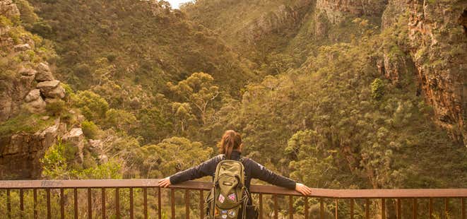
Hidden Gorge loop walk
Discover the ever-narrowing Hidden Gorge and take in panoramic views from Battery Ridge on this full-day 18km circuit walk. This track starts at either Mambray Creek day visitor carpark or the Mambray Creek Campground and then winds through native pine forest lining Mambray Creek. You’ll then reach the gorge where you’ll walk between the steep red-rock cliff walls. Follow the track up to the Battery where you’ll be able to see right over Spencer Gulf on one side and Mt Remarkable summit on the other side. The track then winds back to the carpark. When you’ve finished the walk, head to the local pub in nearby Port Germein for a beer and one of their famous schnitzels.
Make sure you purchase a parking permit online before entering the national park.

Brachina Gorge
Walk past 130 million years of geological history on the popular Brachina Gorge Geological Trail in Flinders Ranges National Park. Extensive signage along the 20km trail will provide you with insight into past climates, the formation of the ranges and the evolution of early life forms in the national park. The gorge is also home to Yellow Footed Rock Wallaby as well as many species of birds and reptiles.
Before heading out on the trail, pick up a geological map and more information on the trail from the Wilpena Pound Visitor Centre. You’ll need to book ahead and pay for car entry into the park. Camping is also available if you book ahead.

Ravine des Casoars Hike
If you’re up for a challenging walk compared to most of the day walks on offer on Kangaroo Island, then head out on the Ravine des Casoars trail. This trail follows the ravine valley through sugar gum woodland and then out to the coast, offering extensive views of the sea and rocky headlands. You’ll then wind your way along the rocky creek before emerging at a beautiful beach where you can spend an afternoon exploring the limestone caves.
The Ravine des Casoars (valley of the Cassowaries) was named by French explorer Nicolas Baudin in 1803. He mistakenly identified the now extinct Kangaroo Island dwarf emus for cassowaries.
The hike begins on the Ravine des Casoars Road, 7km south of the Playford Highway, near Cape Borda Lightstation.

Marion Coastal Walking Trail
The Marion Coastal Walking Trail extends 7.2km from Marino in the north to the Hallett Headland Reserve at Hallett Cove in the south, traversing small coves, rugged cliffs and endless coastal panoramic views. The trail is a great option if you want to keep up your fitness with numerous sets of stairs ascending and descending into the gorges.
The trail also features a ton of great public art. Keep an eye out for the 33 large ‘art signs’ in the shape of dolphins, fish, crash and traditional Karuan shields as well as the 63 smaller aluminium signs that have been installed along the trail.
When you’re finished, head to Boatshed Cafe at Hallett Cove for a woodfired pizza.

Three Falls Grand Hike
Tick off all three of the waterfalls in Morialta Conservation Park with this 7.3km circuit walk. The hike winds around the edge of the gorge and Fourth Creek, offering great views out to the Plains. You’ll first reach Third Falls - the smallest waterfall on the track. Make sure you look above you to see the abseilers making their way down the cliff face as well as koalas relaxing in the gum trees.
After passing through Second Falls, make your way to the largest and most dramatic of the waterfalls, First Falls. Take in this mighty 30-metre waterfall from the viewing area (be prepared to get a little wet from the spray!).
This walk requires some scrambling across rocks, crossing creeks and you might get a little muddy but it’s well worth it!

Heysen Trail
If you’ve dreamed of walking South Australia's renowned multi-day Heysen Trail but don’t have the time, you can still get a taste for it with one of the many short walks on offer. Try the Cape Jervis to Cobbler Hill section for spectacular coastal views over Backstairs Passage out to Kangaroo Island. Look closely to see seals along the coastline and dolphins swimming by. The trail follows sandy coastal tracks and exposed coastal hillsides. At Blowhole Beach the trail then enters Deep Creek Conservation Park where you’ll begin the long climb through native bushland to Cobbler Hill.
Another memorable section of the Heysen Trail is the 15km trail from Moralana Drive to Wilpena. You’ll start off walking beside a creek through Black Gap before climbing the Pound Range to Bridle Gap. Enjoy expansive views of Elder Range before entering Flinders Range National Park.

Pioneer Women’s Trail
Traverse country roads, laneways and bush tracks through the Hahndorf area in the Adelaide Hills on this 26km walk. The Pioneer Women’s Trail honours the early European settlers who supplied Adelaide with fresh produce at a time when most fresh food was imported. From 1838, women and girls carrying baskets of vegetable and dairy products for sale would leave Hahndorf at midnight and walk through rough bush track to Adelaide 35km away. Their route was mapped out in 1980 and turned into a recreational trail.
The trail winds through the back streets of Bridgewater, following Cox Creek before heading across Mt George Conservation Park and out to Stirling. With its many cafes, Stirling is a great spot to relax and refuel before carrying on. The trail then continues through Crafers and Cleland Conservation Park before leading to an opening where you’ll be rewarded with stunning city views. You’ll then pass historic Beaumont House before reaching the end of the trail in Burnside.
Explore More Trip Guides
- Trip Guide
Tasmania's Top Walks
- 12 Places
- Trip Guide
New South Wales Best Day Walks
- 10 Places
- Trip Guide
Victoria's Incredible Short Walks
- 10 Places
- Trip Guide
Queensland's Most Beautiful Walks
- 10 Places