“where mountain forests, streams, & valleys make up nearly 12,000 acres”
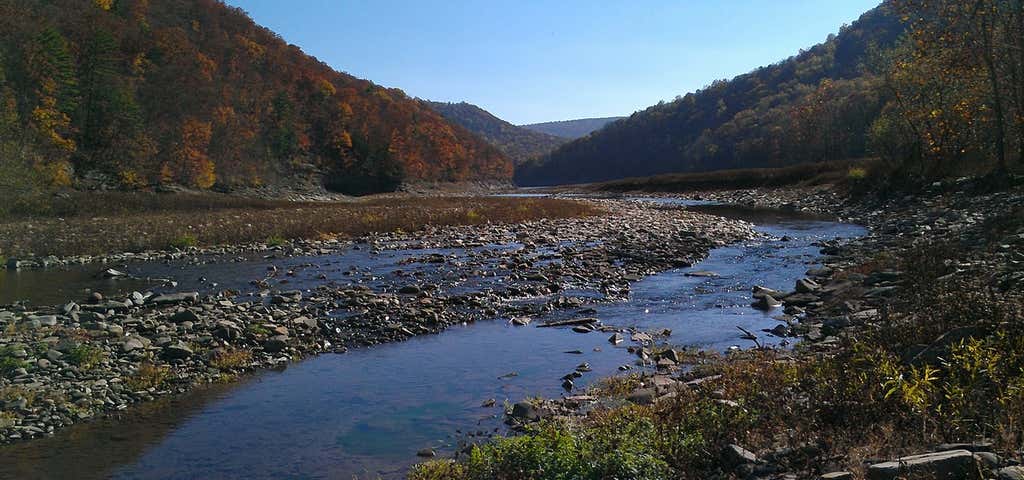
The Potomac State Forest, 11,535 acres situated between the towns of Oakland and Westernport and partially bordering the Potomac River, is reached from Maryland Routes 135 and 560. Mountain forests, streams and valleys make up nearly 12,000 acres in Potomac State Forest. The forest drains into the Potomac River Basin, and features the highest point in any Maryland state forest – Backbone Mountain, elevation 3,220 feet. Another high point in the forest is the rock outcropping near the intersection of Maryland Route 135 and Walnut Bottom Road which overlooks a portion of Potomac State Forest, Savage River State Forest and Crabtree Creek. The Potomac River has its headwaters in this rugged mountain forest where wildlife abounds and there is excellent trout fishing. State Forest regulations are posted in conspicuous locations throughout the forest. Additional information and a brochure can be obtained by calling the forest headquarters.
Be the first to add a review to the Potomac State Forest.
/-79.247934,39.40302,14/300x172@2x?access_token=pk.eyJ1Ijoicm9hZHRyaXBwZXJzIiwiYSI6ImNsczF1Y3RwcTA0ZmgycHAwbngweHlmbDAifQ.G6RP_RvWmMx8yNQSHb3PGQ)
Potomac State Forest
Hours
Problem with this listing? Let us know.
Has RV parking changed? Let us know.
-
Parking
-
Pets Allowed
-
Restrooms
-
Wifi
-
Wheelchair Accessible
-
Credit Cards Accepted
Nearby Hotels
Related Trip Guides
- Trip Guide
Pay Tribute and Reflect at These US Monuments and Memorials
- 14 Places
- Trip Guide
The top things to do on an I-95 road trip
- 50 Places
- 41:46
- 1,983 mi
- Trip Guide
Gone But Not Forgotten: Former National Parks
- 7 Places
- Trip Guide
The top things to do on an East Coast road trip
- 32 Places
- 48:54
- 2,584 mi