“Discover the Lindis region”
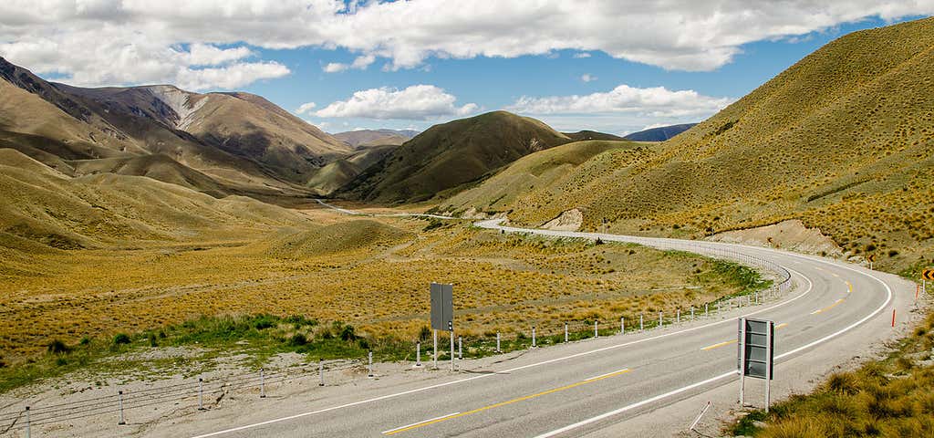
The dramatic Lindis Pass links the Mackenzie Basin with Central Otago. The actual pass crosses a saddle between the valleys of the Lindis and Ahuriri Rivers at an altitude of 971 metres above sea level. For many months of the year, you can expect to see snow in this mountainous area - often down to the roadside.Adjacent to the highway is the Lindis Conservation Area. Here snow tussock grassland dominates the landscape. Longslip Mountain (1494 metres) has one of the most extensive sites of the buttercup ranunculus haastii in the Mackenzie Basin. Native bird species living here include titipounamu (rifleman), riroriro (grey warbler), piwakawaka (fantail) and karearea (falcon). Although there are no formally marked tracks in the Lindis Conservation Area, you're welcome to explore the undulating terrain. It's also possible to walk, mountain bike or horse ride across private land to the Lindis River via Smiths Creek. This route begins is on the Tarras side of the pass - look for the parking area.Remember that this is an exposed alpine area and the weather can be unpredictable. Ensure you carry warm, windproof clothing and appropriate footwear. Find & book flights
Be the first to add a review to the Lindis Pass Lookout.
/169.6447578,-44.588,14/300x172@2x?access_token=pk.eyJ1Ijoicm9hZHRyaXBwZXJzIiwiYSI6ImNsdjQ5N2VtZDA2bW8ycW13ZHAxeGhjbjkifQ.UIccpoAxc7g3BAuK4s9vjg)
Lindis Pass Lookout
Hours
Problem with this listing? Let us know.
Has RV parking changed? Let us know.
-
Parking
-
Pets Allowed
-
Restrooms
-
Wifi
-
Wheelchair Accessible
-
Credit Cards Accepted
Nearby Hotels
Related Trip Guides
- Trip Guide
Garden City to Adventure Capital
- 34 Places
- 12:46
- 483 mi
- Trip Guide
Wellington to Gisborne Long Weekend Roadie
- 18 Places
- 19:22
- 826 mi
- Trip Guide
Cycle The Otago Central Rail Trail
- 34 Places
- 04:20
- 169 mi
- Trip Guide
Great Alpine Highway
- 29 Places
- 10:42
- 414 mi