“travels west-east on the lower slopes of Bunker hill”
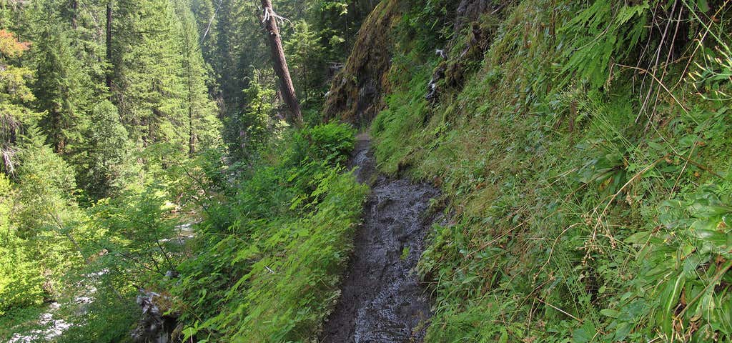
The Lemolo segment meanders into the North Umpqua River canyon, then flattens out near the level of the river. Along the way are many small, cascading waterfalls. There is also an equestrian campground that offers some sites with corrals. Standard camping is also available and facilities include restrooms and picnic tables, but no available water. Directions from Roseburg: Western Trailhead) Travel east on Highway 138 and turn onto Forest Service Road 2610 (Lemolo Lake Road). Follow 2610 for 5.5 miles across the dam which forms Lemolo Lake. Turn left onto FS Road 2610-600 (Birds Point Road). Follow 2610-600 about another half mile to the White Mule Trailhead on the left. Parking is available for 3 standard vehicles and very tight for horse trailers. No restroom facilities.Eastern Trailhead) Travel east on Highway 138 to Forest Service Road #60, the Windigo Pass Road. Follow this for 4.5 miles and turn right onto FS Road 6000-958, the Kelsay Valley Road. Trailhead is at the end of the road in 1.5 miles. This segment of the North Umpqua Trail is accessed by following the Windigo Pass Trail #1412 for 0.1 mile and then Trail #1412A for 0.2 mile.

The Deer Leap Segment of the North Umpqua Trail is 9.6 miles long and rated more difficult. The trail is open to foot, horse and bicycle use and gains 710 feet in elevation.
Be the first to add a review to the North Umpqua Trail (Lemolo Segment).
/-123.0239511,43.3237296,14/300x172@2x?access_token=pk.eyJ1Ijoicm9hZHRyaXBwZXJzIiwiYSI6ImNsdjQ5N2VtZDA2bW8ycW13ZHAxeGhjbjkifQ.UIccpoAxc7g3BAuK4s9vjg)
North Umpqua Trail (Lemolo Segment)
Hours
Problem with this listing? Let us know.
Has RV parking changed? Let us know.
-
Parking
-
Pets Allowed
-
Restrooms
-
Wifi
-
Wheelchair Accessible
-
Credit Cards Accepted
Nearby Hotels
Related Trip Guides
- Trip Guide
A road trip to filming locations featured in 'The Goonies'
- 6 Places
- 00:57
- 28 mi
- Trip Guide
The Ultimate Guide to Crater Lake National Park
- 15 Places
- Trip Guide
- Weekend
Pacific Coast Highway: Oregon - Washington
- 30 Places
- 17:36
- 670 mi
- Trip Guide
The top things to do on a U.S. Route 20 road trip
- 23 Places
- 60:25
- 3,576 mi