“great views for hiking or riding”
This trail is open to hiking and horseback riding. The trail is marked with blaze signs and is steep in some areas. This is a beautiful trail, going by some historic spots. Smith Ditch-!/4 mile built by the CC's for irrigation and water in the 1930's and Gibson's Cave - 1 1/4 mile. From Little Bald Mountains, the view is great to the north and south. The north looks into the low range lands towards Butter Creek, and the South into the Texas and Madison areas. Gibson's Cave and Smith Ditch are exciting attractions to look around in. The Bald Mountain Trail starts near a group campsite located on the Muddy Fork. The trail crosses the Muddy Fork via a foot bridge. Small streams cross the trail at 0.7 and 1.2 miles. The trail then switchbacks up the timbered slop until the junction with the Pacific Crest National Scenic (PCNST) and Timberline Trails. Although the temptation is great, please stay on the trail and do not shortcut the switchbacks as it causes erosion and trail maintenance problems. To make a loop, turn south on the PCNST at the four-way junction at Bald Mountain. Follow it 4.9 miles to Ramona Falls. Return to the starting point in just over two miles by following either portion of the Ramona Falls Loop Trail. In addition to the beauty of Ramona Falls, this 11 mile loop offers unique close-up views of Mount Hood's west side. A more leisurely version of this loop can be made by switching the described direction and traveling up the Ramona Loop to the PCNST and down the Bald Mountain Trail. Directions from Heppner: Take the Scenic Byway just south of Heppner, County Road 603, to the top of Coalmine Hill to the Day-Use area. Approximately 21 miles from Heppner.

The Bald Mountain Trail starts near a group campsite located on the Muddy Fork. The trail crosses the Muddy Fork via a foot bridge. Small streams cross the trail at 0.7 and 1.2 miles. The trail then switchbacks up the timbered slop until the junction with the Pacific Crest National Scenic (PCNST) and Timberline Trails. Although the temptation is great, please stay on the trail and do not shortcut the switchbacks as it causes erosion and trail maintenance problems.
To make a loop, turn south on the PCNST at the four-way junction at Bald Mountain. Follow it 4.9 miles to Ramona Falls. Return to the starting point in just over two miles by following either portion of the Ramona Falls Loop Trail. In addition to the beauty of Ramona Falls, this 11 mile loop offers unique close-up views of Mount Hood's west side. A more leisurely version of this loop can be made by switching the described direction and traveling up the Ramona Loop to the PCNST and down the Bald Mountain Trail.
Photo courtesy of Tom Kloster
Be the first to add a review to the Bald Mountain Trail.
/-119.5577997,45.3531842,14/300x172@2x?access_token=pk.eyJ1Ijoicm9hZHRyaXBwZXJzIiwiYSI6ImNsdjQ5N2VtZDA2bW8ycW13ZHAxeGhjbjkifQ.UIccpoAxc7g3BAuK4s9vjg)
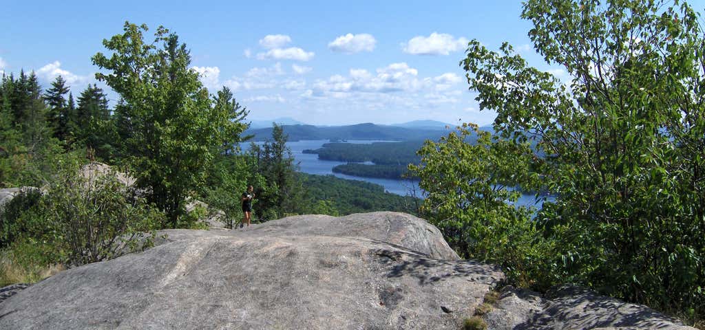
Bald Mountain Trail
Hours
Problem with this listing? Let us know.
Has RV parking changed? Let us know.
-
Parking
-
Pets Allowed
-
Restrooms
-
Wifi
-
Wheelchair Accessible
-
Credit Cards Accepted
Nearby Hotels
Related Trip Guides
- Trip Guide
A road trip to filming locations featured in 'The Goonies'
- 6 Places
- 00:57
- 28 mi
- Trip Guide
The Ultimate Guide to Crater Lake National Park
- 15 Places
- Trip Guide
- Weekend
Pacific Coast Highway: Oregon - Washington
- 30 Places
- 17:36
- 670 mi
- Trip Guide
The top things to do on a U.S. Route 20 road trip
- 23 Places
- 60:25
- 3,576 mi