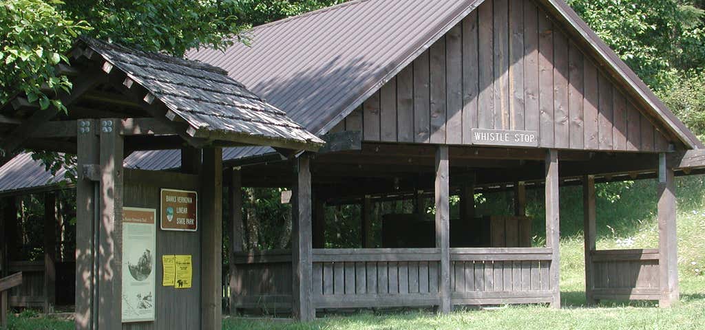
The Banks–Vernonia State Trail is a paved rail trail and state park in northwest Oregon in the United States. It runs for , primarily north–south, between the towns of Vernonia in Columbia County and Banks in Washington County on an abandoned railroad bed. Banks is about west of Portland. The wide trail is open to non-motorized uses such as hiking and biking. A wide horse trail parallels the hiking and biking trail. The rail trail crosses 12 bridges and the Buxton Trestle, a former railroad trestle bridge that is long and high. A second railroad trestle, the Tophill (or Horseshoe) Trestle, was damaged by fire in 1986 and is bypassed with a series of switchbacks at the Tophill trailhead. Amenities available at some locations in the park include picnicking, fishing, wildlife watching, forests, bird-watching, historic sites, public restrooms, parking, horse hitching posts, a loading platform, and a whistle stop shelter. The rail trail connects to a network of about of unpaved mountain-biking trails in L. L. "Stub" Stewart State Park. About 14,000 people used the rail trail in 2004.
Be the first to add a review to the Banks–Vernonia State Trail.
/-123.163690016145,45.6649565262091,14/300x172@2x?access_token=pk.eyJ1Ijoicm9hZHRyaXBwZXJzIiwiYSI6ImNsdjQ5N2VtZDA2bW8ycW13ZHAxeGhjbjkifQ.UIccpoAxc7g3BAuK4s9vjg)
Banks–Vernonia State Trail
Hours
Problem with this listing? Let us know.
Has RV parking changed? Let us know.
-
Parking
-
Pets Allowed
-
Restrooms
-
Wifi
-
Wheelchair Accessible
-
Credit Cards Accepted
Nearby Hotels
Related Trip Guides
- Trip Guide
A road trip to filming locations featured in 'The Goonies'
- 6 Places
- 00:57
- 28 mi
- Trip Guide
The Ultimate Guide to Crater Lake National Park
- 15 Places
- Trip Guide
- Weekend
Pacific Coast Highway: Oregon - Washington
- 30 Places
- 17:36
- 670 mi
- Trip Guide
The top things to do on a U.S. Route 20 road trip
- 23 Places
- 60:25
- 3,576 mi