“westernmost point of the 48 states”
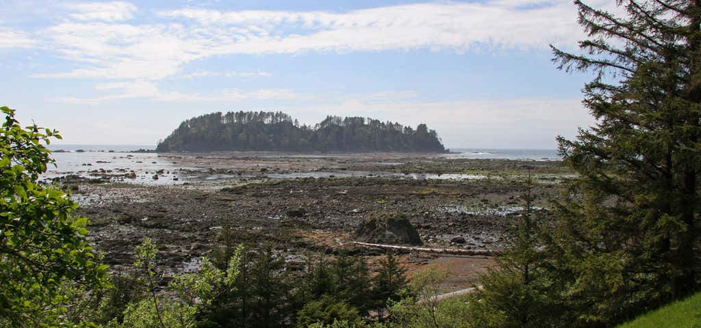
Cape Alava, in Clallam County, Washington, U.S.A., is the westernmost point in the contiguous 48 states, with a longitude of 124° 44′ 11.8″ W (during low tide and walking out to the west side of Tskawahyah Island). The westernmost point is located in Olympic National Park and the Ozette Indian Reservation. Cape Alava is accessible via a 3-mile (5 km) boardwalk hike from a ranger station in the park. Nearby Cape Flattery and Cape Blanco in southern Oregon are also very close longitudinally to being the westernmost points in the contiguous 48 states.

This hike is part of a larger 9.2 mile loop, and it is a MUST. The 3.1 miles from the Ranger Station to Cape Alava is peaceful and easy, most of the path (NOT ALL) is on boardwalk. There are lots of steps so it is not advised for strollers/wheelchairs by any means. Once you get to the Cape you can wander in the tide pools at low tide. From there you can venture south along the beach for 3 miles. There are 2 headlands which require an overland crossing at high tide, and that entails using ropes to climb steep and muddy bluffs (its fun!) Once you reach the south point in the loop (called Sandpoint) you can camp, if you have a permit, and if you climb the grassy knoll on the point you can get an almost 360 degree view of the beaches. Its breathtaking. The 3 mile walk back to the Ranger Station from Sandpoint is also mostly boardwalk and easy. Do this hike!
Be the first to add a review to the Cape Alava.
/-124.7324598,48.1658959,14/300x172@2x?access_token=pk.eyJ1Ijoicm9hZHRyaXBwZXJzIiwiYSI6ImNsdjQ5N2VtZDA2bW8ycW13ZHAxeGhjbjkifQ.UIccpoAxc7g3BAuK4s9vjg)
Cape Alava
Hours
Problem with this listing? Let us know.
Has RV parking changed? Let us know.
-
Parking
-
Pets Allowed
-
Restrooms
-
Wifi
-
Wheelchair Accessible
-
Credit Cards Accepted
Nearby Hotels
Related Trip Guides
- Trip Guide
The Great Northern is a 3,600 mile, cross-country odyssey
- 57 Places
- 69:15
- 3,565 mi
- Trip Guide
- Weekend
Pacific Coast Highway: Oregon - Washington
- 30 Places
- 17:36
- 670 mi
- Trip Guide
The ultimate guide to North Cascades National Park
- 13 Places
- Trip Guide
Olympic National Park is 1,400 sq miles of primeval beauty
- 14 Places