Planning the Ultimate Kancamagus Highway Road Trip: Scenic Drive, Stops, and Itinerary Along NH Route 112
The Kancamagus Highway offers nearly endless opportunities for hiking, camping, swimming, visiting waterfalls and historic sites, and more.
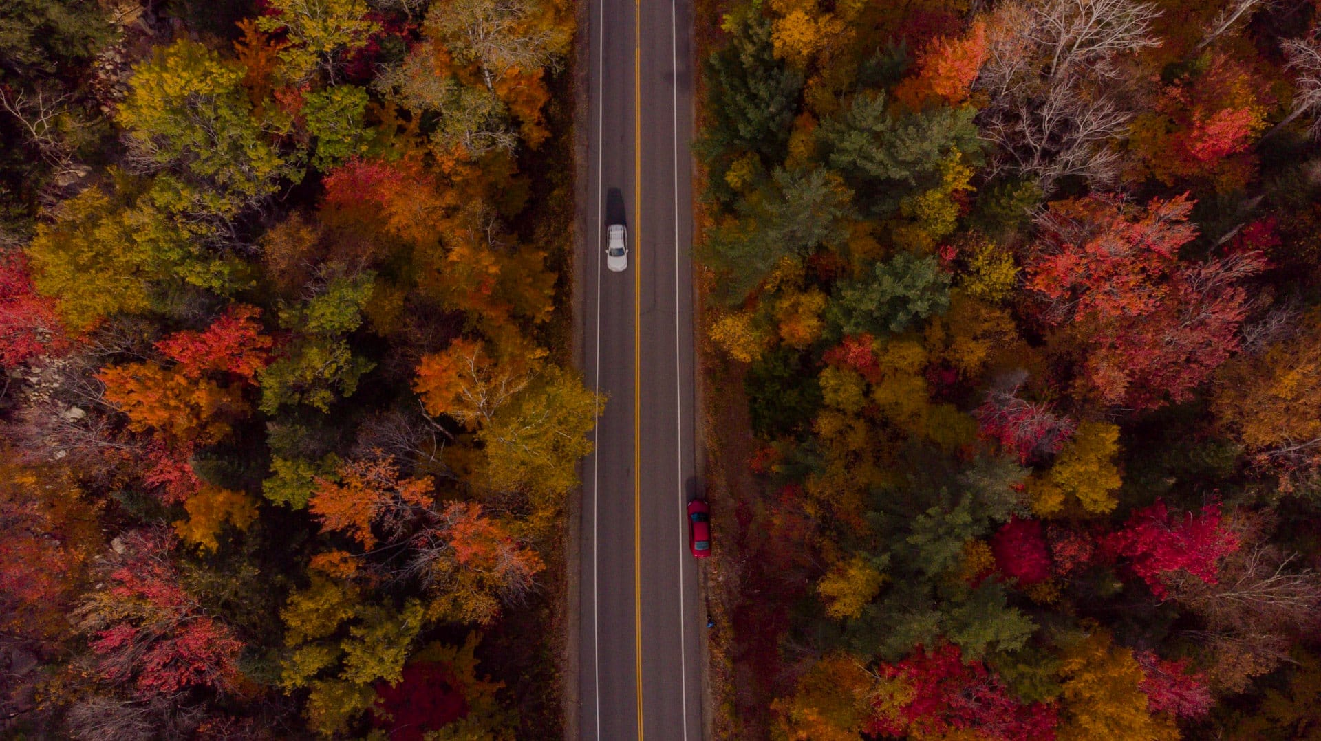
Few scenic byways pack as much into such a short drive as New Hampshire’s Kancamagus Highway. Traversing the White Mountain National Forest as it climbs to the 2,855-foot Kancamagus Pass between Conway and Lincoln, New Hampshire, the Kancamagus Highway offers nearly endless opportunities for hiking, camping, swimming, visiting waterfalls and historic sites, and making frequent stops to pause and enjoy views of mountains, valleys, and rivers.
Key Takeaways
-
The 34.5-mile Kancamagus Highway crosses White Mountain National Forest to a 2,855-foot pass, with nonstop overlooks hikes and waterfalls.
-
It connects Lincoln and Conway with easy access from I-93 and Route 16, and towns provide year-round lodging and services.
-
The road is open in every season and offers swimming holes, ski trails, and scenic overlooks along the way.
Everything you need to know about a Kancamagus Highway road trip
Download the mobile app to plan on the go.

Share and plan trips with friends while discovering millions of places along your route.
Get the AppHow to Plan Your Kancamagus Highway drive
Planning a road trip on the “Kanc” is easy. The Kancamagus Highway is conveniently accessed from major roads on either end (Interstate 93 to the west, and New Hampshire State Highway 16 to the east). The road leads directly into large towns—by local standards, anyway—in both directions as well. To the east, the twin towns of Conway and North Conway are known for winter sports and summer outlet shopping; on the west side, Lincoln is home to the Loon Mountain ski area. Each has abundant, four-season lodging, dining, fuel stations, and attractions.
The White Mountains Visitor Center in Lincoln has regional tourist information; for details about the White Mountain National Forest, stop at the log cabin visitor center at Lincoln Woods on the Lincoln end of the Kancamagus Highway, or the Saco Ranger Station on the Conway end.
The Kancamagus Highway is an out-and-back trip; for a longer road trip, a drive on the Kanc can be included in a loop route by continuing north from Lincoln on Route 3 through Franconia Notch to Twin Mountain, then east on Route 302 past Bretton Woods, Mount Washington, Bartlett, and back to North Conway. Shorter loop drives can be created utilizing Bear Notch Road, open seasonally between the Kancamagus Highway and Bartlett.
Best Stops and Things to do on the Kancamagus Highway
Lower Falls Swimming Area on the Swift River
Lower Falls: A splash-tastic section of the Swift Rivers with gentle cascades and placid pools for summer swims.
Rocky Gorge Scenic Area and Falls Pond Loop
Rocky Gorge: This dramatic and deep cut through the White Mountains bedrock channels the waters of the Swift River into a noisy rush.
Sabbaday Falls Waterfall Walk with Stairs and Viewpoints
Sabbaday Falls: Stairways get you so close to these falls that you feel like you’re inside them.
Bear Notch Road Scene Detour for Overlooks and Hikes
Bear Notch Road: When open from late spring to early fall, this side road off of the Kancamagus Highway offers even more scenic views and hiking opportunities.
Lincoln Woods Suspension Bridge and Pemigewasset Wilderness Access
Lincoln Woods: The suspension bridge here spans the gap between civilization and the vast Pemigewasset Wilderness.
Kancamagus Highway History and Origin of the Name
Pronounced “Kan-kuh-MOG-us,” the Kancamagus Highway is named after the last sagamore, or chief, of the Pennacook people, who lived in the White Mountains. Known as “The Fearless One,” Kancamagus tried to live peacefully with the early European settlers in the region, but clashes in the late 17th century led him to uproot the tribe and move north to a remote area of New Hampshire near Canada.
By the 19th century, small town roads had extended into the mountains from Lincoln and Conway, the latter to the farming community of Passaconaway. Neither road, however, traversed the Kancamagus Pass, and it took until 1937 to connect the two. It was another 22 years before the federal government stepped in and built the Kancamagus Highway, which wasn’t paved until 1964.
Today, the road provides an important transportation link between the communities on both sides of the White Mountains. Named one of the top scenic drives in the country, the Kanc is also a magnet for visitors in every season of the year, from swimming-hole splashers to cross-country skiers, day-tripping motorcyclists to RV campers.
Kancamagus Highway Itinerary and Scenic Highlights by Mile Marker
You can begin a Kancamagus Highway road trip in either Lincoln or Conway, each of which is beautifully positioned to serve as a base for exploring the White Mountains National Forest as well as an abundance of other attractions.
Starting Your Kancamagus Highway Drive in Lincoln or Conway
In Lincoln, Loon Mountain Resort has downhill skiing and snowboarding in the winter and lift-serviced mountain biking in the summer, while the Hobo Railroad runs excursion trains along the Pemigewasset River. Clark’s Trading Post is a throwback, family-friendly destination with a bear show, climbing walls, museums, shops, and a tourist railroad of its own. Nearby Woodstock is home to the Woodstock Inn Brewery, serving great brews and food in a historic home and sunny patio.
Places to Stay Near the Kancamagus Highway
There’s no lodging other than campgrounds on the Kancamagus Highway, but many of the bed-and-breakfasts, hotels, and resorts of Conway and North Conway are conveniently close. The elegant and recently renovated White Mountain Hotel & Resort sits in the shadow of the Cathedral Ledges at Hart’s Location, for example, while the unique Samuel O’Reilly House bed-and-breakfast takes a unique tack on the Victorian era and has a lovely location alongside the Saco River.
Visitors who want to extend a road trip beyond the Kanc will love The Glen House, which sits at the base of mighty Mount Washington—the highest peak in the northeast U.S.—and has direct access to the Mount Washington Auto Road.
Best Restaurants and Dining Spots Near the Kanc
The many dining options in the Mount Washington Valley include favorites like the casual Muddy Moose bar and restaurant in North Conway, craft beers and barbecue at Moat Mountain Brewing Co., prime rib at the Red Parka in Glen (which transforms into a nightclub later in the evening), and fine dining at the Wildcat Inn in Jackson. Big Dave’s is the place to grab a fresh bagel or breakfast if you want to get an early start on your drive; or try a fancy grilled cheese sandwich at Cheese Louise, the last stop for food before you hit the Kanc.
Conway to Hedgehog Mountain Highlights
Saco Ranger Station: The White Mountain National Forest’s Saco Ranger Station has information, interpretive displays, and a retail area with maps, books, recreation passes, and other items for sale. You can pay your $5 day use fee, which allows you to park in any of the parking lots along the Kancamagus Highway, here or at the individual lots. If you plan to visit more than once, consider buying a White Mountain National Forest Annual Pass ($30 individual, $40 household). The ranger station also has nicer restrooms than you’ll find elsewhere along the highway.
Albany Town Forest (0.7 miles): Located on the small section of the Kanc that’s not within the White Mountain National Forest, the 302-acre Albany Town Forest has a 5-mile network of hiking trails that run along the Swift and Saco rivers. There’s also a 1-mile mountain biking loop trail.
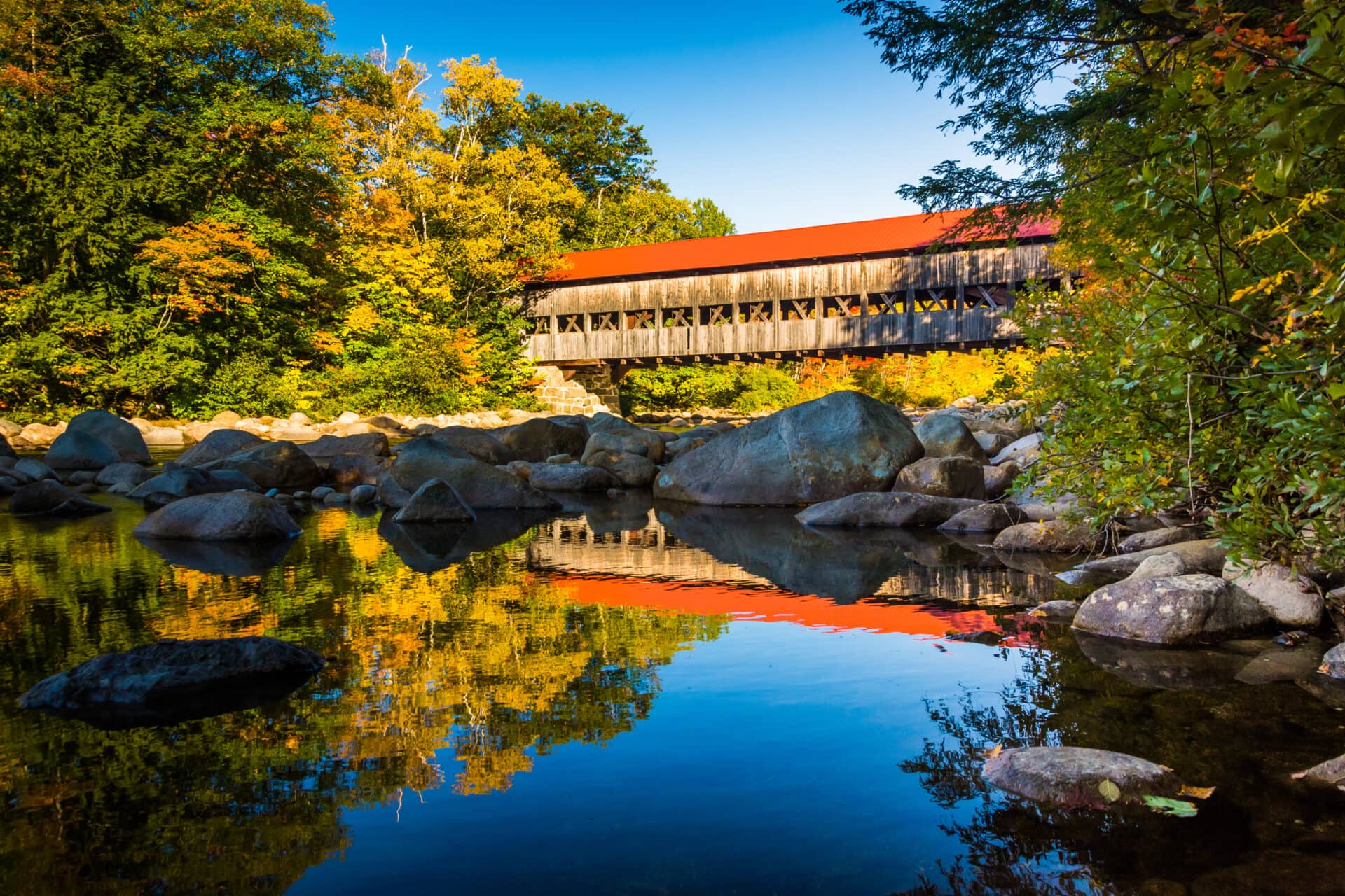
Albany Covered Bridge (6.1 miles): Built in 1858, this classic New England covered bridge remains in service, providing pedestrian and automobile access to the Nanamocomuck Ski Trail, the 49-site Covered Bridge Campground (reservations required), and the 3.1-mile Boulder Loop Trail. A popular Swift River fishing area sits just below the bridge abutments.
Blackberry Crossing Campground (6.2 miles): Originally serving as a Civilian Conservation Corps (CCC) camp in the 1930s, the Blackberry Crossing Campground has 26 first-come, first-served campground sites, hand pumps for water, and vault toilets. An interpretive trail details the area’s CCC history.
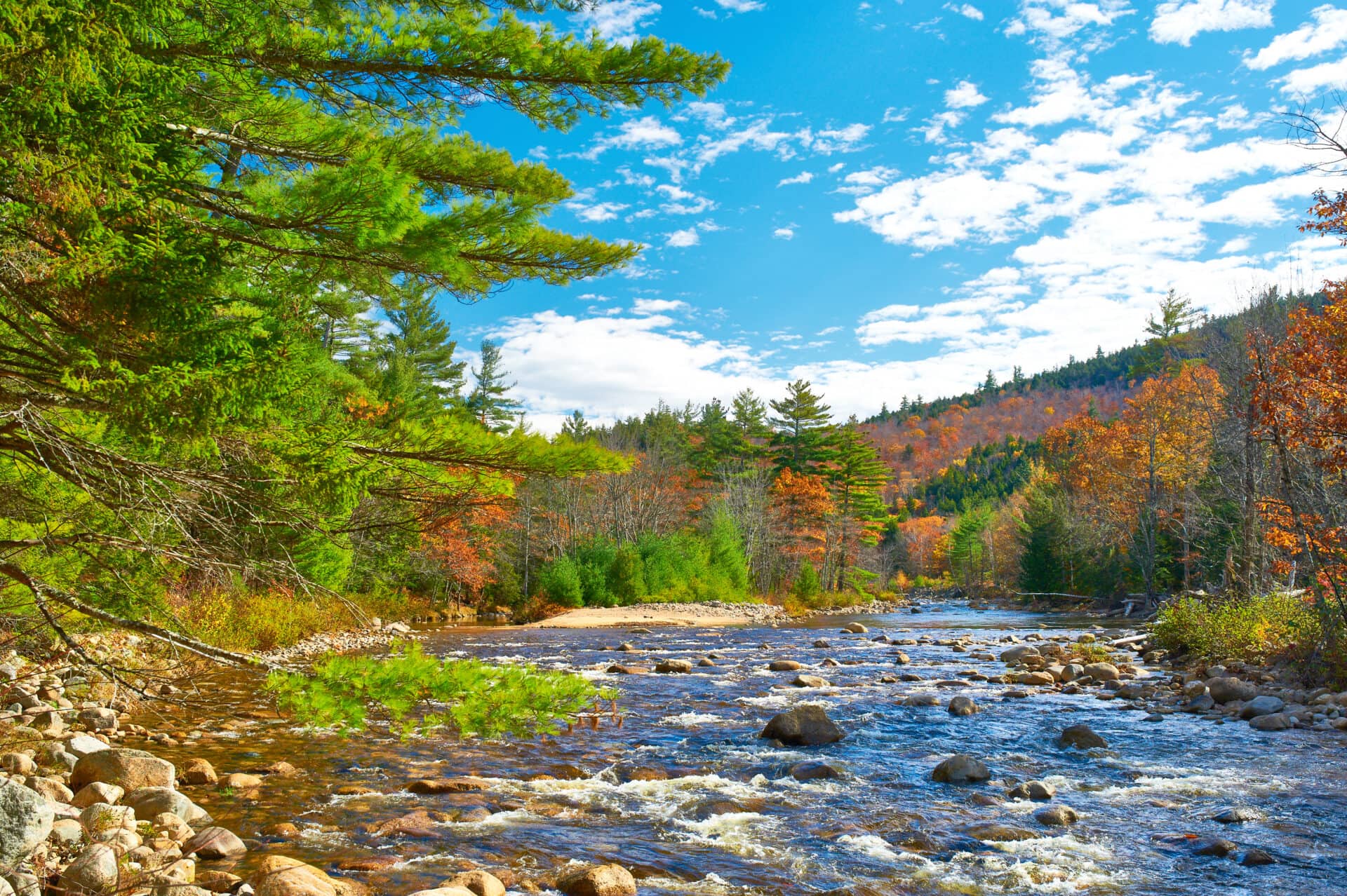
Lower Falls (6.8 miles): One of the most popular stops on the Kancamagus Highway, Lower Falls has a CCC-constructed picnic pavilion overlooking a stepped waterfall on the Swift River that attracts families of swimmers to the water and sunbathers to its rocky ledges in the warmer months. The Nanamocomuck Ski Trail also can be accessed here.
Rocky Gorge Scenic Area (9 miles): A short, accessible path through a pine forest leads to a bridge crossing a deep, narrow gorge and waterfall. The view is spectacular, but just look—swimming is prohibited in the gorge. Restrooms are available. Rocky Gorge also serves as the trailhead for the 1-mile Lovequist Loop Trail, which circles Falls Pond.
Champney Falls Trailhead (10.5 miles): Park here for the 3.4-mile out-and-back hike to Champney Falls and Pitcher Falls; the trail also connects to the Piper Trail, which leads to the summit of Mount Chocorua.
Bear Notch Road (12.1 miles): When open, Bear Notch Road connects the Kancamagus Highway to Route 302 in Bartlett, home of the Attitash ski resort. The 9-mile drive, which follows an old logging supply route used by the Bartlett and Albany Railroad, has four scenic viewpoints and accesses the Attitash Trail to the summit of Table Mountain. Most of the road is closed between November and early May, although a 1-mile segment on the Kancamagus Highway end is plowed to allow year-round access to the Nanamocomuck Ski Trail.
Jigger Johnson Campground (12.4 miles): This campground, named for a White Mountains logging boss, has 76 campsites (nine for tents only, the others for tents or RVs), potable water, picnic tables, and toilets. It’s also the only Kancamagus Highway campsite with showers. A trail leads from the campsite to the nearby Russell-Colbath House Historic Site.
Russell-Colbath House Historic Site (12.5 miles): A self-guided interpretive path leads to a historic home built in 1832; along with a nearby cemetery it’s the last remnant of the farming village of Passaconaway. The house is periodically open for guided tours July through September; check at the ranger station for schedules. A newer barn on the site is used for events, and the half-mile Rail and River Trail visits the Swift River near the site of an old logging railroad bridge.
Oliverian Brook Trailhead (13.2 miles): The easy to moderately difficult Oliverian Brook Trail runs 1.9 miles to Passaconaway Cutoff (near the base of Mount Passaconaway) and 4.4 miles to Paugus Pass. The trail is open to hikers and cross-country skiers in winter.
Sawyer Pond Trailhead: (13.5 miles): It’s 4.5 miles one way from the Kanc to Sawyer Pond on this moderately difficult hiking trail, which includes fording the Swift River. (It’s an easier, 4-mile round trip to the lake from the north end of the trail, which begins off of Route 302 in Bartlett.)
Passaconaway Campground (14.2 miles): Close to the midpoint of the Kancamagus Highway, this campground has 33 forest-shaded tent, trailer, and RV sites, including a couple sites located stream side. The trailhead for the Downes Brook, UNH, and Mount Potash hiking trails start across the street, on the south side of the Kancamagus Highway.
Sabbaday Falls to Lincoln
Sabbaday Falls (14.5 miles): A beautiful 0.6-mile riverside footpath leads to a series of staircases offering up-close views of the 45-foot Sabbaday Falls. The mist from the falls, carved out of a basalt fault line, is cool and refreshing on a hot summer day. This is another very popular spot on the Kanc, so parking can sometimes be an issue.
Pine Bend Brook Trailhead (16.4 miles): This 9-mile out-and-back trail along an old logging railroad grade offers access to the summit of North Tripyramid and the Sandwich Range Wilderness. Parking is on the roadside only.
Sugar Hill Overlook (17.3 miles): Pull off the road here to stretch your legs and bask in the northeast views of Owl Cliff, Mount Tremont, Bear Mountain, and, of course, Sugar Hill.
Sawyer River Trailhead (18.5 miles): The bad news: This hike requires you to ford the Swift River, which as the name implies can sometimes have quite a strong current. The plus side: It’s not a very popular trail, so if you value solitude, this is your hike. The river is easiest to cross in late summer or early fall. The trail runs a total of 7.5 miles north to Route 302.
Lily Pond (19.3 miles): If you time your visit right—dawn or dusk are best—you might see a moose in this mountain pond. The Livermore Trail and Upper Nanamocomuck cross-country ski trail can also be accessed here. It’s just a short walk from the gravel parking lot to the pond.
C.L. Graham Overlook (21.7 miles): Gaze upon the Swift River watershed from this northeast-facing scenic overlook. This area was once a supply depot for lumber companies; before that, it was a meeting place or “wangan ground” for local Native Americans.
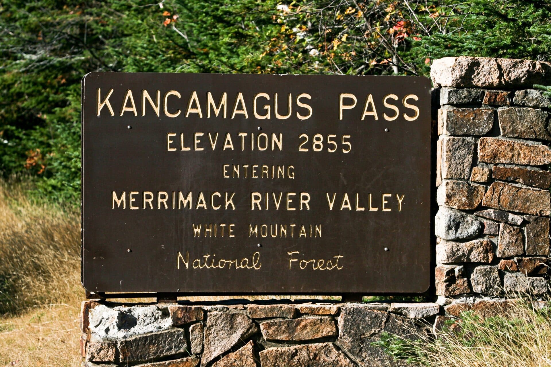
Kancamagus Pass (21.8 miles): The highest point on the Kancamagus Highway, the pass is at 2,855 feet (870 meters) above sea level and separates the Saco and Merrimack river watersheds. Be sure to pull off the roadway to take a photo of the sign.
Pemigewasset Overlook (21.9 miles): Unobstructed views southwest from this scenic viewpoint include the Osceola Mountains. It’s a nice place to stop for lunch thanks to the covered picnic pavilion, which offers a shady spot to take in the landscape. There’s also a vault toilet here.
Unnamed Overlook (23.3 miles): This sometimes overlooked pullout on the south side of the Kancamagus Highway just east of the more celebrated Hancock Overlook also has great views of the Osceolas.
Hancock Overlook (23.8 miles): Wrapped by the Kanc’s most notoriously curved section of highway, the Hancock Overlook is another stop worth making for its Osceola Mountains views and shady covered pavilion. The overlook also serves as the trailhead for the Hancock Notch trail, which connects with the Cedar Brook and Hancock Loop trails to reach the top of Mount Hancock. RVs and autos towing trailers are warned away from this pullout due to difficult turns.
Otter Rocks (27 miles): Families flock to this swimming hole on the Hancock Branch of the Pemigewasset River, which has a small pool and picnic tables overlooking the river. Caution is advised when water levels are high.
Forest Discovery Trail (27.8 miles): Another family-friendly stop, the Forest Discovery Trail is a 1.5-mile loop trail gaining about 200 feet of elevation. Interpretive panels explain the natural environment as well as forest management. Trail guides are available in a box at the trailhead.
Big Rock Campground (28 miles): Reserve in advance to stay overnight at this 25-site wooded campground. And yes, there is a large, glacier-deposited rock here.
Lincoln Woods (30 miles): The gateway to the 45,000-acre Pemigewasset Wilderness Area and the rugged alpine terrain of the Franconia Mountains, Lincoln Woods has a visitor center with detailed park, hiking, and camping information. A picturesque suspension bridge carries hikers over the Pemigewasset River to trailheads into the largest wilderness area in the northeast U.S. There’s a gentle, self-guided loop trail near the river, while more hardcore hikers head north on the Eastside and Lincoln Woods trails to the Bondcliffs and Thirteen Falls campsites, Franconia Falls, and beyond.
Hancock Campground (30.5 miles): A year-round campground with 56 wooded sites, drinking water, and vault toilets close to Lincoln Woods, the Hancock Campground doesn’t accept reservations—campsites are first-come, first-served.
Frequently asked questions
Where does the Kancamagus Highway start and end?
From west to east, the Kancamagus Highway begins in Lincoln, New Hampshire, and ends in Conway, New Hampshire.
How long is the Kancamagus Highway and how long does it take to drive?
The Kanc has speed limits that vary from 15 miles per hour on its hairpin turns to 50 miles per hour on some long, straight stretches of road. In good weather conditions, you can easily drive the length of the 34.5-mile highway in an hour if you don’t stop. Rain or snow will slow your progress significantly on a road that has a number of steep and twisting segments, however. Adding stops—which you should—makes for a longer journey.
Does the Kancamagus Highway have a fee or parking pass requirement?
There is no charge to drive this public highway. The Kanc is a segment of New Hampshire State Route 112, which runs about 56 miles between Bath and Conway, New Hampshire.
How many miles is the Kancamagus Highway?
The Kanc is 34.5 miles long.
What is the best way to travel the Kancamagus Highway?
The vast majority of people travel the Kanc by private automobile. It’s also a popular route for motorcyclists, and is accessible for RVs, as well. The road also attracts its fair share of cyclists, although it’s a challenging pedal with its steep grades and 1,463 feet of elevation gain.
What is the best time of year to drive the Kancamagus Highway?
The Kancamagus Highway can be driven in every season, and each has its own charms. Fall foliage season is probably the most picturesque time of year for a drive, but summer is fun for cooling splash stops in the Swift River, and the snows of winter offer a stark beauty.
What are the driving conditions on the Kancamagus Highway?
In most weather conditions the Kanc is an easy drive, though it does require more awareness than a typical trip down I-93. The two-lane undivided highway has a maximum speed limit of 50 mph—a rule regularly exceeded on straighter stretches of the road, where drivers may speed around you using the opposing travel lane when the highway has a dashed yellow line.
There’s a sharp hairpin turn on the Lincoln side of Mount Kancamagus near the Hancock Overlook, and the steep grades in several sections of the road require caution and good brakes. The road gets plowed frequently in winter, but driving the Kanc in a snowstorm—particularly at night—can feel daunting. At all times of year, keep a sharp eye out for bicyclists, motorcycles, and traffic entering and leaving scenic viewpoints, campgrounds, and other turnouts from the highway.
Is it better to drive the Kancamagus Highway east to west or west to east?
It doesn’t really matter which direction you drive the Kancamagus Highway. There are towns with food, lodging, gas, and other points of interest at both ends of the highway, and all attractions are accessible from either lane of traffic.
Are there bathrooms and rest areas on the Kanc?
There are more than a dozen restroom locations maintained by the White Mountains National Forest along the Kancamagus Highway, including at the Lincoln Woods, Great Gulf Wilderness, and Champney Falls trailheads and at campgrounds and scenic overlooks. In addition, there are restrooms at the Saco Ranger Station on the eastern end of the highway, and plenty more in the town of Lincoln at the western end.
Written by Robert Curley
