
Ultimate Pacific Coast Highway Road Trip Guide: Highway 1 & U.S. 101 from Washington to California
Driving the PCH along the West Coast of the U.S. is high on many roadtrippers’ bucket lists—and it’s easy to understand why.
The Pacific Coast Highway, or the PCH, is one of the most famous road trip routes in the U.S., right up there with Route 66 and Skyline Drive in terms of popularity.
Key Takeaways
While many people still consider the Pacific Coast Highway to be the California section only, Highway 1 and U.S. Route 101 combine to provide an epic road trip along nearly the entirety of the West Coast of the U.S. that offers everything from beaches lined with palm trees to misty, rainforest-covered mountains.
More common than an end-to-end journey is to drive various segments of the road: Dana Point to Los Angeles, L.A. to San Francisco, San Francisco north to the Oregon border, or the Oregon and Washington coastal route north to Olympic National Park.
The rainforests of Washington’s Olympic Peninsula are just one aspect of the natural beauty encountered along the Pacific Coast Highway, which crosses the mighty Columbia River, passes alongside redwood forests, and meanders through California’s wine country from Sonoma to San Luis Obispo. Breathtaking views of cliffs, beaches, and crashing ocean waves are near-constant companions, and drives through quaint coastal towns are paired with passages through San Francisco and Los Angeles, almost always within hailing distance of the sea.
Everything you need to know about a Pacific Coast Highway road trip
- Pacific Coast Highway road trip map
- Our favorite attractions
- Pacific Coast Highway history
- Washington: Olympic Peninsula
- Washington: Willapa Hills
- Oregon: North Coast
- Oregon: Central Coast
- Oregon: South Coast
- California: Northern Coast
- California: Bay Area
- California: Central Coast
- California: Southern California
- FAQs
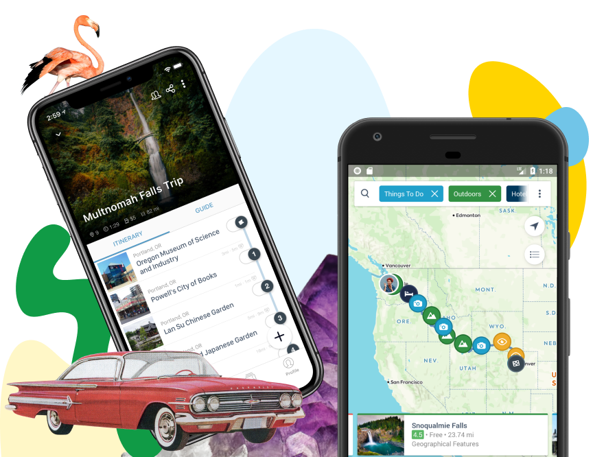
Download the mobile app to plan on the go.

Share and plan trips with friends while discovering millions of places along your route.
Get the AppOur favorite attractions
Olympic National Park on the Pacific Coast Highway (Washington)
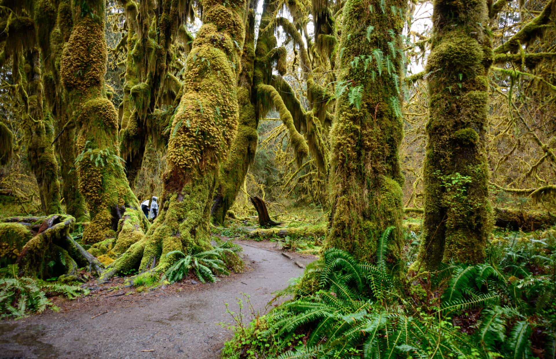
Olympic National Park: It’s hard to miss Olympic National Park at the north end of the PCH—U.S. 101 nearly circumnavigates the 922,000 acres of rainforests, mountains, glaciers, and wilderness. The park literally begins at sea level, with the PCH providing direct access to Rialto Beach and other sections of the park on the coast of the Olympic Peninsula. The Hoh Rain Forest in the park’s interior gets up to 170 inches of rain annually, which feeds the lush greenery, rivers, and waterfalls. Contrast this environment with the park’s 2.6-mile-long Blue Glacier, descending from the 7,980-foot Mount Olympus.
Redwood National Park and State Parks Road Trip Stops (Northern California)
Redwood National and State Parks: Visitors can spend hours or days immersed in the glory of these parks, which contain some of the largest trees in the world. The redwood forests can be explored via hikes of varying lengths and skill levels, taking you to such must-sees as the 1,500-year-old Big Tree and the Tall Tree Grove. Howland Hill Road offers a 10-mile scenic drive through redwood forests, but RVs are prohibited from its twisting course; the Newton B. Drury Scenic Highway is an alternative route that’s more RV-friendly. From the less-explored coastal sections of the park you can spot whales in the Pacific Ocean and the Klamath River.
Mendocino Coastal Town Getaway on Highway 1
Mendocino: A Victorian seaside village with homes converted to small inns and bed-and-breakfasts invite visitors to linger and soak in Mendocino’s laid-back culture and explore the beauty of the northern California coast, including redwood forests, wineries, beaches, and whale watching.
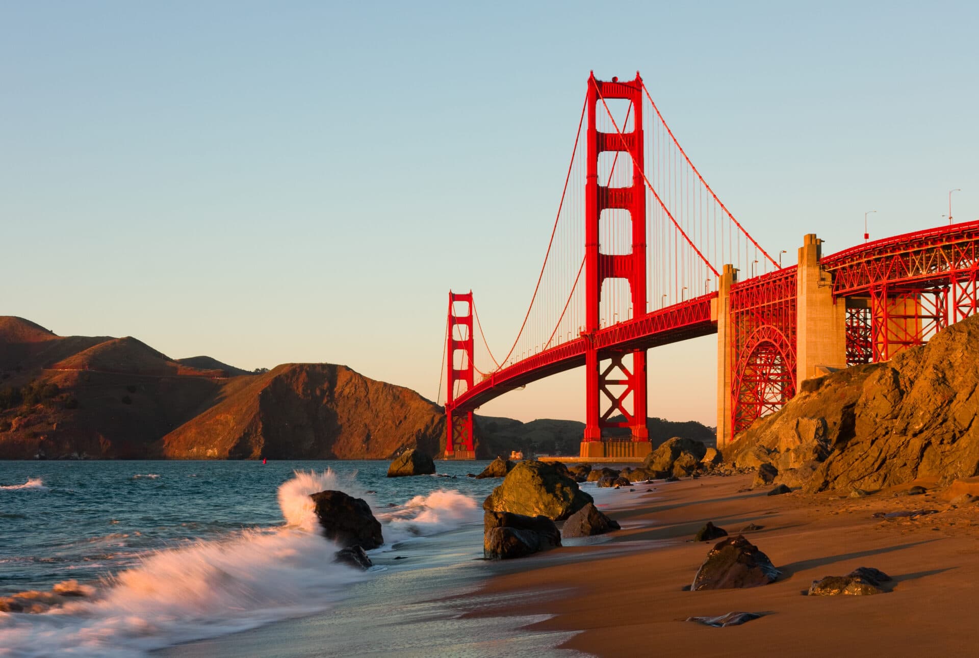
Golden Gate Bridge Drive Across Highway 1/US-101
The Golden Gate Bridge: The PCH passes right over the Golden Gate Bridge in San Francisco, and for many that’s thrill enough. When it opened in 1937, it was the longest and tallest suspension bridge in the world. To get the most out of a visit, park your car and walk across the historic bridge, which connects the city to the Marin Headlands. Better yet, rent bikes in downtown San Francisco to ride across the bridge and downhill to the charming town of Sausalito, where you can have lunch before taking a ferry back to the city.
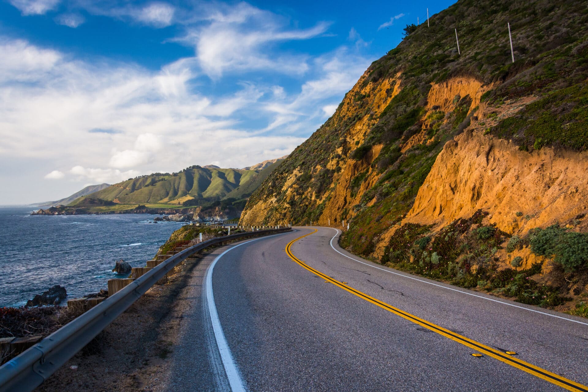
Big Sur and Monterey Peninsula Scenic Drive
Big Sur and the Monterey Peninsula: The image of the PCH residing in most people’s minds is the rugged segment on the Central Coast of California between Carmel and San Simeon, known as Big Sur. The meeting of the Santa Lucia Mountains and the Pacific Ocean results in a dramatic landscape of tall cliffs, steep mountain slopes, and thundering waves, interspersed with redwood forests and beaches. While millions of people visit Big Sur each year—mostly via the PCH—the area remains largely uninhabited, preserving its great natural beauty.
Hearst Castle Tours Near San Simeon
Hearst Castle: Close to San Simeon is the hilltop mansion built by millionaire newspaper publisher William Randolph Hearst. Built over several decades on a 250,000-acre ranch beginning in 1919, and with antiques and even entire decorated rooms brought over from Europe, the mansion is now open to the public as a museum. Tours of the huge complex focus on specific areas of the home and grounds, including itineraries that take in the grand rooms, upstairs, cottages, and kitchens, and special interests like art, architecture, and the castle’s association with Hollywood.
San Luis Obispo Wineries and Mission History
San Luis Obispo: California’s Highway 1 takes a rare detour away from the coast to pass through the town of San Luis Obispo, founded by Spanish missionaries in 1772 and now most famous for its excellent wines. The restored Mission San Luis Obispo de Tolosa dates back to the city’s founding and is a reminder of California’s Spanish colonial period, while the state’s 20th-century car culture flourished in San Luis Obispo thanks to the intersection of Highway 1 and U.S. 101. The thriving downtown is full of shops and restaurants, while wine country begins right on the outskirts of town, with several wineries located along U.S. 101.
Santa Monica Pier, Beaches, and Boardwalk
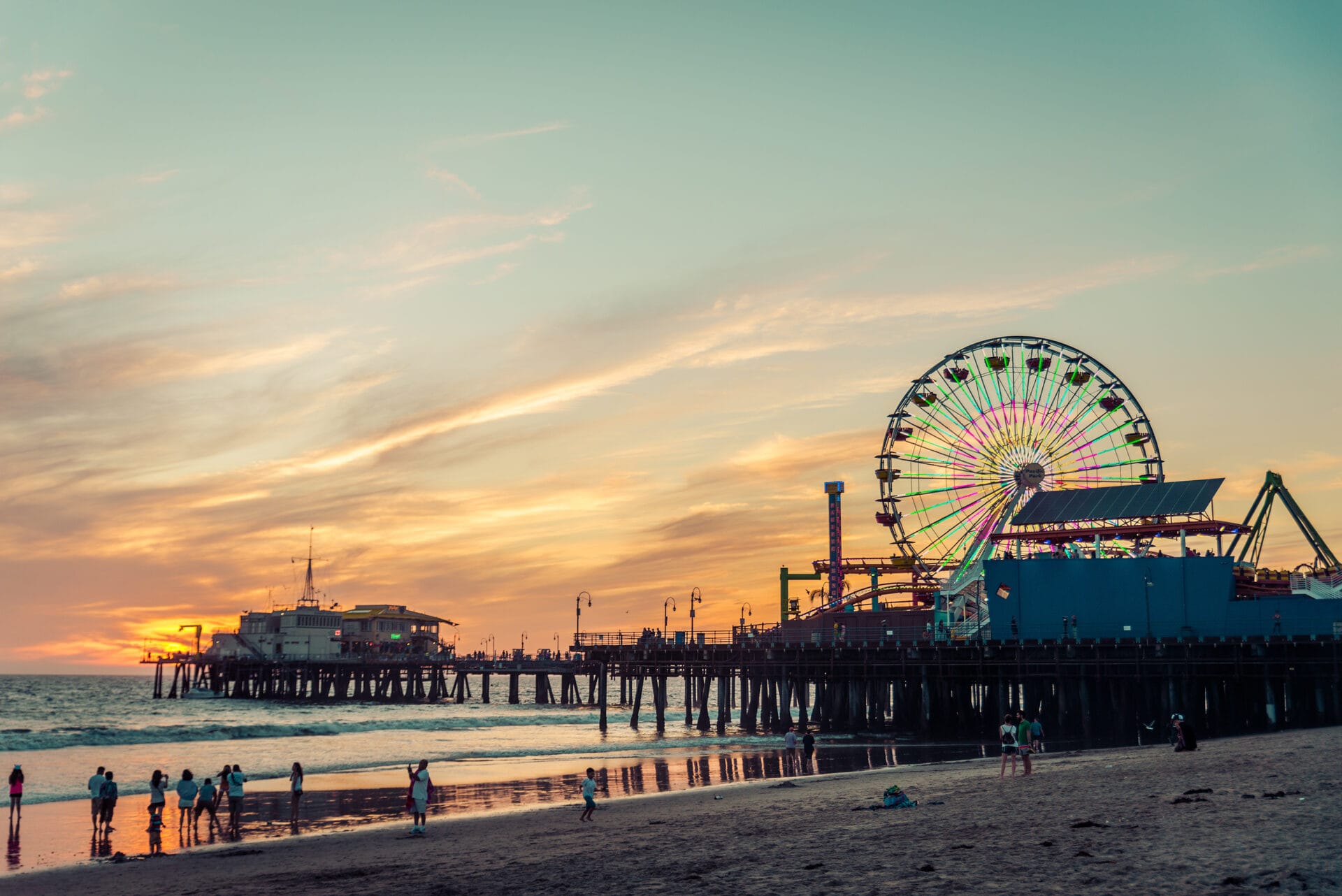
Santa Monica: Highway 1 spends some time wending through the street grid of downtown Los Angeles, but it’s all about the beach once it hits Santa Monica. Here, the PCH passes by Tongva Park and the famous Santa Monica Pier and its iconic Ferris wheel, cruising alongside Santa Monica State Beach and Palisades Park. It’s a great place to get out of the car and stroll the boardwalk to Muscle Beach and Venice Beach, as well as walking out to the amusement park and other attractions on the long, wide fishing pier.
Pacific Coast Highway History and Timeline
The PCH has its origins in the desire to build a coastal road connecting Ventura and Santa Barbara, California; by 1913, a paved road allowed drivers to travel alongside the Pacific Ocean from Los Angeles to San Francisco.
The tricky Big Sur segment was added in the 1920s and 1930s, in part by prison laborers. Around the same time, U.S. 101 was being built along the coast of Oregon and Washington. As various other sections of road were completed, the Highway 1 designation in California began appearing in the 1930s, and the full California section of what would become known as the PCH opened in 1951.
Highway 1 runs 656 miles from near Dana Point, California (where it intersects with I-5), north to Leggett, California, where it meets U.S. 101. The latter continues nearly 1,000 miles further north, along the coastline of Oregon and California.
Washington: Pacific Coast Highway Road Trip Guide
Olympic Peninsula: Port Angeles to Aberdeen (U.S. 101 Highlights)
Olympic National Park occupies the majority of the Olympic Peninsula, and while there’s no way to drive through the park, most of the park entrances are off U.S. 101, including the portion of the road that’s part of the PCH. The scenic highway begins in the town of Port Angeles on the Salish Sea near Seattle, which also serves as the north entrance of the park.
From the north entrance, the scenic Hurricane Ridge Road climbs to the higher elevation areas of the park, accessing a variety of hiking trails, the Head O’ the Hills campground, and a seasonal ski area. Heading west of Port Angeles takes you to Olympic Hot Springs Road, which leads to the park’s Elwha Valley area, Lake Crescent, and the Sol Duc area, home of the historic Sol Duc Hot Springs Resort.
Highway 101 turns south to pass through the town of Forks before connecting to Upper Hoh Road, which runs east into the park’s Hoh Rainforest. The PCH then makes its first connection with the Pacific Ocean at Ruby Beach—also part of the national park—skimming the rugged coastline past the Kalaloch campground and lodge and South Beach before crossing the Queens River at the small town of Queets inside the Quinault Indian Reservation. The PCH makes its last contact with Olympic National Park at Lake Quinault, where several more campgrounds and the Quinault Rain Forest are located, before reaching the town of Aberdeen.
Willapa Hills: Aberdeen to the Columbia River Crossing
Known as the Gateway to the Olympic Peninsula, Aberdeen straddles the Chehalis River and is home to several offbeat attractions, including a memorial to Nirvana singer Kurt Cobain, who dropped out of Aberdeen High School to pursue his music career. U.S. 101 returns to the coast at Willapa Bay, passing through the Willapa National Wildlife Refuge, which contains a rare old-growth coastal cedar forest.
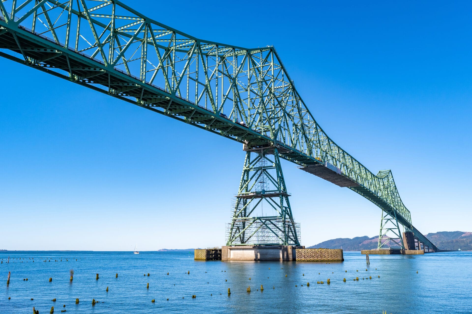
The PCH hits the Long Beach Peninsula at the town of Long Beach, a resort town known for its boardwalk, beaches, and the World Kite Museum. Nearby Cape Disappointment State Park has old military ruins, a lighthouse, and hiking trails through forests and cliff-top views of the ocean. The PCH crosses the broad mouth of the Columbia River via the Astoria-Megler Bridge, the longest continuous truss bridge in North America.
Oregon: Pacific Coast Highway Coastal Route
Oregon North Coast: Astoria, Cannon Beach, Haystack Rock
Crossing the Columbia River brings you to Astoria, Oregon; downtown attractions include the Fort George Brewery, the Bridgewater Bistro with its spectacular views of the Astoria-Megler Bridge, and the Columbia River Maritime Museum, where you can learn about the explorations of Lewis and Clark, who reached the Pacific Ocean here in 1804, after a yearlong expedition from Missouri. Across Youngs Bay is a recreation of Fort Clatsop, where the explorers camped before making their return journey in 1805; the fort is part of Lewis and Clark National Historic Park.
The PCH stays glued to the Oregon coastline as it heads south of Astoria, passing through beach towns like Sunset Beach and Gearhart. Seaside is home to the Seaside RV Resort as well as a variety of amusement parks, an aerial adventure course, an aquarium, and a beachfront promenade dating back to the 1920s. Hikers will love the Tillamook Head Trail just south of Seaside, which climbs 900 feet over 3.6 miles to mount spectacular headlands overlooking the coast.
Mighty Haystack Rock is the iconic symbol of Cannon Beach, renowned for having some of Oregon’s best beaches. In addition to a beautiful shoreline, Rockaway Beach has a 1.2-mile boardwalk trail leading to a preserve of ancient cedar trees, including Oregon’s tallest cedar—154 feet high and almost 50 feet in circumference.
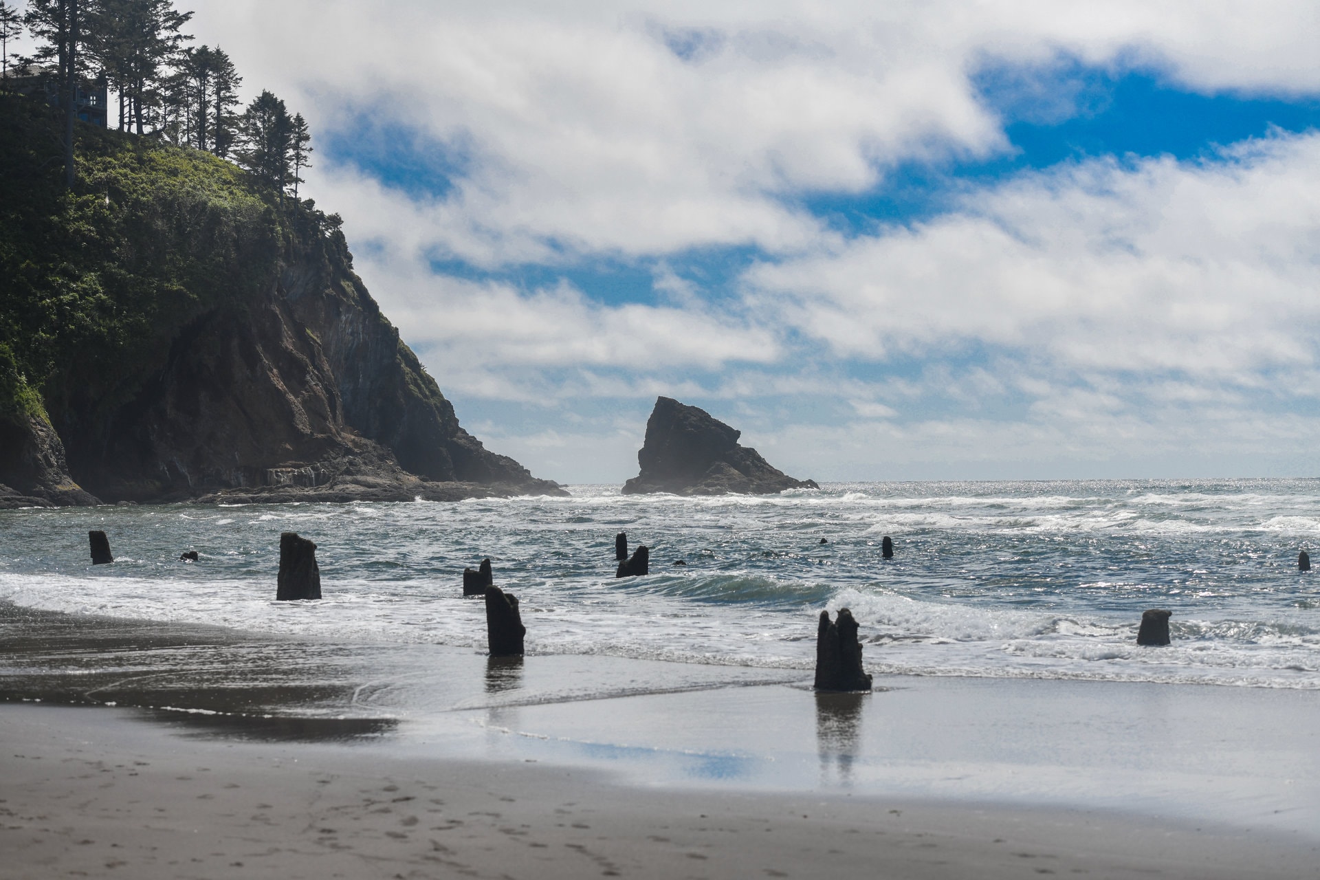
Between Tillamook and Pacific City, you can take a detour onto the Three Capes Scenic Loop, which leads to Cape Meares, Cape Lookout, and Cape Kiwanda. The Tillamook Air Museum houses a collection of rare and vintage aircraft in a massive former blimp hangar. The town of Tillamook, which is in Oregon’s dairy country, is also known for its cheese museum and kayaking on the multiple rivers feeding into Tillamook Bay. Earthquakes are the prime suspect in the creation of the Neskowin Ghost Forest, the stumpy, partly submerged remnants of a Sitka spruce forest just offshore of the town of Neskowin.
Oregon Central Coast: Depoe Bay Whales and Newport Aquarium
The Nature Conservancy’s Cascade Head Preserve includes hiking trails through Sitka spruce and hemlock forests to grassy overlooks on the protected Pacific headlands. The seaside towns of Lincoln City, Cutler City, and Kernville are hubs for RV parks as well as hiking and beaches; the Otis Cafe in Lincoln City is one of the top breakfast spots in Oregon.
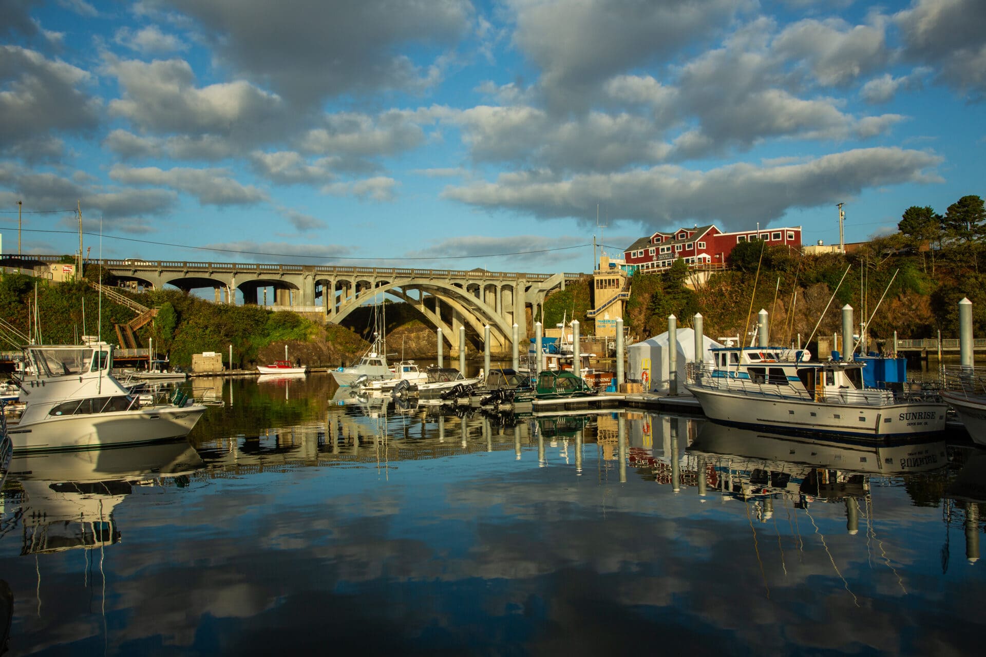
Whale watching cruises depart from Depoe Bay, and you can also spy passing gray whales with binoculars from the shore at the Oregon state parks’ Whale Watching Center (the best viewing is between May and September). U.S. 101 is Depoe Bay’s Main Street, the address for the popular fine-dining Restaurant Beck, as well as the Whale, Sea Life, and Shark Museum. Keep the theme going with a stay at the Whale Cove Inn, a boutique hotel overlooking a marine sanctuary just south of downtown.
The Oregon Coast Aquarium is a highlight of downtown Newport, where the circa 1871 Yaquina Bay Lighthouse stands watch over the jetty-protected inlet. The PCH passes through town on the arched Yaquina Bay Bridge, which has a pair of observation areas where you can stop for pictures. For boat-to-table fresh dining, make a reservation at Local Ocean.
Waldport is known for crabbing, but if you don’t want to dig them yourself you can order them cooked at the Salty Dawg Bar and Grill or the Alsea Bay Crab Co. The town also serves as the gateway to the Siuslaw National Forest, which offers camping and hiking in more than 630,000 acres of oceanfront, old-growth forests, and towering mountain peaks.
Oregon South Coast: Dunes, Coos Bay, Bandon, Port Orford
The Oregon Dunes National Recreation Area in Reedsport contains the largest field of sand dunes in North America, some topping 500 feet high. Founded as a railroad camp in the 19th century, Reedsport has transitioned from the lumber industry to a hub for ATV activity on the local sand dunes. The city is also known for an annual chainsaw carving competition, held over Father’s Day weekend, and various carvings can be seen around town.
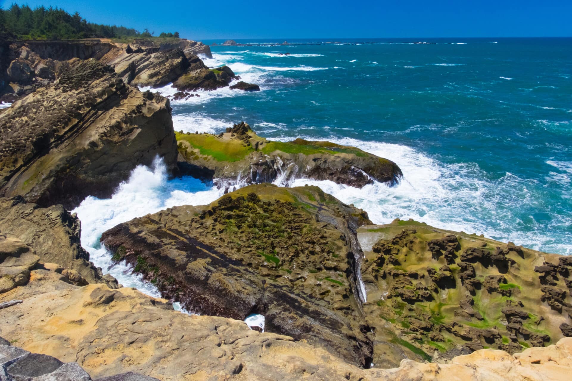
The twin towns of Coos Bay and North Bend comprise the Oregon Bay Area: They combine to form the biggest city on the Oregon Coast. The downtown Marshfield District is a center for the arts and includes the historic Egyptian Theater, while the stretch of coast south of the city is largely undeveloped state and federal parkland. The 41-mile Cape Arago Highway is a scenic alternative to the PCH, a loop drive that can include stops to see the Cape Arago Lighthouse and seals and sea lions on Simpson Beach. The highway, also marked as Route 540, begins in downtown Coos Bay.
The Old Town of Bandon has a boardwalk with shops, galleries, and restaurants like Tony’s Crab Shack, where you can get the gear to catch your own Dungeness crab and have it cooked to order. The Bandon Dunes Golf Resort has lodging and one of the nation’s top golf courses. Alternatively, book a campsite at Bullards Beach State Park, which has camping close to a 4-mile beach and the Coquille River Lighthouse.
Art galleries, kayaking trips, hiking, and mountain climbing are part of the diverse charms of Port Orford, an active fishing port that’s the westernmost town in the contiguous U.S. RV and tent camping is available at Cape Blanco State Park, where visitors can enjoy miles of hiking trails and visit the oldest still-standing lighthouse in Oregon.
Fishing on the Rogue River (which can also be enjoyed on a jet boat tour) is a highlight of a stop in Gold Beach, which has miles of mostly deserted beaches and hiking in the Rogue River-Siskiyou National Forest. The latter, crossed by the Pacific Crest Trail, has tent, RV, and cabin camping—the perfect base for exploring more than 1.7 million acres of wilderness, including the world’s tallest pine tree.
The Rogue River-Siskiyou National Forest was the site of perhaps the oddest attack of World War II, when a floatplane launched from a Japanese submarine dropped two incendiary bombs in 1942—a failed attempt to start a forest fire. The pilot of the plane, Nobuo Fujita, later visited the area and donated his family’s samurai sword as a gesture of apology; the sword resides in the Chetco Public Library. Chetco is another popular stop for outdoor recreation along the PCH, including whale watching, bicycling, and beach activities.
California North Coast: Redwoods and Rugged Shoreline
Jedediah Smith and Del Norte Coast Redwoods State Parks
Crossing the border into California’s Del Norte County on the PCH means entering redwood country: These giant coastal trees, some 500 to 700 years old, will be more or less constant companions as you head south on U.S. 101 toward San Francisco and the Bay Area.
Crescent City is named for its broad sweep of beach, and the historic Battery Point Lighthouse has stood watch over the shore since 1856. But the town’s main claim to fame is its proximity to two parks full of tall trees: Jedediah Smith Redwoods State Park and Del Norte Coast Redwoods State Park. U.S. 101 passes directly through the latter as you drive south towards Klamath, home to the Cathedral Tree—nine trees that have grown together to form a sylvan shrine. The Sky Trail gondola ride and the Redwood Canopy Trail with its elevated suspension bridges are two unique ways to experience the redwood forest.
Highway 101 skirts the edge of Prairie Creek Redwood State Park, but a popular detour is to take the spur onto the Newton B. Drury Scenic Parkway, a 10-mile jaunt into the heart of a redwood forest. The RV-friendly parkway includes a variety of scenic pullouts, including one for the Big Tree, a 286-foot-tall coast redwood. The Elk Prairie and Gold Bluffs Beach Campgrounds have cabins and sites for RVs up to 27 feet.
Near the town of Orick is the intersection with Bald Hills Road, another scenic drive that includes stops at the Lady Bird Johnson Grove within Redwoods National and State Parks as well as a beautiful overlook of Redwood Creek. Keep an eye out for herds of Roosevelt elk as you explore the Orick area.
Eureka is a charming coastal city with 19th-century Victorian homes on Humboldt Bay, a popular destination for wildlife-viewing cruises. A visit to the Sequoia Park Zoo downtown offers the added bonus of hiking or biking through 67 acres of urban redwood forest. U.S. 101 spends its final miles inland as you drive south toward Humboldt Redwoods State Park; within this 53,000-acre park is the largest contiguous old growth redwood forest on Earth, the 10,000-acre Rockefeller Forest.
U.S. 101 ends in the small town of Leggett, mostly famous for its Drive-Thru Tree Park—a 315-foot redwood with an opening at its base that’s wide enough for (some) cars, but not RVs, to drive through. Here, the PCH continues west toward the sea on Highway 1.
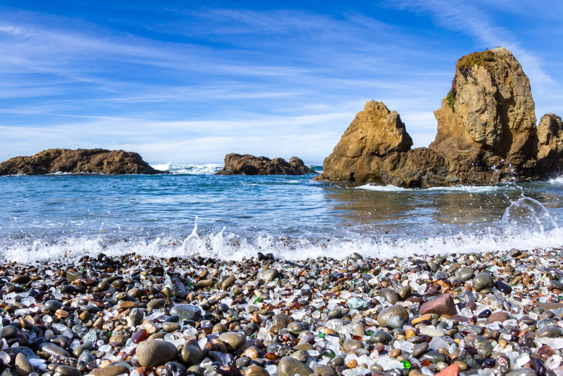
Devonte Lookout is one of several scenic pullouts worth stopping at once you hit the Pacific Coast again. Highway 1 passes through a variety of small coastal towns before reaching Fort Bragg, where you can view—but don’t take—a colorful variety of sea glass washed up on Glass Beach and walk across the scenic Pudding Creek Trestle Bridge. The Skunk Train is another fun way to play among the redwoods—the excursion train departs Fort Bragg for trips through the forest and across rivers on an old logging route.
Redwoods aren’t the entire story of this segment of the PCH: You also can visit a pygmy forest in Jug Handle State Natural Reserve, hike out to the remote Point Cabrillo Light Station, and bask in waterfalls and the swift waters rushing through the canyon at Russian Gulch State Park. By the time you reach Mendocino you’ll be ready to relax at this historic town’s restaurants, bed-and-breakfasts, shops, and galleries.
California Bay Area: Sonoma Coast to San Francisco
Point Reyes Hikes and Muir Woods Redwoods
The scenery on Highway 1 south of Mendocino is particularly spectacular as the road largely hugs the coastline, passing through small towns like Albion and Little River. If your intention is to incorporate a visit to California’s Napa and Sonoma counties—also known as wine country—Highway 128 south of Albion is a popular route inland. Otherwise, stay on Highway 1 and head for Point Arena.
Highway 1 is Point Arena’s Main Street, and this small town (population 460) is overrepresented with great restaurants like Franny’s Cup and Saucer and the Bird Cafe and Supper Club in the historic Point Arena Hotel. The town’s art scene is centered on the Arena Theater, an art deco classic dating to 1928. Standing 115 feet high, the Point Arena Lighthouse remains operational and has two museums to visit.
Fort Ross was founded in 1812 by Russian immigrants. You can tour the former settlement, which sits right on the coast and has been part of Fort Ross State Historic Park for more than 100 years. In addition to 17 miles of undisturbed shoreline, Sonoma Coast State Park boasts the only public campground on the Russian River, with tent and RV sites at Wright’s Beach.
You don’t have to drive into the valleys to sample Northern California wines: The Sonoma Coast Vineyard is located right on Highway 1 in Bodega Bay and produces everything from chardonnay to pinot noir and sparkling brut rosé. With a selection of small inns and campgrounds, Bodega Bay is a nice place to lay your head for the evening; you can also spot whales from Bodega Head or go horseback riding on the beach and dunes. The Tides Wharf Restaurant not only has fresh local seafood but was also a film set for Alfred Hitchcock’s classic thriller The Birds.
Just north of San Francisco in Marin County, the Point Reyes National Seashore has an abundance of hiking trails that will make you feel a million miles from the city—even though downtown is visible from some parts of the park. Speaking of views, you’ll get a spectacular one from the top of 2,500-foot Mount Tamalpais, another popular hiking destination nearby, alongside the famous Muir Woods redwood grove.
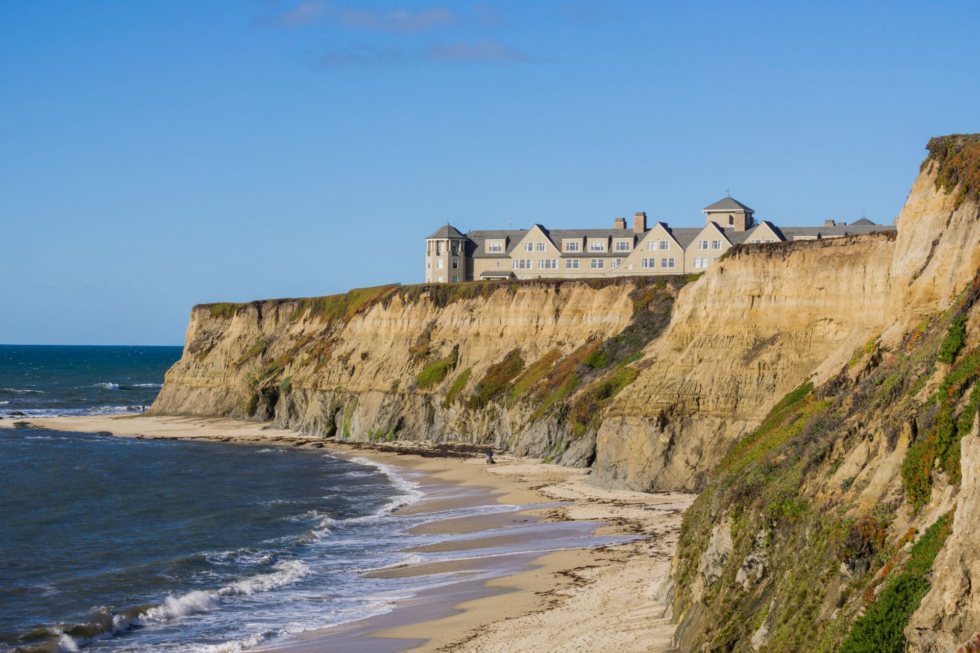
Highway 1 exits the spectacular Marin Headlands via the Golden Gate Bridge, passing through downtown San Francisco before leaving the city behind for small coastal towns like Pacifica and Montara. Half Moon Bay is home to the famous Mavericks surf break and full of restaurants, hotels, and shops. Coastal isolation gives way to a carnival atmosphere in Santa Cruz, where the city’s iconic boardwalk features amusement park rides like a 1911 Looff Carousel and the Giant Dipper roller coaster.
California Central Coast: Monterey, Big Sur, San Luis Obispo
Bixby Bridge, McWay Falls in Big Sur, Santa Barbara Mission and Waterfront
Monterey is the front door to California’s fabled Central Coast and the segment of Highway 1 most commonly associated with the Pacific Coast Highway. The Monterey Bay Aquarium is world famous, as is the Pebble Beach golf course; Cannery Row, the old fish-packing district, is now populated with seafood restaurants and shops. While the PCH veers away from the shore in Monterey, the coastal 17-Mile Drive is a popular alternative.
Civilization thins out as you head south of Monterey and Carmel by the Sea; the PCH bisects Point Lobos State Natural Reserve, which has a network of coastal hiking trails that includes a sea lion viewing area. This twisting segment of Highway 1 is only occasionally interrupted by narrow bridges and scenic overlooks, although you can stretch your legs with a hike to the bluffs in Garrapata State Park.
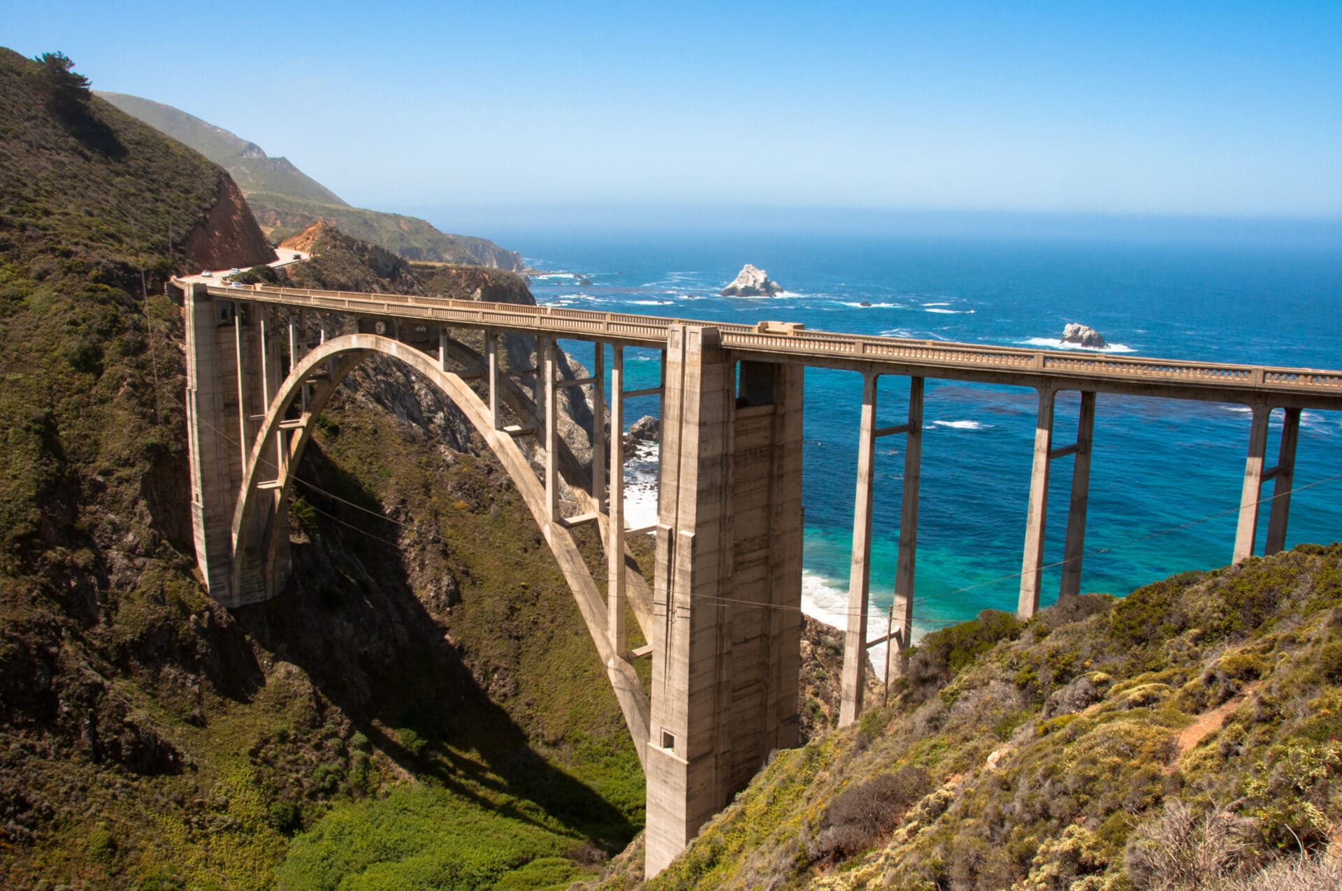
Bound by the Santa Lucia Mountains and the Pacific Ocean, Big Sur is the epitome of a PCH road trip, with little to divert your attention other than amazing scenery—and the need to keep your eye on the serpentine road. Camping and hiking are the main attractions at a series of state parks in the Big Sur area, including the picture-perfect McWay Falls tumbling into the ocean in Julia Pfeiffer Burns State Park and the purple sand and Keyhole Rock at Pfeiffer Beach. The PCH itself is the star at the dramatic Bixby Creek Bridge. Surfers and birders share the shore at Sand Dollar Beach, and you can stand in awe of the big bucks that millionaire William Randolph Hearst spent on his Hearst Castle, located in the hills above San Simeon.
San Luis Obispo is one of California’s top viticultural regions, and the Central Coast city is also a cultural hub and historic site, founded by Spanish missionaries in 1772. The inland route of the PCH makes access to the wineries of the Edna Valley a breeze; prominent vintners include Wolff Vineyards.
Franciscan friars who founded the mission in Santa Barbara still occupy the site established in 1786; the present mission building, which is open to visitors, dates to 1820. The mission inspired much of the other architecture in Santa Barbara, arguably one of California’s most beautiful cities. The PCH passes right by some of the city’s most popular attractions, including the Santa Barbara Zoo, the Santa Barbara Maritime Museum, and the shops and restaurants of Stearns Wharf.
California Southern California: Ventura to San Diego Beaches
Malibu, Santa Monica Pier, and Venice Beach
Beaches and surfing are the prime attractions of Ventura, and you might want to embrace the California vibe with a stop at In-N-Out Burger on your way through town. Or, take a break from driving with a day trip to Channel Islands National Park, an island habitat for seals and seabirds with sea caves and a rare Torrey Pine forest.
If you have to drive in Los Angeles—and nearly everyone does—it might as well be a scenic drive on the PCH. Highway 1 tightly hugs the shore as it passes through Malibu, Will Rogers State Beach, and Pacific Palisades before reaching Santa Monica’s iconic pier—which has starred in countless Hollywood movies and marks the end of Route 66. Stop for a ride on the Ferris wheel or a stroll down Muscle Beach and Venice Beach, or continue on through Manhattan Beach to Long Beach, where you can tour the elegant Queen Mary cruise ship.
Huntington Beach is perhaps the most famous surf town in the U.S., and the International Surfing Museum is worth a visit whether or not you plan to hang 10 yourself. Laguna Beach is all about the shore, with multiple beaches to choose from, but it also has a vibrant arts scene led by the Laguna Art Museum—unique in that it only displays art depicting California.
Fun on the water takes many forms in Dana Point, near the southern terminus of Highway 1 and the PCH. Here you can swim, surf, parasail, go whale-watching, paddleboard, sail—or just build a bonfire and relax at Doheny State Beach, which has a tent and RV campground. If you time it right (usually mid-March), you may arrive in time to witness the swallows return to nearby San Juan Capistrano.
Frequently asked questions
How long does it take to drive the entire Pacific Coast Highway?
It would take at least 40 hours, or nearly 2 days, to drive the length of the Pacific Coast Highway without stopping. But the whole point of driving the PCH is to take your time and make plenty of stops to enjoy the scenery along the way. A minimum of 6 days is recommended for the popular San Diego to San Francisco segment of the highway; adding Oregon and Washington to your itinerary could easily double that.
How many miles is the Pacific Coast Highway?
The Pacific Coast Highway, also known as Highway 101 on its north end and Highway 1 to the south, runs 1,650 miles from Port Townsend, Washington, to San Diego, California.
What is the best way to travel the Pacific Coast Highway?
Driving a car is the ideal way to experience the PCH—and if it’s a convertible, all the better. RVs are permitted on the highway, but the narrow, twisting roadway on some segments can be a challenge for less-experienced drivers. The PCH is also a highly desirable route for motorcyclists.
What is the best time of year to drive the Pacific Coast?
Weather-wise, early spring to late fall is the best time to drive the PCH; the tradeoff is that the traffic is heaviest during the summer months. Fog can be a factor in June, July, and August. September is perhaps the single best month to take a PCH road trip. Winter weather, including snow, can become a factor in the Oregon and Washington segments of the highway.
What are the driving conditions on the Pacific Coast Highway?
The PCH is a two-lane, undivided highway along much of its length and particularly in the coast-hugging segments that make it famous, such as the Big Sur area. Speed limits on the road’s many hairpin turns drop to 25 mph, and there are also slow-speed sections where the road passes through more populated areas. Elsewhere, the speed limit may get as high as 55 mph. Summer fog and winter snow can make driving hazardous, and driving at night on the PCH should be avoided when possible. Landslides are not uncommon, especially in California, which can lead to construction related delays or road closures.
Is it better to go north or south on Pacific Coast Highway?
Many drivers—and especially those with a fear of heights—prefer to travel the Pacific Coast Highway from south to north so that their car or RV occupies the right lane (the one further from the sheer drop-offs on the more precarious coastal segments of the road). Going this way also makes it easier to pull off at scenic overlooks and take photos. On the other hand, if you want the thrill of driving along the edge of the ocean and a view unobstructed by oncoming traffic, you may prefer the north-to-south route.
Written by Robert Curley