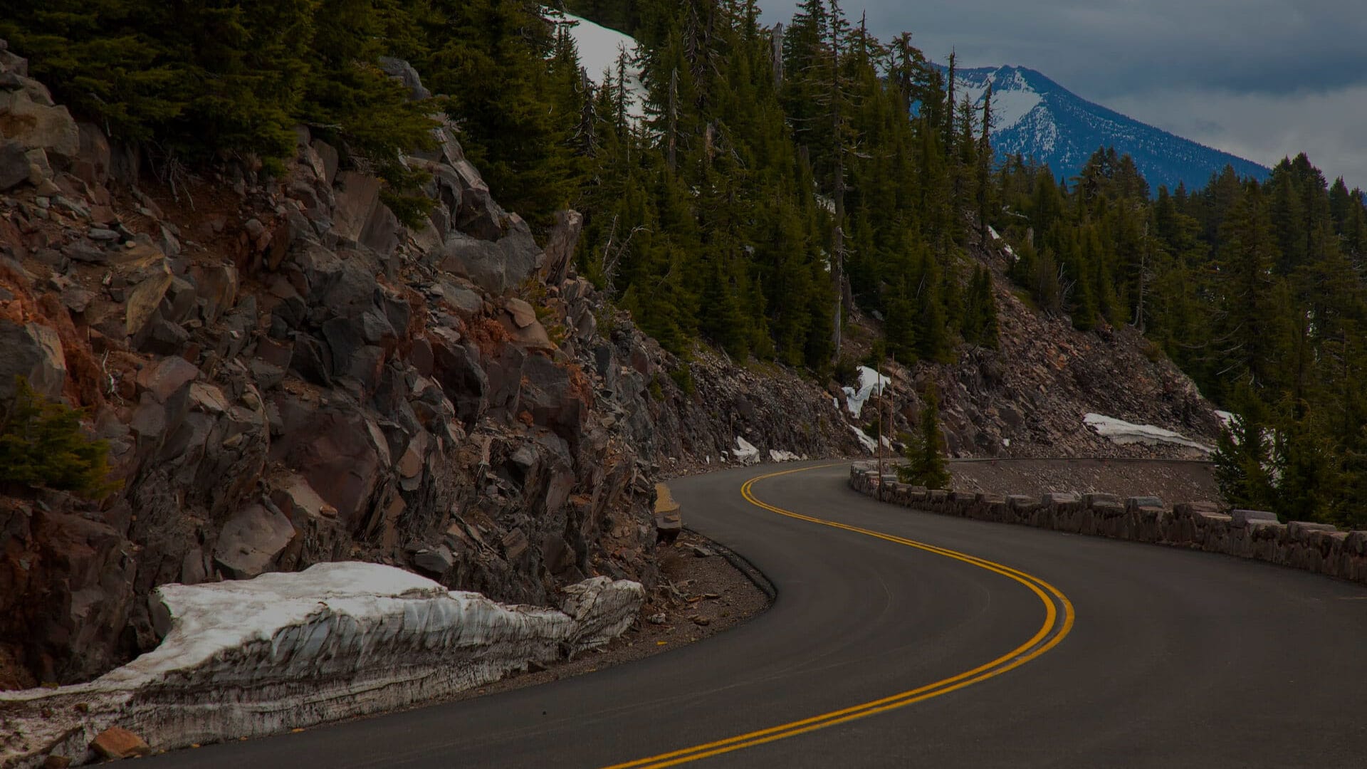
From towering peaks to deep craters, ancient lava flows to steaming lakes, almost everything you see on a drive along Volcanic Legacy Scenic Byway was formed—and continues to be formed—by volcanic activity. But the volcano-to-volcano drive from Lassen Volcanic National Park to Crater Lake National Park offers far more than a lesson in volcanology: Hiking, biking, boating, camping, and a wide variety of winter sports can also be built into a Volcanic Legacy Scenic Byway road trip.
Everything you need to know about a Volcanic Legacy Scenic Byway road trip
- Volcanic Scenic Byway road trip map
- Our favorite attractions
- Volcanic Scenic Byway history
- Lassen Volcanic National Park to Chester
- Around Lake Almanor
- Chester to Susanville, California
- Susanville to Old Station, California
- Hat Creek Recreation Area to Burney
- Burney to Mount Shasta City
- Dunsmuir to Weed
- Weed to Dorris
- Medicine Lake Loop
- Tulelake, California, to Klamath Falls, Oregon
- Klamath Falls to Highway 62
- Crater Lake National Park
- FAQs
Download the mobile app to plan on the go.

Share and plan trips with friends while discovering millions of places along your route.
Get the AppThe Volcanic Legacy Scenic Byway officially begins in Mineral, California, one of several gateways to Lassen Volcanic National Park. It’s not a linear road—the scenic highway includes several loops around lakes and through parks, as well as detours put to use each winter when high-altitude segments are closed due to snow. In summer, for example, the byway ends with a 33-mile transit of Rim Drive around Crater Lake National Park. But since the road is only fully open between July and October, visitors in other seasons have to content themselves with concluding their journey with a ride along the west rim, where the road stays open year-round.
Our favorite attractions
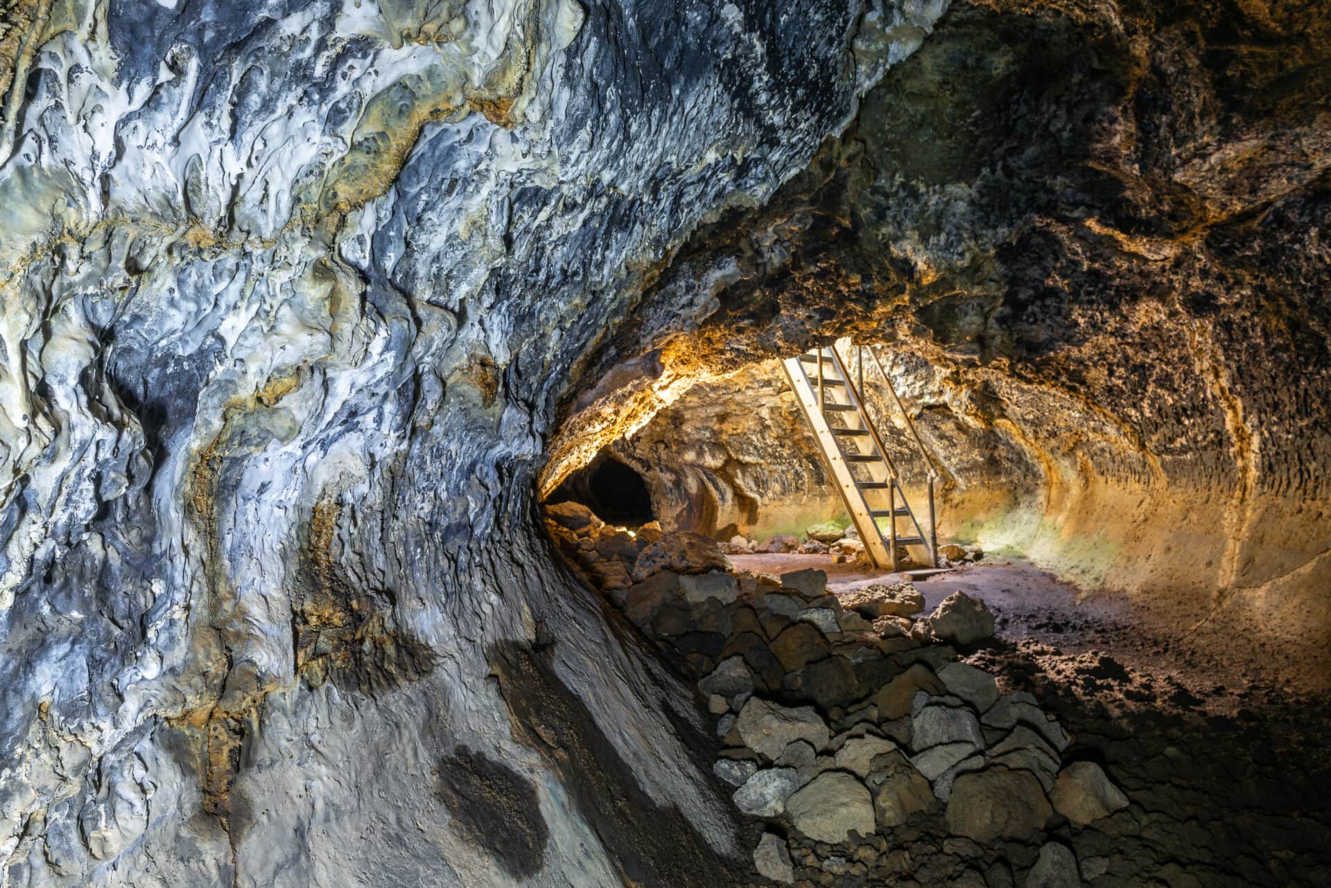
Subway Cave: Plunge from a sunny pine forest into complete darkness as you walk a third of a mile through a cave-like lava tunnel. Don’t forget to bring a flashlight (or at least your smartphone).
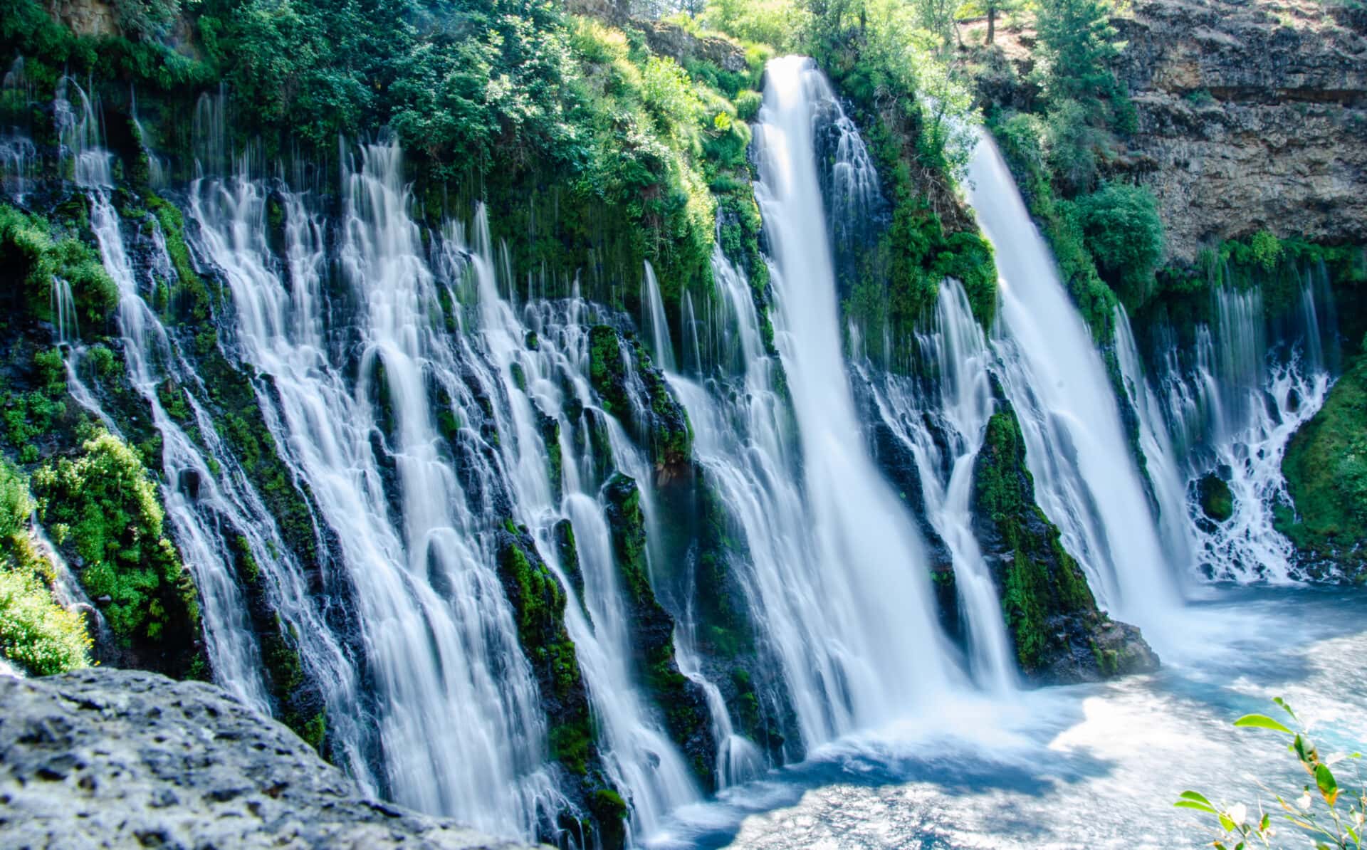
Burney Falls: Natural springs feed this 129-foot waterfall, so you never have to worry about showing up and finding them dry. Every day 100 million gallons of water flow over the falls, bound for Lake Britton.
Medicine Lake: You get a lot of scenic mileage out of the relatively short loop around Medicine Lake, including a mountain made of volcanic glass, craters, lava tubes, an ice cave, and a historic fire tower.
Lava Beds National Monument: The 13 hiking trails in this national park site lead to volcanic features like lava tubes, caves, cinder cones, and craters, plus petroglyphs and battlefields from the Modoc War.
Crater Lake Rim Drive: You’ll have to compete with summer crowds for the opportunity to drive around the entire rim during the short season when it’s fully open, but it’s well worth it to see the spooky islands and clear waters of Crater Lake from dozens of angles.
Volcanic Legacy Scenic Byway history
The landscapes visited on a Volcanic Legacy Scenic Byway drive are the result of hundreds of thousands of years of volcanic eruptions. The route itself was established in more recent years—the Oregon segment of the byway was designated in 1997 by the U.S. Federal Highway Administration, and was joined by the California segment only in 2002, when the Volcanic Legacy Scenic Byway was named an All-American Road. The vision of creating a volcano-to-volcano drive was first conceived by Christine Lilienthal, who established the Oregon portion of the route from Chemult to Crater Lake and the Fremont-Winema National Forest. Oregon and California communities then partnered to extend the route southward to Lassen Volcanic National Park.
A Volcanic Legacy Scenic Byway road trip by segments
Divided into 11 regions, the 500-mile scenic highway begins in Lassen Volcanic National Park in Northern California. It then meanders north through the Cascade Mountains, passing through small towns, lakes, waterfalls, forests, grasslands, historic sites, and ski areas on its way to southern Oregon and Crater Lake National Park.
Lassen Volcanic National Park to Chester
From the town of Red Bluff, California, take California Highway 36 east to Mineral, which serves as the southwest entrance to Lassen Volcanic National Park. Here you’ll find the Kohm Yah-mah-nee Visitor Center, staffed by park rangers and featuring an exhibit hall, auditorium, amphitheater, store, dining area, and a gift shop and cafe.
A drive on the 30-mile park road from Mineral to Loomis offers an overview of the active geothermal features of Lassen Volcanic National Park. The mud pots and steam vents of the Sulphur Works are easily accessible from the road, as is the aptly named Boiling Spring Lake. Other sites, like Bumpass Hell—the largest geothermal feature in the park—require some hiking. The road leads to Manzanita Lake (a great spot for fishing and camping) and rises to more than 8,500 feet above sea level near Lassen Peak before reaching the park’s northwest entrance, home of the Loomis Museum. Open in the summer only, the museum is housed in a 1927 building constructed of volcanic rock and also serves as a park visitor center.
Roadtrippers who want to linger in Lassen will find eight campgrounds, six of which are along the park road; the Manzanita Lake, Butte Lake, and Summit Lake campgrounds are best for RVs. Hotel-style accommodations are available at the Drakesbad Guest Ranch, a secluded, 22-room lodge in the Warner Valley. The dining room at the guest ranch serves three meals daily to guests and other park visitors; other dining options include the cafe at the Kohm Yah-mah-nee Visitor Center and the Camper Store at Manzanita Lake Campground.
The official route of the Volcanic Legacy Scenic Byway is a counterclockwise loop from Mineral, so you’ll have to double back through the park to continue the circle. Heading east on Highway 36 toward Chester you’ll cross the Pacific Crest Trail, which cuts through the heart of Lassen Volcanic National Park (and six other national parks) on its 2,653-mile journey between the Mexican and Canadian borders. Chester serves as the approximate midpoint for the long trail.
Around Lake Almanor
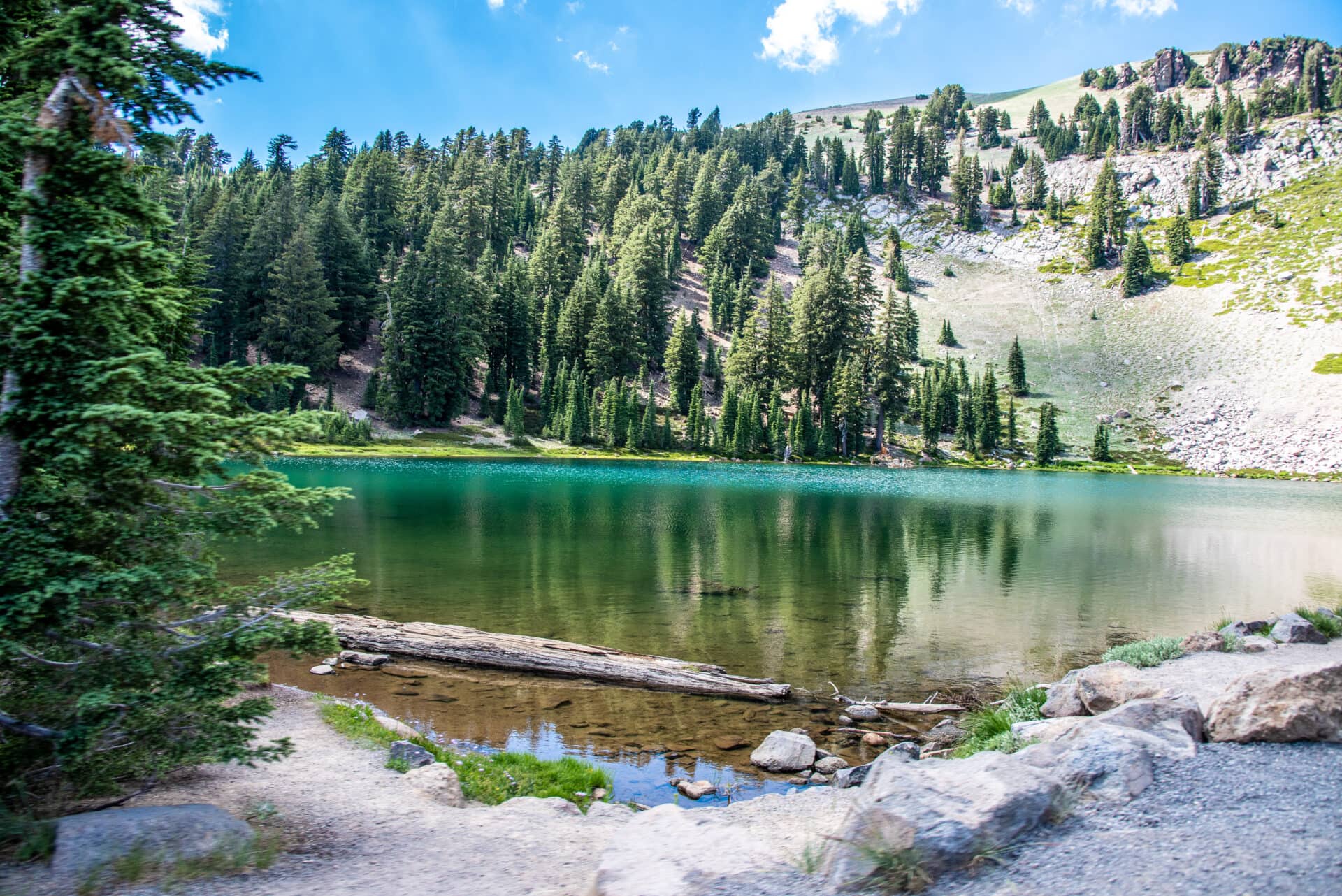
The Lake Almanor area includes some of the closest hotels, campgrounds, and restaurants to Lassen Volcanic National Park. As the Volcanic Legacy Scenic Byway loops around the national park, it makes a detour around Lake Almanor, skipping through the towns of Almanor, Lake Almanor West, and Prattville. Visitors have the opportunity to play in the lake, which is an important reservoir but also allows swimming, fishing, and boating. RVers and campers can also choose from 840 sites around Lake Almanor.
The Lake Almanor Recreation Trail, located in the Lassen National Forest, is a long (19 miles out and back) but only moderately strenuous hike offering views of Lake Almanor, Dyer Mountain, and Lassen Peak. The trailhead is near Canyon Dam at the southern end of the lake. Hiking to Humboldt Peak (the trailhead is on the west side of the lake, off Humbug Road) is an opportunity to put some footprints on the Pacific Crest Trail on the 6-mile, 4-hour round trip to the 7,087-foot summit of a local high point with excellent views.
Chester to Susanville, California
Located on the north shore of Lake Almanor, Chester is a still-active lumber town—you can learn some of the history of the industry at the Collins Pine Museum in town. Local accommodations include a selection of bed and breakfasts and 1950s-vintage motels; the Ranch House is a popular stop for salads, burgers, and sandwiches.
Speaking of logging, there’s no lumberjack more famous than Paul Bunyan, and the town of Westwood lays claim to being the hometown of the axe-wielding giant and his faithful companion, Babe the Big Blue Ox. Keep an eye out for the massive wooden statues of Paul and Babe as you drive toward Susanville on Highway 36.
If you want to stretch your legs in Susanville, head to Skyline Park, which has a pleasant 1-mile walking trail. For something more challenging, try the Bizz Johnson National Recreation Trail, which follows the path of the former Fernley and Lassen Branch Line of the Southern Pacific railroad for more than 25 miles from Susanville into the Susan River Canyon.
Susanville to Old Station, California
Susanville is a popular place to stay the night for Volcanic Legacy Scenic Byway travelers. The Diamond Mountain Casino and Hotel has dining, gaming, and a pool in addition to rooms and suites; beer and pizza are the go-to menu items at Lassen Ale Works at the Boardroom downtown.
A minor detour from the scenic byway on Highway A1 in Susanville leads to the Eagle Lake Recreation Area, which has 173 RV and tent campsites and fishing for Eagle Lake trout. Just off Highway 44, which traces the Lassen Emigrant Trail, you’ll find Crater Lake, where trout swim in waters that plunge 78 feet down into a volcanic crater. There’s also a Lassen National Forest campground here, but the steep and rough 7-mile road off the highway makes it a poor option for motorhomes and large trailers.
Hat Creek Recreation Area to Burney
The Hat Creek Rim Overlook, about 3 miles east of the town of Old Station, is a good introduction to the volcanic landscape between Lassen Peak and Mount Shasta. It’s also possible to hike part of the Pacific Crest Trail, which passes close to the overlook off of Highway 44.
Old Station’s history includes being a stagecoach stop and a military outpost in the 1850s. Today, it serves as the gateway to the Hat Creek Recreation Area, whose attractions include world-class trout fishing, hiking, camping, an active volcanic area, and—in the winter—the opportunity to get a permit and cut your own Christmas tree.
All are located within Lassen National Forest, and the Old Station Visitor Information Center is your best resource for learning about all the area has to offer. The Hat Creek Campground and Cave Campground are close to two major volcanic features: the Spattercone Nature Trail, a 1.5-mile loop to a miniature volcano, and Subway Cave, a lava tube you can walk through.
As you head out of Old Station, look for signs for the Bridge Picnic Area on Highway 89, about 8 miles north of the junction with Highway 44. It’s a nice spot to stop for lunch, with picnic tables close to Hat Creek. For breakfast or lunch in town, try JJ’s Cafe.
Burney to Mount Shasta City
This stretch of Volcanic Legacy trades fire for water—it’s known as the Waterfalls Region of the Scenic Byway. Heading north on Highway 89 you’ll intersect Highway 299; to the west is the town of Burney, worth the short detour to check out the Alpine Drive Inn, which has been slinging burgers and shakes since 1956. To the east you’ll find the Fort Crook Museum, which tells the story of the U.S. Army outpost established in 1857 near Fall River Mills. Nearby Ahjumawi Lava Springs State Park is unique in that it can only be reached by boat; freshwater springs flow from lava flows where four lakes converge.
Back on Highway 89 you’ll soon see signs for McArthur-Burney Falls Memorial State Park; the spring-fed,129-foot Burney Falls is known for its exceptional beauty, and there are five blazed hiking trails in the park as well. A short distance away is the Lake Britton Trestle Bridge, famed for its appearance in the infamous railroad bridge scene in the movie Stand By Me. The bridge is now part of the Great Shasta Rail Trail.
The McCloud River Falls Trail is a 3.9-mile hike that takes you to all three tiers of McCloud Falls. If you prefer to drive, there are paved roads leading to the Lower, Middle, and Upper falls.
The McCloud Hotel was built in 1916 to house lumber workers; it now provides lodging and food for the many visitors—including Scenic Byway travelers—who use the town of McCloud as a base for exploring the Mount Shasta area. McCloud RV Resort and Friday’s RV Retreat are both close to town, as well. Floyd’s Frosty is a beloved local burger and ice cream stand.
Dunsmuir to Weed
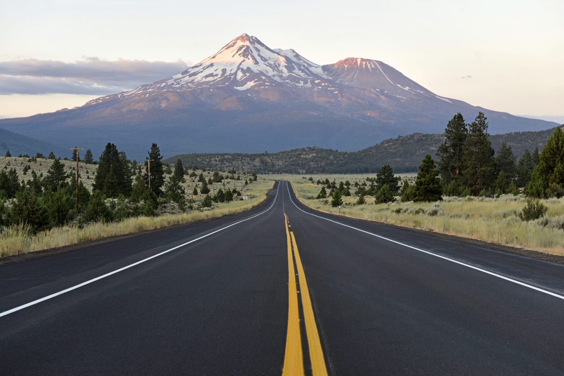
Mighty Mount Shasta, a 14,179-foot volcanic peak whose last eruption was just 200 years ago, looms over this segment of the Volcanic Legacy Scenic Byway. Tourists have been visiting this region to experience its dramatic beauty since the 19th century. Today, it’s mountain bikers who come in summer, and snowsports enthusiasts head to the Mount Shasta Ski Park in the winter.
Mount Shasta City has dozens of dining and lodging options to choose from, including Lilys Restaurant for inspired American cuisine and the spa and golf destination of Mount Shasta Resort. In addition to attempting the challenging summit of Mount Shasta, visitors to Shasta Trinity National Forest can enjoy fishing on Shasta Lake as well as camping and hiking. The Castle Crags Wilderness is known for its towering granite spires and deep canyons.
The 2.5-mile Black Butte Trail rewards hikers with excellent views of Mount Shasta—the mountain and the town. Close to the town of Dunsmuir, two exits south of the Scenic Byway on I-5 is the short hike to Hedge Creek Falls, a waterfall spilling over a natural cave.
Weed to Dorris
You might guess that the town of Weed got its name from either lawn pests or a grow op, but in fact it honors pioneer Abner Weed, who founded a lumber business here. The Weed Store is a must-stop for kitschy souvenirs with all of the punchlines you’d expect.
Deer Mountain is a hub for snowmobiling over 250 miles of trails in the Klamath, Shasta Trinity, and Modoc National Forests. Pluto’s Cave, between Deer Mountain and Whaleback, is a large lava tube that is open for exploration. If you enjoy fishing, steer west to Juanita Lake, which has a 23-site campground and is jumping with trout, bass, and catfish. The Butte Valley National Grassland provides a strikingly different aspect to the volcanic landscape along the Scenic Byway—18,425 acres of shrub steppe that you can drive through.
The little town of Dorris has one big claim to fame: The stars and stripes fly from a 200-foot flagpole, the tallest west of the Rocky Mountains.
Medicine Lake Loop
The Medicine Lake section of Modoc National Forest can be accessed from two locations on the Volcanic Legacy Scenic Byway—McCloud or Tulelake, which are connected by the Modoc Volcanic Scenic Byway. Traveling from the Tulelake end has the advantage of combining the drive with a visit to Lava Beds National Monument.
Medicine Lake and the Medicine Lake Recreation Area are a hotbed (so to speak) of volcanic and geothermal attractions, as well as a fun place to put a boat in the water. The loop drive around the lake can include stops to hike to the Medicine Lake Glass Flow, the Giant Crater Lava Tube, Little Glass Mountain, and the Jot Dean Ice Cave—a lava tube that now contains ice year-round.
Tulelake, California, to Klamath Falls, Oregon
Tulelake is infamous as the location of two World War 2 internment camps for American citizens of Japanese descent—you can visit Tule Lake National Monument to learn more of the history.
Surrounding Tulelake are several big natural areas, including the Tule Lake National Wildlife Refuge (a major stopover for migratory birds), the Lower Klamath National Wildlife Refuge (established in 1908 by President Theodore Roosevelt as a hunting preserve), and—most significantly—Lava Beds National Monument.
Geological and human history converge at Lava Beds National Monument, where volcanic eruptions have created hundreds of caves—many open to spelunkers—and the vast fields of lava that emerged from the Medicine Lake Shield Volcano, called the Devil’s Homestead. You’ll also learn about the Modoc War, fought in this rugged land in 1872 and ’73, when the U.S. Army attempted to forcibly remove members of the Modoc tribe from their home territory. Sites include the hideout of Modoc leader Captain Jack and Gillems Camp, where hundreds of soldiers were quartered.
Indian Well is the only campground in Lava Beds National Monument; it can accommodate tents, trailers, and RVs up to 30 feet. There are also several private RV parks in the area.
Klamath Falls to Highway 62
The Volcanic Legacy Scenic Byway finally crosses into Oregon near the city of Klamath Falls, which occupies the southern end of Klamath Lake. The town serves as an endpoint for the 105-mile OC&E Woods Line State Trail, a rail trail running northeast to the Thompson Reservoir, and is home to several museums and galleries. The Running Y Ranch Resort features the only Arnold Palmer-designed course in Oregon. Downtown Klamath Falls also has a variety of dining options, including a brew pub, an Irish bar, Mexican restaurants, and a fancy steakhouse called Rooster’s.
The Scenic Byway traces the west shore of Klamath Lake along Highway 140. Eagle Ridge County Park has six tent campsites located on a 635-acre peninsula jutting into the lake, but there is also RV-friendly camping available at Collier Memorial State Park, where visitors can check out a museum about logging.
The 2.3-million acre Fremont-Winema National Forest is crossed by two national recreation trails (Fremont and Crane National), a classic lakeside resort (Lake of the Woods), and abundant camping, hiking, snow sports, boating, and fishing. The Klamath County Museum is located on the ground of Fort Klamath, a military outpost established in 1863. The Jackson Kimball State Park, located at the headwaters of the Wood River, is a lovely place to picnic, kayak, or camp.
Crater Lake National Park
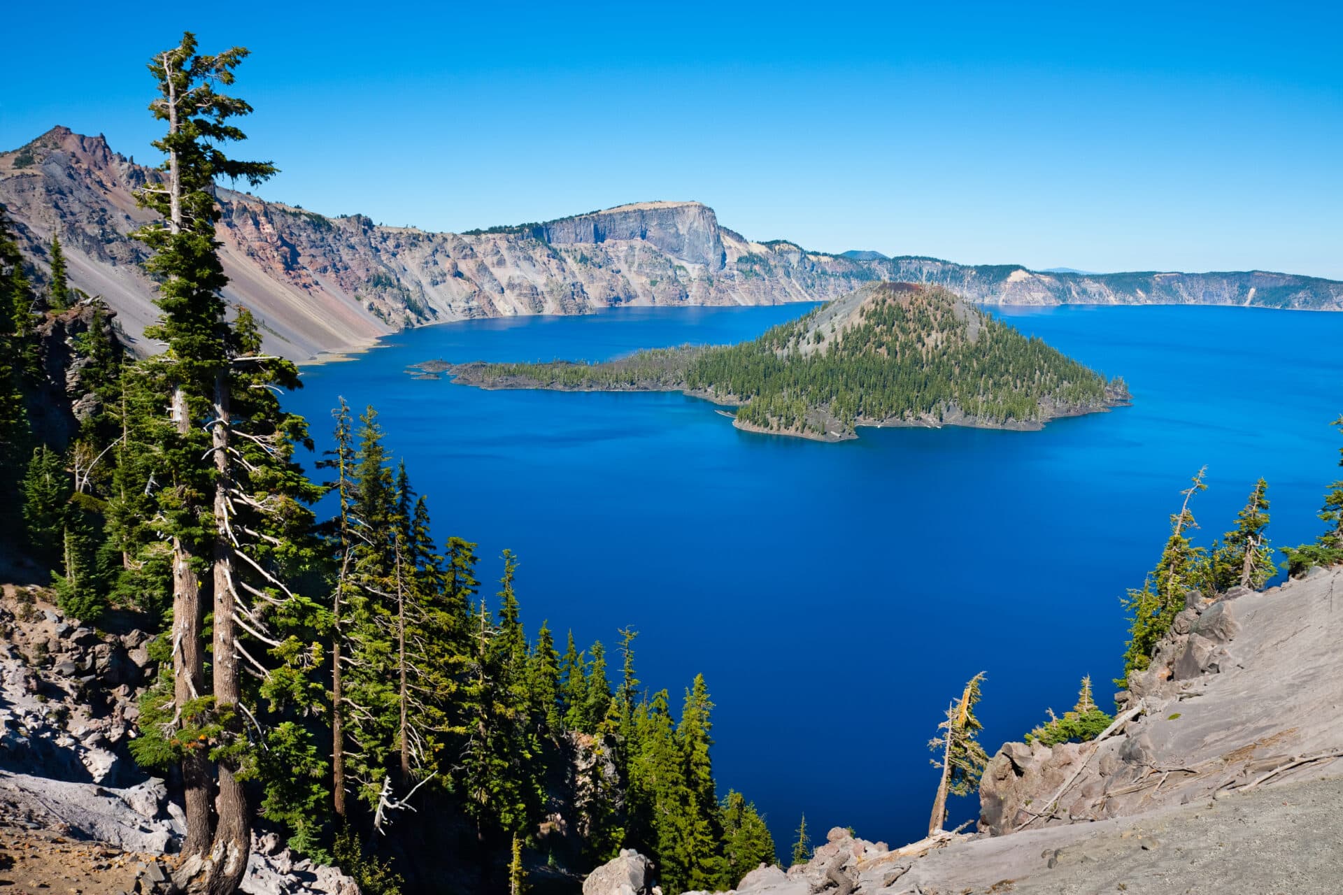
The northward course of the Volcanic Legacy Scenic Byway concludes in Crater Lake National Park. The deepest lake in the U.S. fills the caldera of a volcano that erupted 7,700 years ago, and travelers can enjoy endless views of the crystalline waters from the 33-mile Scenic Rim Drive. When fully open (typically July through October), the loop road includes 30 overlooks.
Even when travel through Crater Lake National Park is limited to the west shore of the lake, there’s plenty to see. The Rim Visitor Center is located in a historic artist’s studio in Rim Village, and rangers lead guided walking tours that cover the history and architecture of the village.
The 71-room Crater Lake Lodge is the premier place to stay in the park; overlooking the lake from Rim Village, it accommodates guests from May-October. Mazama Campground has 214 campsites, ranging from tent-only to full RV hookups.
The Cleetwood Cove Trail is the only way to get to the lakeshore on foot; the steep trail ends at a beach where you can swim and fish. Boat tours of the lake also are available; some stop at Wizard Island, a volcanic cinder cone, for ranger-led programs. Away from the lake, the 2.5-mile hike to the summit of Mount Scott—the highest point in the park—offers 100-mile views back to Mount Shasta.
Frequently asked questions
Where does the Volcanic Legacy Scenic Byway begin and end?
The Volcanic Legacy Scenic Byway begins at Lassen Volcanic National Park in northeastern California and ends at Crater Lake National Park in southwestern Oregon.
How long does it take to drive the Volcanic Legacy Scenic Byway?
Technically you can drive the Volcanic Legacy Scenic Byway in as little as 2 days, but we recommend taking at least 5 if you want to build in even minimal sightseeing during your visit. The 500-mile Volcanic Legacy Scenic Byway is divided into 11 regions and includes such highlights as Lassen Volcanic National Park, Burney Mountain, the Shasta Trinity National Forest, Mount Shasta, Klamath National Forest, Lava Beds National Monument, the Fremont-Winema National Forest, and Crater Lake National Park. You could spend months exploring it all.
How much does the Volcanic Legacy Scenic Byway cost?
There are no tolls charged for driving the Volcanic Legacy Scenic Byway, but admission fees apply if you plan to visit the national parks along the way. The current entrance fee for Lassen Volcanic is $30 per car, Lava Beds National Monument is $25, and Crater Lake National Park is $30. If you plan to visit multiple parks, it makes sense to purchase an America the Beautiful pass for $80, which will get you into every U.S national park for a year.
How many miles is the Volcanic Legacy Scenic Byway?
The Volcanic Legacy Scenic Byway is 500 miles long and mostly follows secondary highways, with only a short segment of interstate highway (California’s I-5 freeway near Mount Shasta).
What is the best way to travel the Volcanic Legacy Scenic Byway?
Most people tour Volcanic Legacy Scenic Byway by personal automobile, although it can also be toured by motorcycle and RV.
What is the best time of year to drive the Volcanic Legacy Scenic Byway?
The Volcanic Legacy Scenic Byway is open year-round. July to September is the busiest time of year at the national parks along the way. Klamath Lake is a popular destination in the fall, when millions of migrating birds stop over; a winter visit offers more solitude and cold-weather sports like cross-country and downhill skiing, snowshoeing, and snowmobiling. Some RV parks stay open in winter, as well.
What are the driving conditions on the Volcanic Legacy Scenic Byway?
Most of the Volcanic Legacy Scenic Byway is open for travel year-round, although winter weather can sometimes cause closures. In Crater Lake National Park, the full loop of Crater Lake is generally open only from July through October. Lassen Park Road is the only part of the byway that restricts travel by large RVs (over 40 feet).
Is it better to drive the Volcanic Legacy Scenic Byway north to south?
Anchored by U.S. national parks on both ends, the Volcanic Legacy Scenic Byway can be driven in either direction. The scenic road can also be accessed at nearly any point from the I-5 freeway, which runs parallel along most of its length.
Written by Robert Curley
