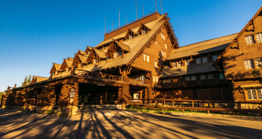
Backpack on, boots laced, and hiking poles extended, I’m physically ready to face one of my favorite hikes to the top of Mount Ralston. On the southwestern edge of California’s Desolation Wilderness, this peak stands high enough to see a number of pristine alpine lakes, including Fallen Leaf Lake, Lake Aloha, and Lake Tahoe. It’s also a victim of the 2021 Caldor Fire, and its black spires of charred pine stand at broken attention along Highway 50. I’m physically prepared but captive to worry: Will the blackened trail destroy my experience here?
Mount Ralston is on a beautiful stretch of riverside two-lane highway that intersects Eldorado National Forest between South Lake Tahoe and Sacramento. Before the fire, the drive was punctuated with green and utter peace. This forest is a popular destination for hikers, backpackers, paddleboarders, kayakers, off-roaders, campers, and more. “Eldorado is one of those unique forests … [it] is so vast,” says Stephanie Bishop, public information officer with Eldorado National Forest.
The Caldor Fire burned 221,835 acres, much of it in Eldorado National Forest. Ignoring the fire’s scar won’t erase the damage, it will only take a part of the forest away from me. I’m not ready for that loss. So, on this brilliant Saturday afternoon, I lock the car door, dig my feet into the sand, and approach the trail.
Further reading...

What to expect when visiting a burn area
While you may be inclined to avoid regions damaged by wildfire when traveling, I implore you to still visit these places during your Western road trips and vacations. They can offer unforgettable adventures, a chance to see forest regrowth, outdoor recreation with fewer crowds, and an opportunity to place money in hurting local economies.
Bishop’s first piece of advice for planning a trip to a burn area is to prepare mentally, as the location will be visually changed and may offer a jarring sight. “It shouldn’t stop anybody,” she encourages. “It has never stopped me from going back and enjoying the locations and doing the activities that I’ve done in the past.”
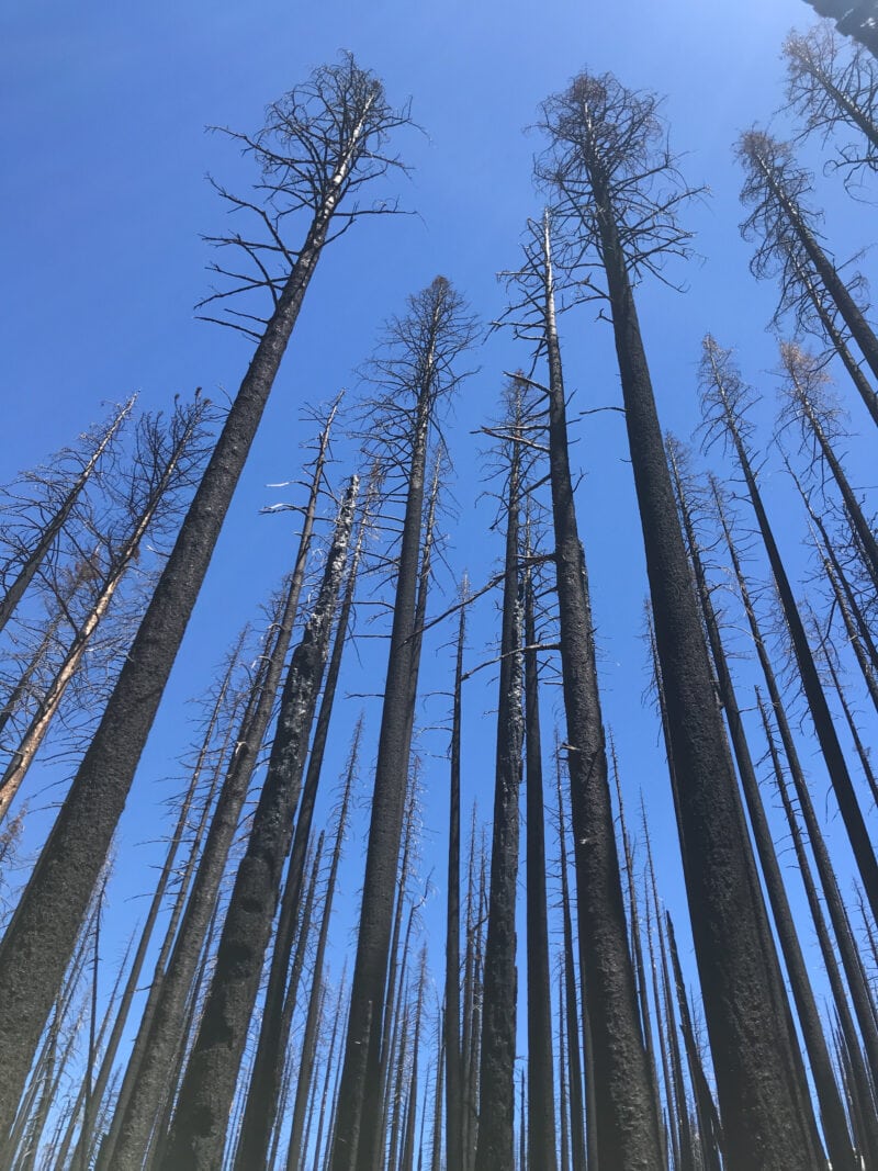
I muddle my way through the initial incline of the hike, focusing my eyes on the ashen trail. The first section of the 6.6-mile trail is hot. The shade is gone with the conifer’s canopy. It’s not until I stop to catch my breath that I notice the incredible contrast between the cobalt sky and the black, bare trunks.
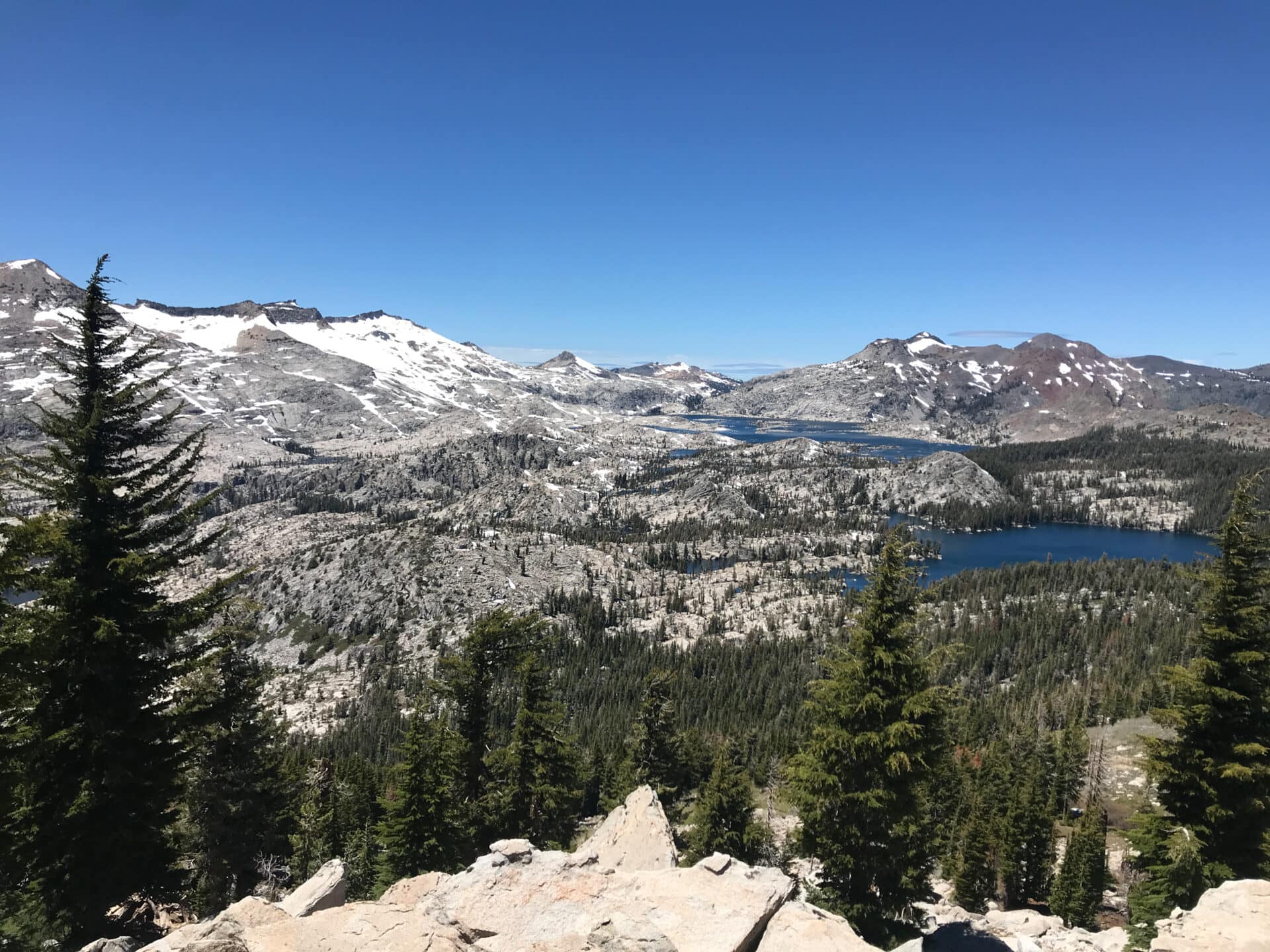
Bishop is right; it’s dystopian. However, the sturdy trail flows just as I remember and floods my mind with happiness. There’s still beauty here. The trail is soft and wonderful to walk on. I can hear a waterfall roaring and a creek finding its way from the last of the snowmelt. Somewhere in the distance ring two echoing calls of an eagle. And the views, as I start to climb up the strenuous pitch, open up to showcase the vast network of granite peaks south of the highway.
Subtle, welcomed signs of regrowth
In the midst of attempting to walk at a 90-degree angle, green materializes just off the trail, thriving in a desert of black. This is one part of the trip I’m not prepared for, though it’s a common experience. “What you will see is the slow natural regrowth that’s going on,” Bishop says. Ferns unfurl in patches as large as a dining room table. One is even growing in the middle of the trail, a happy sign of both regrowth and few pedestrians. Though Bishop warns me that in severe burn areas, “it will be 20 to 30 years before trees are large enough to resemble what many would consider a forest,” regrowth is well underway just 7 months after the fire was completely extinguished. Ferns and mosses are the first flora to return after a forest fire, followed by fireweed and morel mushrooms the first spring after a blaze. Two years after a fire, grasses and wildflowers return, flourishing in the unobstructed sunshine.
As the trail ascends, it brings me to the peak. Standing at 9,239 feet, Ralston peers into the granite, alpine playgrounds of Desolation Wilderness, Mokelumne Wilderness, and Lake Tahoe. I can even see the Coastal Range across the Central Valley.
On this perfect, cloudless Saturday afternoon, I have the peak to myself. “I don’t know about you, but I appreciate [when] no one’s here,” Bishop says. “Sometimes the trail is just way too crowded for me and I just want to be able to enjoy nature to myself.”
Not only will the landscape in a burn area be quieter, but so will the campsites, restaurants, and other attractions in the area. And these areas will generally be grateful to have some additional money coming into their economy after a traumatic event like a wildfire. Many businesses in the counties affected by the Caldor Fire were forced to close due to evacuations in the area. Some, like Sierra-at-Tahoe, have yet to reopen and have lost nearly a year’s worth of income.
Ways to manage risk in a burn area
An unforgettable recreation experience is waiting for you behind the blackened trees. If you’d like to explore an area that has been impacted by fire, know that though mitigation and rehabilitation efforts have been made, there are still risks. Bishop advises taking the following actions and understanding that you, the recreator, are responsible for your own safety.
- Before you go, familiarize yourself with current closures and conditions.
- Obey forest orders and closures.
- Obey speed limits and anticipate potential poor road conditions.
- Know the limitations of yourself and your vehicle.
- Properly maintain your vehicle.
- Don’t stray from the trail.
- Be conscious of weather, especially wind and rain.
- Avoid areas with known hazards such as fire weakened trees and unstable soil.
- Pack the essentials:
- First aid kit
- Map, compass, and GPS system
- Sun protection
- Jacket, rain gear, extra socks, hats, and gloves
- Flashlights, lanterns, and headlamps
- Repair kit and tools
- Food
- Water
- Shelter
- Inform a trusted contact of your travel plans.
- Practice thoughtfulness and good judgment.
- Do not assume that you will have cell reception.
Meet the Author
- Related Articles
- Latest Articles