Planning a Skyline Drive road trip
There’s a lot to see, do, and love on this 105-mile scenic byway that cuts north to south across Virginia’s Shenandoah National Park.
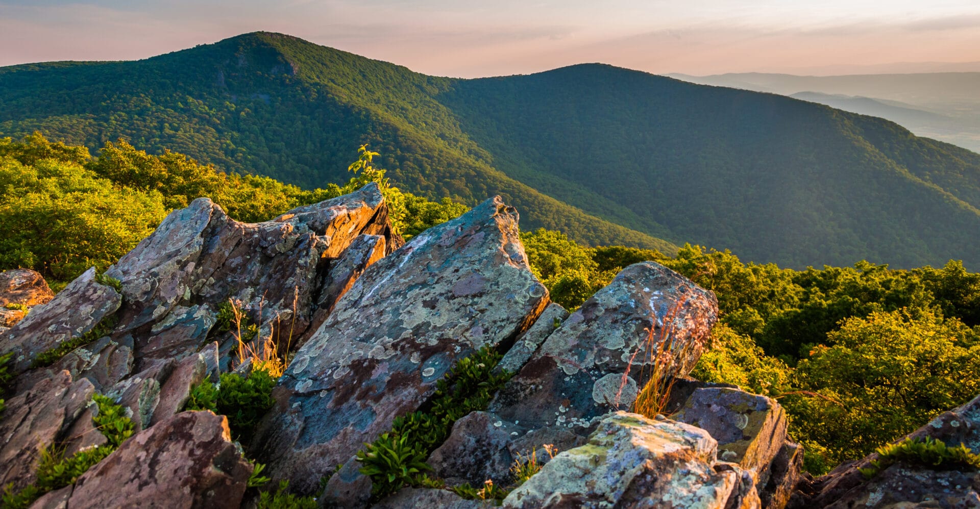
Taking in the scenery of Skyline Drive is a bucket-list item for nature lovers and outdoor enthusiasts, and the road attracts more than 1.2 million visitors each year. Many come eager to take in vibrant fall foliage or colorful spring wildflowers.
The road is widely considered one of the most scenic drives in the U.S. The drive from north to south across Virginia’s Shenandoah National Park rewards with overlooks, picnic areas, hiking trails, waterfalls, historic landmarks, and the remains of former homesteads.
Concrete mileposts along Skyline Drive make it easy to keep track of where you are within the national park. Before you pile everyone into the car, note that lodges, restaurants, campgrounds, and convenience stores (known as “waysides” in the park) are closed from late-fall to early-spring. In winter, only the Harry F. Byrd, Sr. Visitor Center is open, and only from Thursday through Monday. However, Skyline Drive is open every day the scenic byway is not impacted by inclement weather.
Everything you need to know about a Skyline Drive road trip
Skyline Drive road trip map
Four Skyline Drive access points—Front Royal, Thornton Gap, Swift Run Gap, and Rockfish Gap—split Shenandoah National Park into three similar-sized districts. The North District is closest to Washington, D.C., attracting visitors motoring in from the city and suburbs. The Central District is home to the park’s two lodges, while the South District is known for more rugged terrain.
There are two visitor centers on Skyline Drive, including Dickey Ridge Visitor Center in the North District and Harry F. Byrd, Sr. Visitor Center in the Central District. There are also three camp stores for snacks, supplies, and souvenirs, one in each of the park’s three districts. For sit-down meals, there are two restaurants at each of the in-park lodges.
Download the mobile app to plan on the go.

Share and plan trips with friends while discovering millions of places along your route.
Get the AppOur favorite attractions
A scenic trip along Skyline Drive has so much to offer, including sensational views, historic landmarks, and iconic trails—there’s even a signature park dessert. Here are five of our favorite things along Skyline Drive at Shenandoah National Park.
Rapidan Camp: The rustic summer retreat of 31st President Herbert Hoover during the Great Depression is located in the park’s Central District, near milepost 52.8 on Skyline Drive. Three historic cabins alongside the Rapidan River have been restored to their original 1929 appearances.
Appalachian Trail: A lengthy 101-mile segment of the iconic Appalachian Trail criss-crosses Skyline Drive for the full length of Shenandoah National Park. Several popular day hikes, including Mary’s Rock, Stony Man, and Hightop Mountain, include stretches of this trail.
Hawksbill Summit: At an elevation of 4,051 feet, Hawksbill Summit is the highest point in Shenandoah National Park. A popular out-and-back hike to the top starts at milepost 45.5. At the summit, there is a scenic viewing platform and a small stone picnic shelter.
Mile-High Blackberry Ice Cream Pie: While not an attraction per se, you won’t want to leave Skyline Drive without a slice of the park’s delicious signature dessert. In-season, order up a slice at any of the restaurants at Skyland or Big Meadows Lodge (both in the Central District).
Fox Hollow Trail: There are a lot of big views along Skyline Drive, but there’s also a lot of history. This loop hike guides visitors across the former farm of the Fox family, one of more than 400 homesteading families that lived on the rural land before the park was established in 1935.
Skyline drive history
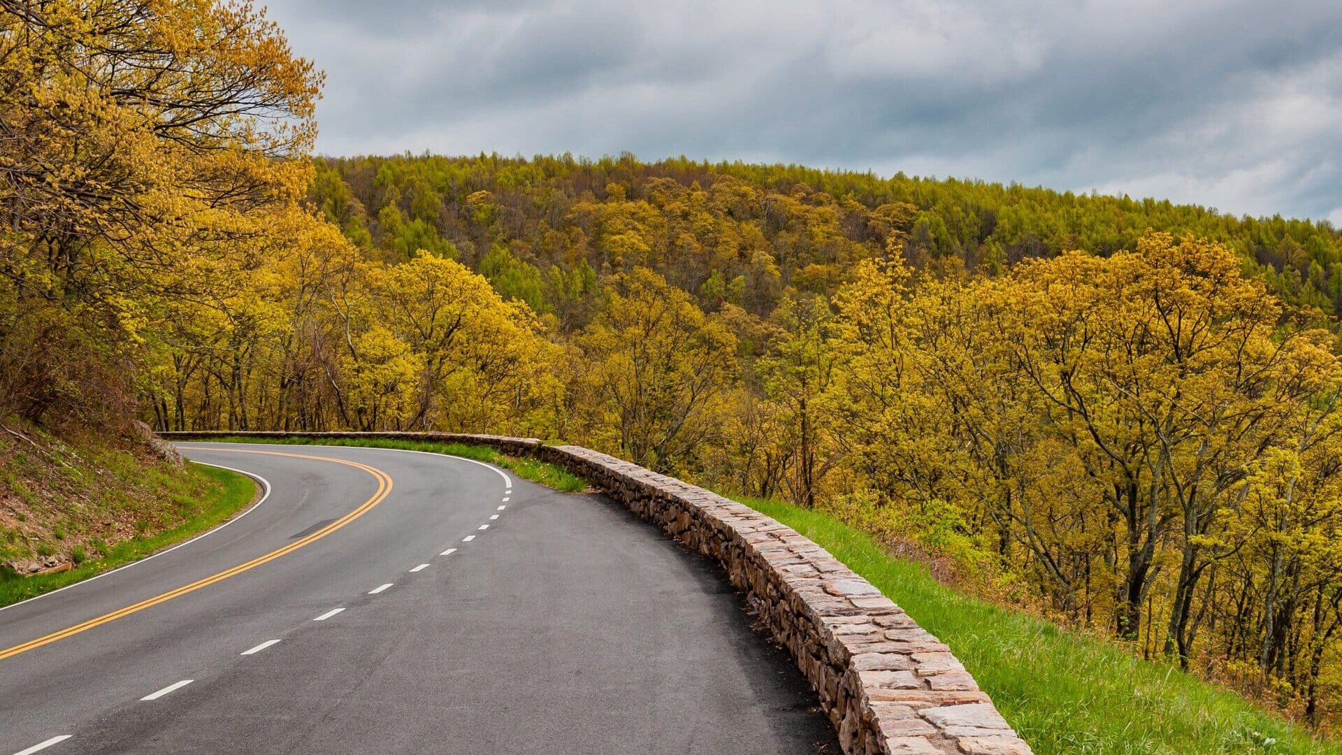
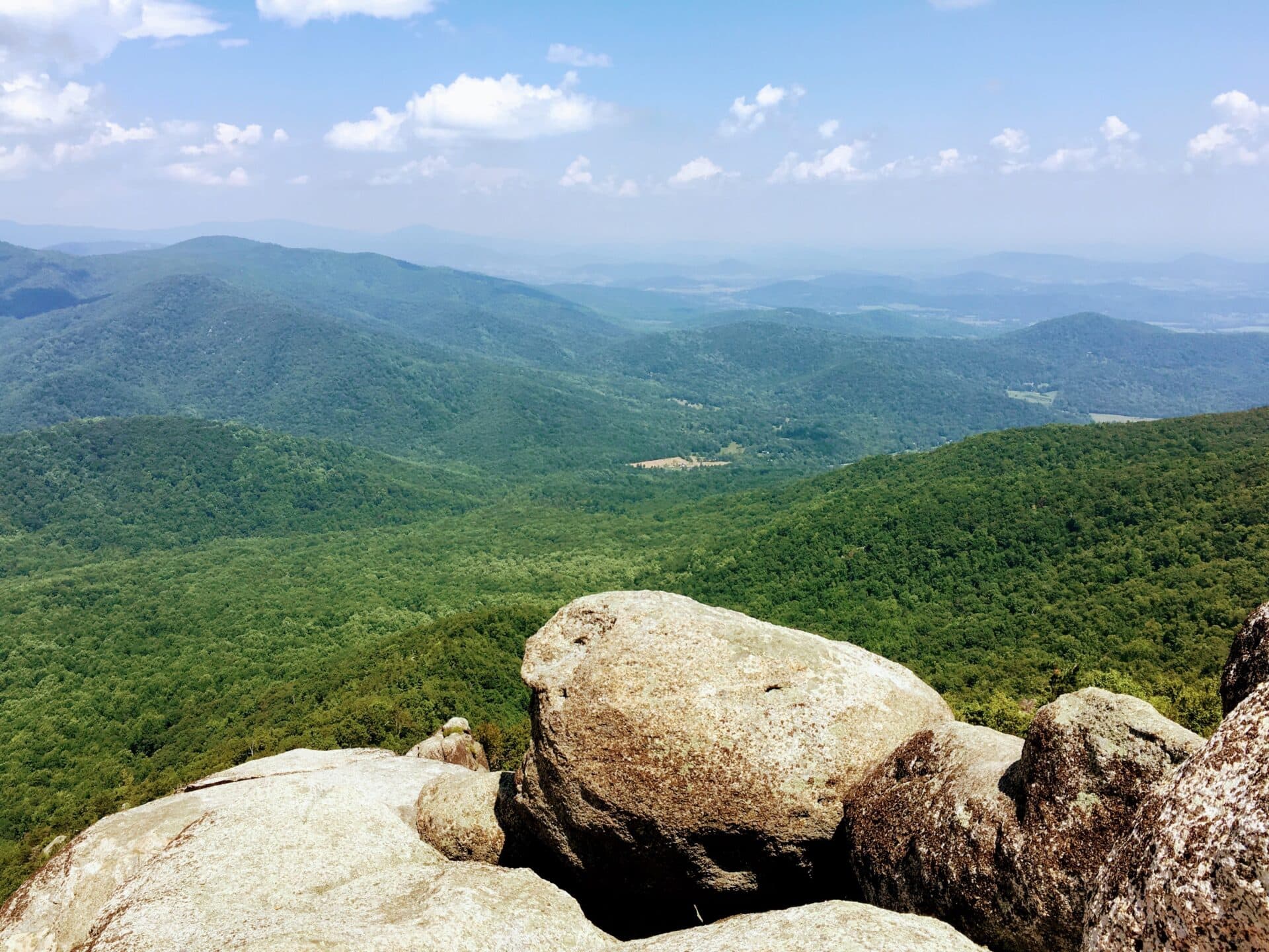
Skyline Drive is a 105-mile scenic byway that crests the Blue Ridge Mountains. Completed in 1939, Skyline Drive meanders north to south across Shenandoah National Park, allowing visitors spectacular views of Virginia’s Shenandoah Valley from more than 75 pull-off overlooks.
More than 500 miles of hiking trails criss-cross Shenandoah National Park, including 101 miles of the famed Appalachian Trail, which generally parallels Skyline Drive. Every now and again, the trail crosses over the scenic byway, then crosses back.
Skyline Drive is especially popular in October when celebrated fall foliage is bursting with vibrant golds and ambers. In peak leaf peeping season, it’s best to seek out Skyline Drive on weekdays, early mornings or late in the day for brilliant golden hour leaves.
A Skyline Drive road trip by segments
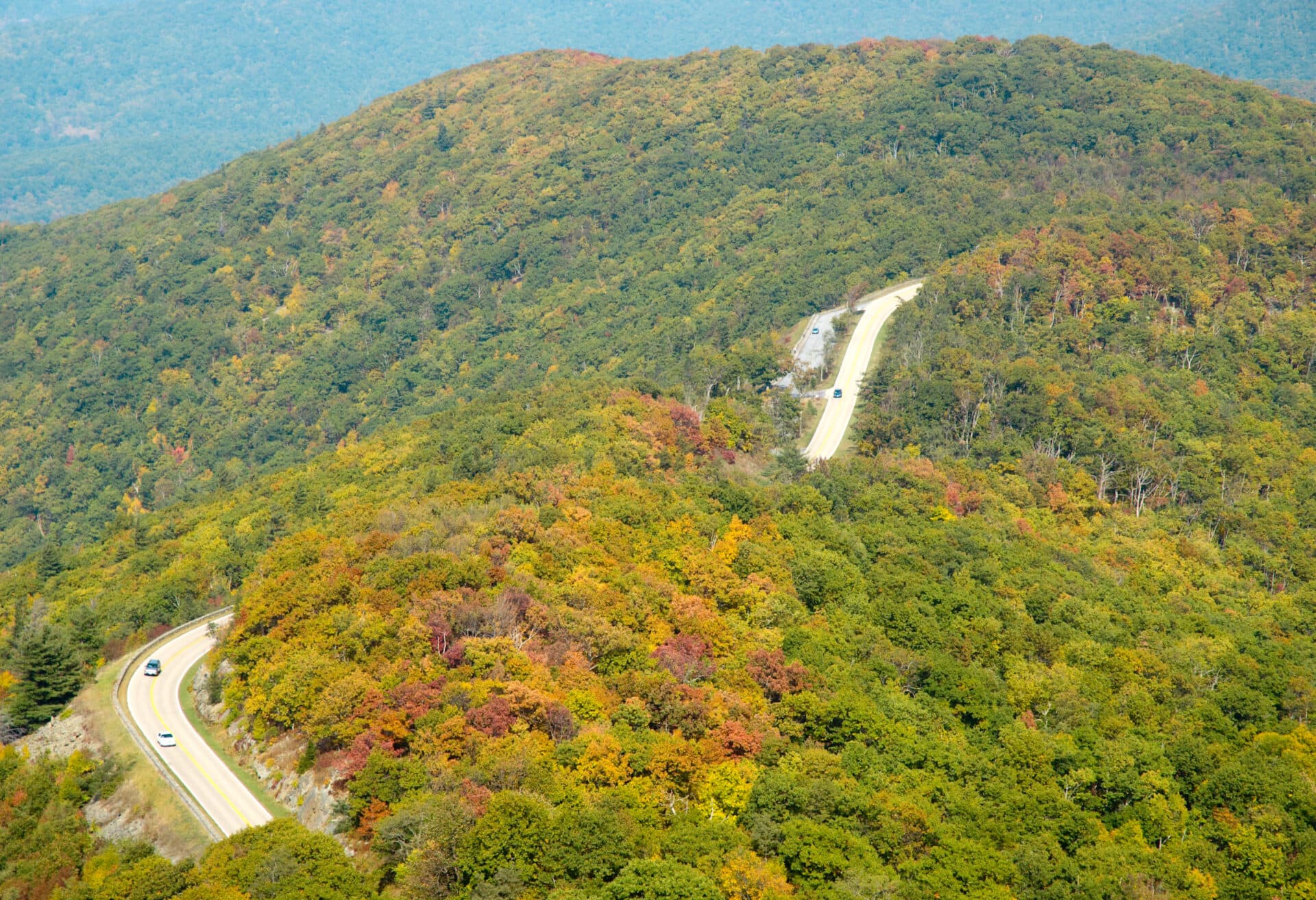
Skyline Drive, which snakes from north to south across Shenandoah National Park, has concrete mileposts every one mile. This makes it easy to identify your location in the park, whether you’re in the North District (milepost 0.0 to 31.5), Central District (milepost 31.5 to 65.7), or South District (milepost 65.7 to 105.4).
Ranger-staffed park entrances on Skyline Drive bookend the start and finish of each park district, including Front Royal (milepost 0.6), Thornton Gap (milepost 31.5), Swift Run Gap (milepost 65.7), and Rockfish Gap (milepost 105.4). Here’s what to know about Skyline Drive, which is open to RVs, travel trailers, and horse trailers.
Front Royal to Thornton Gap
The North District of Shenandoah National Park begins where Skyline Drive meets U.S. Route 340 in Front Royal. Enter the park by way of Skyline Drive, then pay the entrance fee of $30 per vehicle at milepost 0.6 (the entrance fee is good for 7 consecutive days). This quiet section of the park runs along Skyline Drive to Thornton Gap at milepost 31.5.
Make the Dickey Ridge Visitor Center (milepost 4.6) your first stop for nature exhibits and a short park film. Kids ages 7 through 12 can complete a Junior Ranger activity booklet to be sworn in as a Junior Ranger and earn a badge. Behind the visitor center, west-facing vistas attract plein-air painters on clear days. You’ll also find restrooms and a picnic area with picnic tables and charcoal grills.
From the visitor center, walk across Skyline Drive to reach the start of the Fox Hollow Trail. This easy 1.2-mile loop hike offers a glimpse into rural mountain life. Stroll past hand-placed rock walls and a historic cemetery filled with burial plots of the Fox family, one of many families that lived on land that later became a part of Shenandoah National Park.
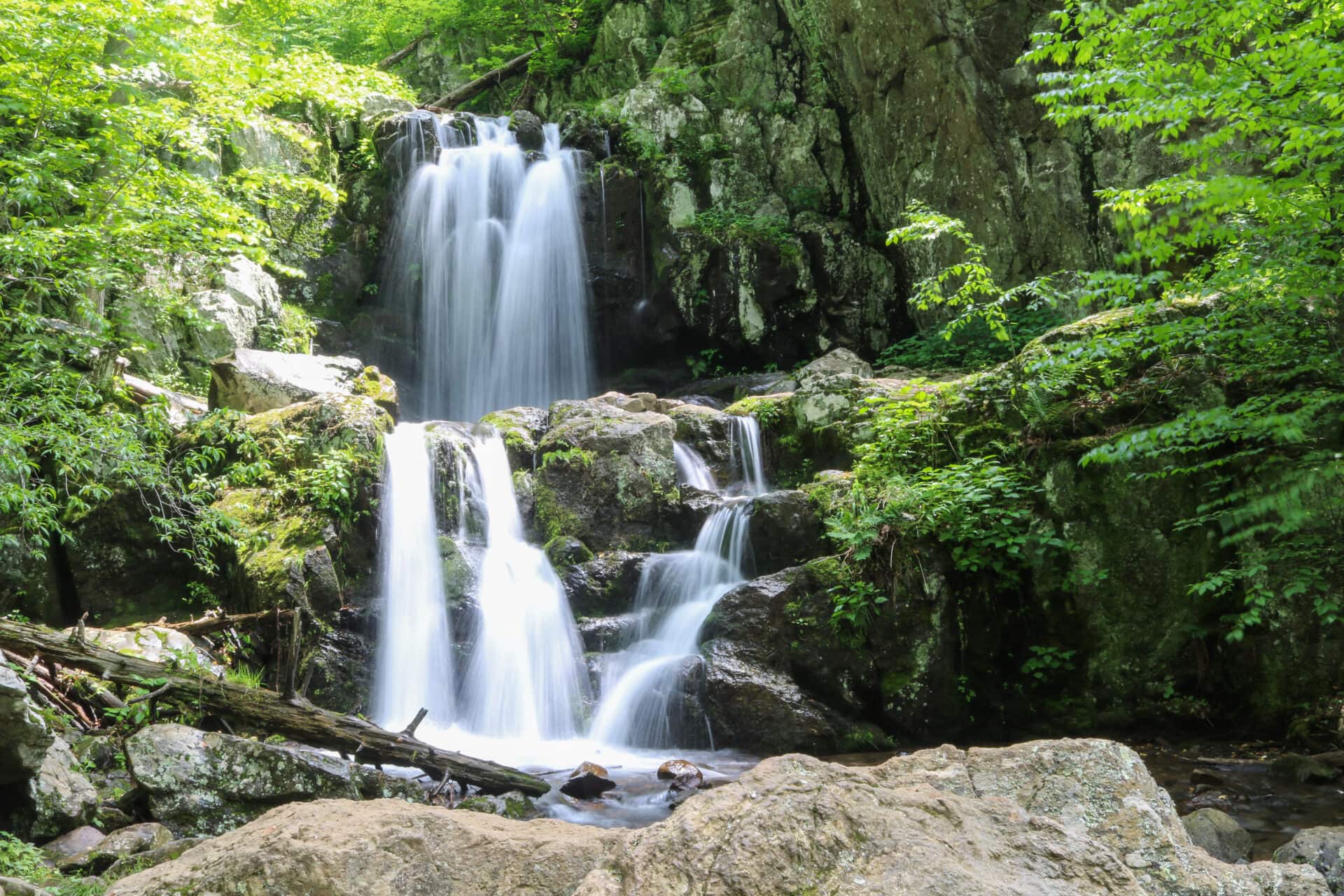
Stop at milepost 21.1 for a 6.5-mile loop hike with scenic views of 93-foot-tall Overall Run Falls, the tallest waterfall in the national park. The falls are best in spring or fall when you’re more likely to reach a tumbling waterfall rather than a trickle, which can be the case on warm summer days.
Mathews Arm Campground (milepost 22.1) is the only campground in the park’s North District. There are 165 sites with picnic tables and fire rings, including 47 sites that can be reserved online. All other sites are first-come, first-served. Three group campsites each allow up to 25 people. All campsites are non-electric with no hookups. There are no showers at this campground.
For sundries and supplies, as well as pre-packaged sandwiches and a grill for burgers and fries, stop in Elkwallow Wayside at milepost 24.1. This convenience store is a helpful resource for day-use visitors and overnight campers. You’ll also find restrooms, camping supplies, and souvenirs, as well as an adjacent picnic area.
Thornton Gap to Swift Run Gap
Shenandoah National Park’s most popular section is the Central District, which runs from the Thornton Gap entrance at milepost 31.5 to the Swift Run Gap entrance at milepost 65.7. There are ranger-staffed pay stations at both entrances. The Central District is home to the park’s two lodges, horseback riding stables, and two campgrounds.
As you enter the Central District, make the super-size Panorama parking area at milepost 31.6 your first stop for restrooms and the trailhead for the Mary’s Rock hike. From here, it’s a 3.7-mile out-and-back hike, mostly along the white-blazed Appalachian Trail, to the top of Mary’s Rock.
Continuing south on Skyline Drive, you will encounter the only restriction in Shenandoah National Park for RVs. The 670-foot-long Mary’s Rock Tunnel at milepost 32.2 has a maximum clearance of 12 feet, 8 inches. There are no clearance restrictions in the park’s North District or South District.
For rock climbers (even newbies), Shenandoah Mountain Guides leads rock climbing adventures at Little Stony Man Cliffs. Not a rock climber? Not a problem. An easy 0.5-mile hike (one-way) starting at milepost 39.1 delivers visitors to rocky outcrops at Little Stony Man Cliffs for sweeping views and rainwater-filled shallow pools.
At milepost 41.7, Skyland, one of two in-park lodges, beckons visitors with 179 guest rooms, stylish suites, and rustic cabins. At an elevation of 3,680 feet, Skyland sits at the highest point on Skyline Drive. There is a gift shop and two on-site restaurants, including Pollock Dining Room, which serves elevated farm-to-fork flavors, and Mountain Taproom, a no-frills grill with pub grub, like chicken wings and burgers.
Skyland is also home to Skyland Stables, which offers 1-hour and 2.5-hour guided horseback trail rides. For small children, hand-guided 15- and 30-minute pony rides are available. Several hiking trails set off from Skyland, including the Millers Head Trail (1.5 miles, out-and-back) and the Appalachian Trail, which leads to views from atop Stony Man Mountain.
More hiking trails call to visitors motoring along Skyline Drive. At milepost 43, the Limberlost Trail is a stroller-friendly 1.25-mile loop on a crushed greenstone surface. This is the only fully-accessible trail at Shenandoah National Park. Further on, hike to the top of Hawksbill Mountain, the highest point in the park at an elevation of 4,051 feet.
The Harry F. Byrd, Sr. Visitor Center is located at milepost 51. An “Iron Mike” statue greets visitors walking in and celebrates the men of the Civilian Conservation Corps who created much of Shenandoah National Park during the Great Depression. A 14-minute video called Shenandoah: The Gift details the formation of the national park. Inside, you’ll find restrooms and a bookstore.
Adjacent to the visitor center is Big Meadows Wayside, a convenience store and souvenir shop, which has restrooms, picnic tables, and a small gas station. It’s also across Skyline Drive from Big Meadows, which hosts periodic night sky programs with local astronomy clubs.
At milepost 51, you’ll also find Big Meadows Lodge, which has 101 guest rooms across the main lodge and historic cabins. There are two on-site restaurants, including Spottswood Dining Room, which serves regional and theme dishes, like the New Deal Roast Turkey Plate, and New Market Taproom, which has casual fare, local beers, and family-friendly trivia nights.
The Big Meadows Campground at milepost 51.2 is the largest campground in the park with 221 campsites, including 168 sites that can be reserved online. All other sites are first-come, first-served. This campground has 51 tent-only sites, as well as two group sites that each allow up to 15 people. All campsites are non-electric with no hookups.
Historic Rapidan Camp, President Herbert Hoover’s summer retreat, can be reached by way of a 4.2-mile out-and-back hike on the Mill Prong Trail, which starts at milepost 52.8. Three original structures, including Creel Cabin, the Prime Minister’s Cabin, and the President’s Cabin (“Brown House”), have been restored to original 1929 appearances.
The Lewis Mountain Campground at milepost 57.5 is the smallest of the four campgrounds at Shenandoah National Park. There are 30 first-come, first-served sites. All campsites are non-electric with no hookups. There are also 15 cabins for rent at Lewis Mountain Campground.
Swift Run Gap to Rockfish Gap
Shenandoah National Park’s South District is cool and calm, but also rugged and mountainous. This section runs from the Swift Run Gap entrance at milepost 65.7 to the Rockfish Gap entrance at milepost 105.4 in Waynesboro. There are ranger-staffed pay stations at both entrances. The South District is home to a campground, as well as the park’s only large group campground.
For big views, plan for a 3-mile out-and-back hike along a southbound stretch of the Appalachian Trail, which you can pick up at milepost 66.7. The forested hike leads to a rocky overlook on Hightop Mountain, the highest point in the national park’s South District.
For snacks and drinks, stop at Loft Mountain Wayside at milepost 79.5. This convenience store, gift shop, and made-to-order grill also has restrooms and picnic tables. From here, you can pick up the easy Frazier Discovery Trail across Skyline Drive for rock scrambles, creek crossings, and scenic overlook views.
The Loft Mountain Campground is also located at milepost 79.5, on the east side of Skyline Drive, atop Big Flat Mountain. This large campground has 207 sites, including 55 sites that can be reserved online. All other sites are first-come, first-served. There are 50 tent-only campsites. All sites are non-electric with no hookups. There is also an on-site camp store.
For large groups, Dundo Group Campground is in the South District, at milepost 83.7. There are three group tent camping sites, each of which can hold up to 20 people. All sites are non-electric and can be booked online up to one year in advance. A large picnic area is located at the south end of the group campground, which has picnic tables, water spigots, and restrooms.
From the Dundo Group Campground, it’s a cinch to reach the Jones Run Trail at milepost 84.1. From here, it’s a 2-mile hike (one-way) to reach 42-foot-tall Jones Run Falls. Bring a towel and water shoes; there are several watering holes on the way for an invigorating splash. For added steps, and more waterfalls, continue on to hike alongside the Doyles River.
You’ll soon reach Doyles River Falls, which includes 63-foot-tall Lower Falls and 28-foot-tall Upper Falls. After the second waterfall, loop back to your starting point by way of the Browns Gap Fire Road and Appalachian Trail. All in, the loop hike alongside Jones Run and Doyles River clocks in at 7 miles.
For sensational views, one of the best—and easiest—hikes in the park is the 1-mile loop that takes hikers to Blackrock Summit for sweeping views across Massanutten Mountain and the Shenandoah Valley. A boulder field allows for a fun rock scramble that delivers even more views. Pick up the trail in the parking area at milepost 84.4.
There is no physical visitor center in the park’s South District, but a mobile visitor center can often be found in-season parked at Beagle Gap at milepost 99.5. Park rangers can suggest hiking trails, answer questions, and provide park maps.
Frequently asked questions
Where does the Skyline Drive begin and end?
Skyline Drive begins where it meets U.S. 340 in Front Royal. The 105-mile scenic byway meanders north to south, ending at milepost 105.4 in Waynesboro, where Skyline Drive meets U.S. Route 64. From here, Skyline Drive becomes the Blue Ridge Parkway.
How long does it take to drive Skyline Drive?
It takes approximately 3 hours to drive the full length of Skyline Drive.
How much does Skyline Drive cost?
There is a fee of $30 per vehicle (including RVs) or $25 per motorcycle to access Skyline Drive and Shenandoah National Park. The entrance pass is valid for 7 consecutive days. Entrance is free for America the Beautiful pass holders.
How many miles is the Skyline Drive?
Skyline Drive is 105 miles long, and can be accessed by way of four entry points, including Front Royal, Thornton Gap, Swift Run Gap, and Rockfish Gap.
What is the best way to travel Skyline Drive?
Most visitors travel Skyline Drive in a car, but it is also possible to travel by motorcycle. RVs, including motorhomes and travel trailers, are permitted along the full length of Skyline Drive. The only warning is Mary’s Rock Tunnel at milepost 32.2, which has a maximum clearance of 12 feet, 8 inches.
Cycling is also permitted on Skyline Drive. Road bikes are suggested. Be prepared for narrow shoulders and steep inclines along the scenic byway.
What is the best time of year to drive Skyline Drive?
Fall is a popular time of year to travel Skyline Drive to experience colorful fall foliage. Spring is also popular, as this is when wildflowers, like asters, goldenrods, and mountain laurel, are in bloom.
A word of caution about winter on Skyline Drive. Sections or the full length of the scenic byway often close due to inclement weather. To check the current road status, visit Shenandoah National Park’s website and social media channels or opt-in to the park’s alert system by texting SHENALERTS to 888777.
What are the driving conditions on the Skyline Drive?
Skyline Drive is a winding two-lane road with ups and downs. You may encounter blind corners here and there, so stay alert behind the wheel. In winter, Skyline Drive may shut down, in part or in full, due to ice or snow. For current road status, visit Shenandoah National Park’s website or social media channels.
Is it better to drive Skyline Drive north to south?
The most popular direction on Skyline Drive is north to south, from Front Royal to Waynesboro. This is largely due to Front Royal’s proximity to the populous Washington, D.C., area, which is an easy 90-minute drive east of Shenandoah National Park.
Are there restrooms on Skyline Drive?
There are restrooms all along Skyline Drive, including at visitor centers, camp stores, lodges, and picnic areas, though some may be locked when closed for the season. Year-round, you’ll also find restrooms (flush toilets) at the Panorama parking area (milepost 31.6) and a porta-potty at the Beagle Gap parking area (milepost 99.5).
What is the speed limit on Skyline Drive?
The speed limit on Skyline Drive is 35 mph.

Erin Gifford is a freelance travel and outdoor recreation writer. She has written for The Washington Post, Chicago Tribune, AFAR.com, and Parents. She recently published her first hiking guidebook, Hiking with Kids Virginia: 52 Great Hikes for Families. She’s currently on a quest to run a half marathon in every U.S. state.