In this part of the world, life is tied, inextricably, to the water.
Perched on the rim of a rugged island at the southern end of Alaska’s Inside Passage, Ketchikan has very little pavement. Roughly 30 miles of road meander north to south along a foggy coastline, but not all the navigable routes here are paved. You could drive the full length of the Tongass Highway in less than an hour—but there are enough hiking trails, parks, monuments, museums, cultural landmarks, shops, restaurants, and outdoor adventures to keep you occupied for weeks.
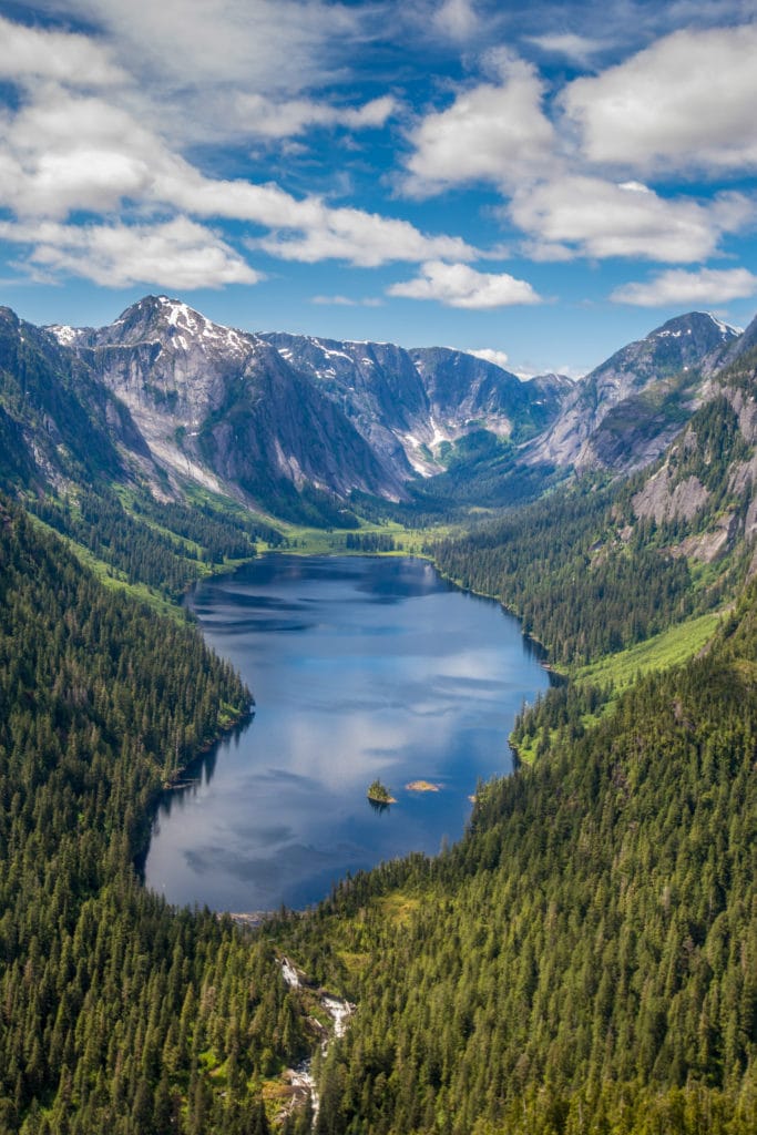
And all paths lead to the water. Ketchikan sits on the southwestern edge of Revillagigedo Island, hemmed in by straits and canals that feed the nearby North Pacific, crisscrossed by rivers and dotted with lakes. In southeast Alaska, “road trip” is a misnomer; to really get around here, you have to embrace water travel. That means ferries, fishing vessels, and float planes.
It’s raining when I land at Ketchikan’s tiny airport, located on its own island one nautical mile from town. It’s also raining when I leave, and on almost all the days in between. With an annual average of about 150 inches of precipitation, Ketchikan is one of the wettest cities in the U.S.
Further reading...
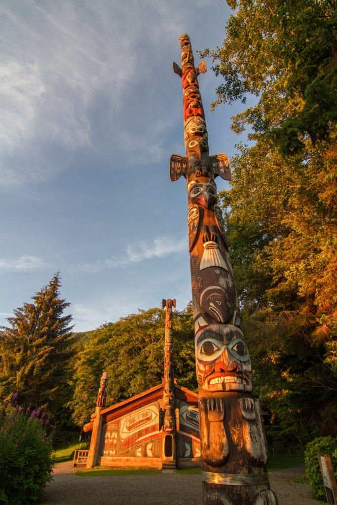
Totems
A ferry carries me across the Tongass Narrows, and Ketchikan rises into view: Its colorful clusters of buildings climb a steep bluff, painted in shades of pink, blue, and green made somehow more saturated by the diffused light of the overcast day. On the drive up to Cape Fox Lodge, I spot an enormous bald eagle, swooping low over the spruce trees. When I gasp, awestruck, my driver laughs. “You’ll see so many,” he says, “you’ll just get used to them.” He’s half right: I’ll see a hundred or more as I explore the city and its surrounding islands, but I’ll be stunned every time.
The lodge is my first taste of Ketchikan’s rich artistic culture and Indigenous heritage. Built and partially owned by the Tlingit people, it’s full of massive wooden beams, totem carvings, and colorful artwork influenced by the ocean and rivers, and the animals who live there. In the dark, cold winter months, the people of Ketchikan make art. For a city with fewer than 9,000 residents, it has a disproportionate number of theatre and dance troupes, galleries, and shops owned by local artists selling carvings, paintings, and prints.
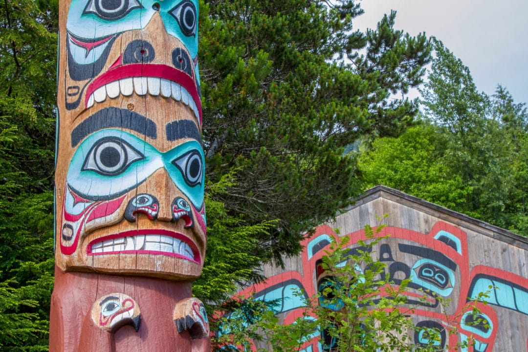
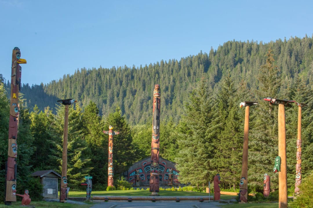
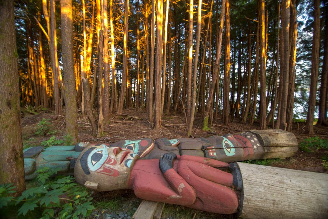
The art of totem carving is still practiced by the Native Tlingit, Haida, and Tsimshian people in Ketchikan. North of town, Totem Bight State Historical Park is a historic site packed with restored totem poles. A few miles south of my base camp at the Cape Fox Lodge is Saxman Village, a Native community where visitors can learn the history of totem making and watch master carvers at work.
Salmon Capital of the World
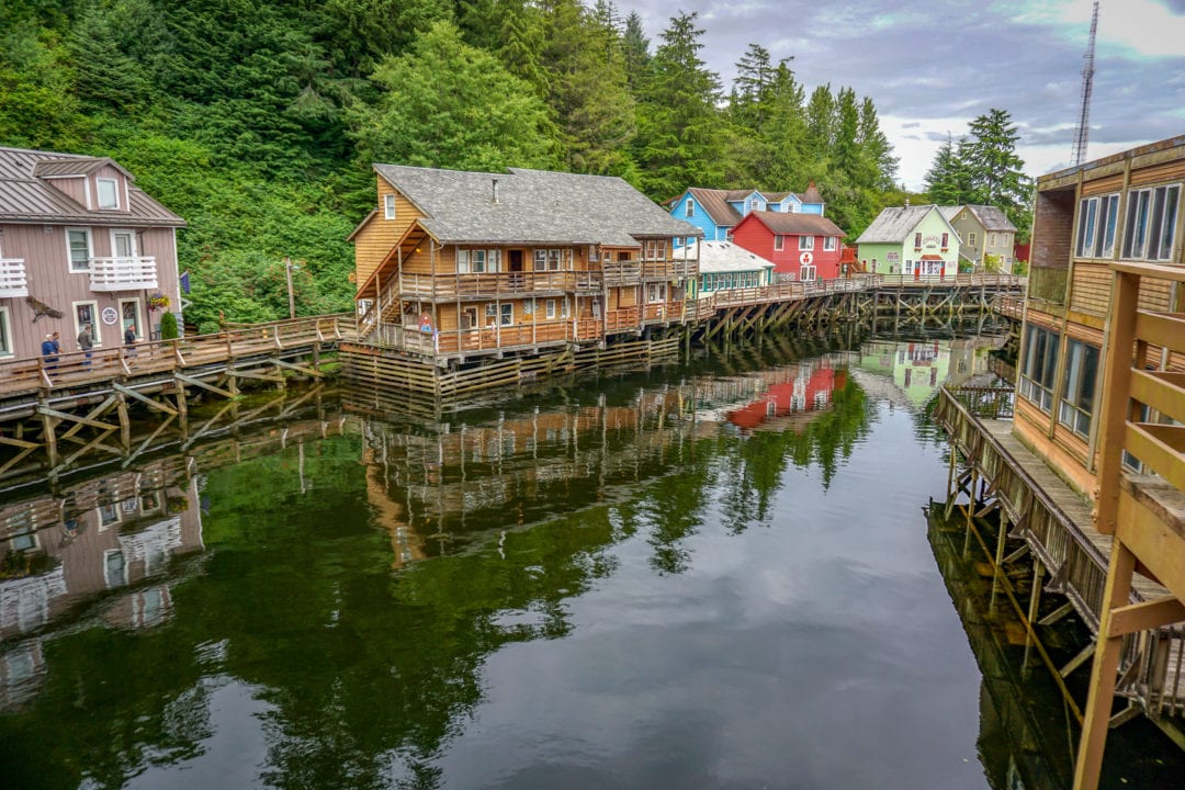
After I check in at the lodge, I take a quick hike down to Creek Street on Married Man’s Trail. The name is a holdover from Creek Street’s history as Ketchikan’s “red light district,” but today the narrow buildings suspended over the water house stores and galleries. It’s July, and the salmon are just starting to run in the tributary. In another month, the creek will be thick with fish swimming upstream.
The waters around Ketchikan are home to giant halibut, prehistoric-looking lingcod, whales, sea lions, Dungeness crab, and countless other cold-water species, but salmon are a touchstone. Commercial fishing is one of Ketchikan’s oldest and biggest industries. The coastline is dotted with canneries, and a huge sign stretching over the main road into town calls it “The Salmon Capital of the World.”
Sportfishers come from all over the world to reel in a big Chinook—also known as king salmon—and that’s how my own Ketchikan “road trip” begins in earnest the next day. From a small boat operated by fishing resort Steamboat Bay on nearby Noyes Island, I haul in a massive, thrashing king. My adrenaline is still pumping as I hoist it for the camera, beaming with pride.
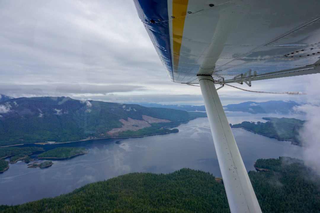
Float planes and pontoons
The next leg of my trip features a mode of transportation that’s quintessentially Alaskan. I climb aboard bush pilot Steve Kamm’s six-seater float plane, and he’s motoring across the choppy surf before I’ve even fastened my seatbelt. This kind of aviation is a way of life in southeast Alaska, where remote communities are almost entirely dependent on the small aircraft, outfitted with pontoons, that take off from—and land on—water.
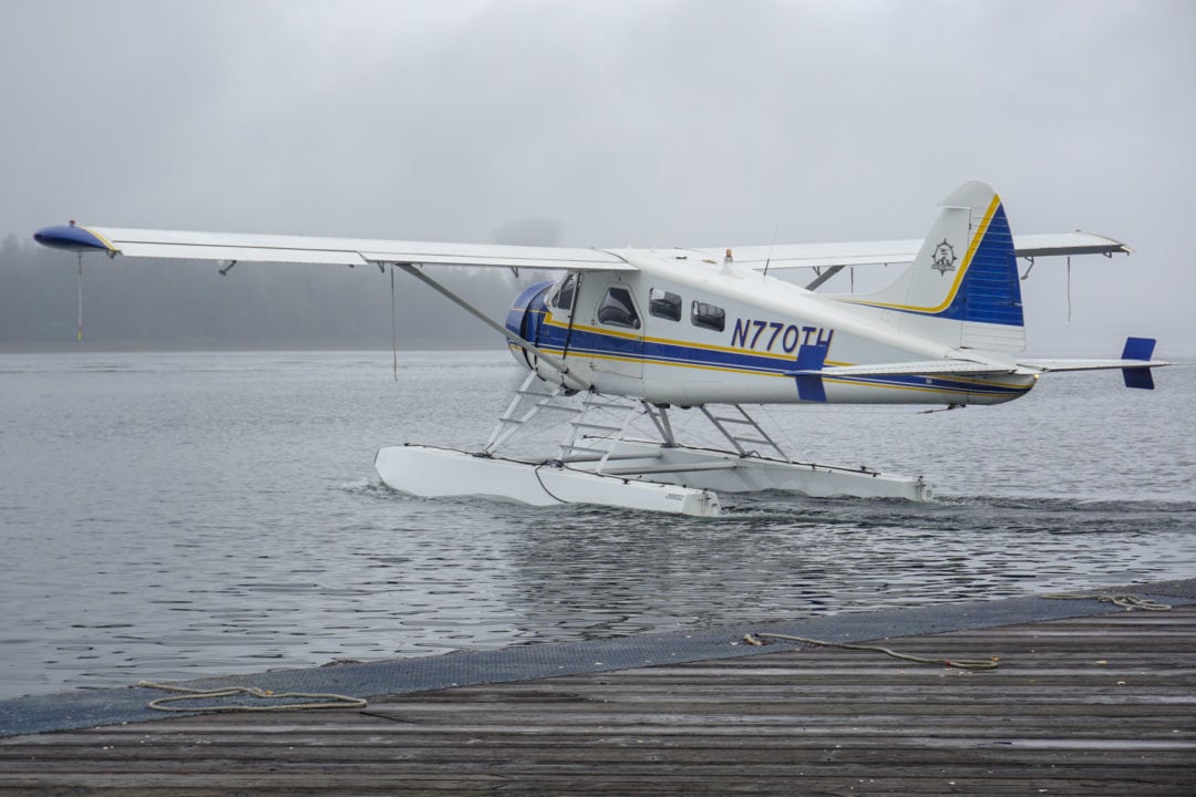
“Everything’s a runway,” Kamm says as we fly low over dense conifer forests. “Everywhere there’s water, we can go—and in southeast Alaska, that’s everywhere.”
The air over Ketchikan is always buzzing with float planes carrying mail, supplies, and people to surrounding villages, and taking tourists “flightseeing.” One of the most popular destinations (and for good reason) is Misty Fjords National Monument located 22 miles east of town. It’s a spectacular place: Sheer rock walls rise 3,000 feet straight out of the water, waterfalls tumble into glacier-carved ravines, mountain goats amble in the cliffs, and brown bears fish in the streams.
“People’s expectations about Misty Fjords are way lower than what they actually get,” says Kevin Roof, a veteran pilot with local airline Taquan Air. “They think, ‘Oh yeah, we’re going on a little flight, we’re going to see some mountains,’ and people are literally brought to tears.”
A modern-day Atlantis
Back at the dock in downtown Ketchikan, my road trip gets back on an actual road. The Tongass Highway winds north along the coast for just under 7 miles before the turnout for picturesque Ward Lake, ringed with hiking trails and well-kept campgrounds. It’s the perfect starting point to explore some of the 17 million acres that make up the Tongass National Forest, the largest remaining temperate rainforest in the world and the largest national forest in the United States.
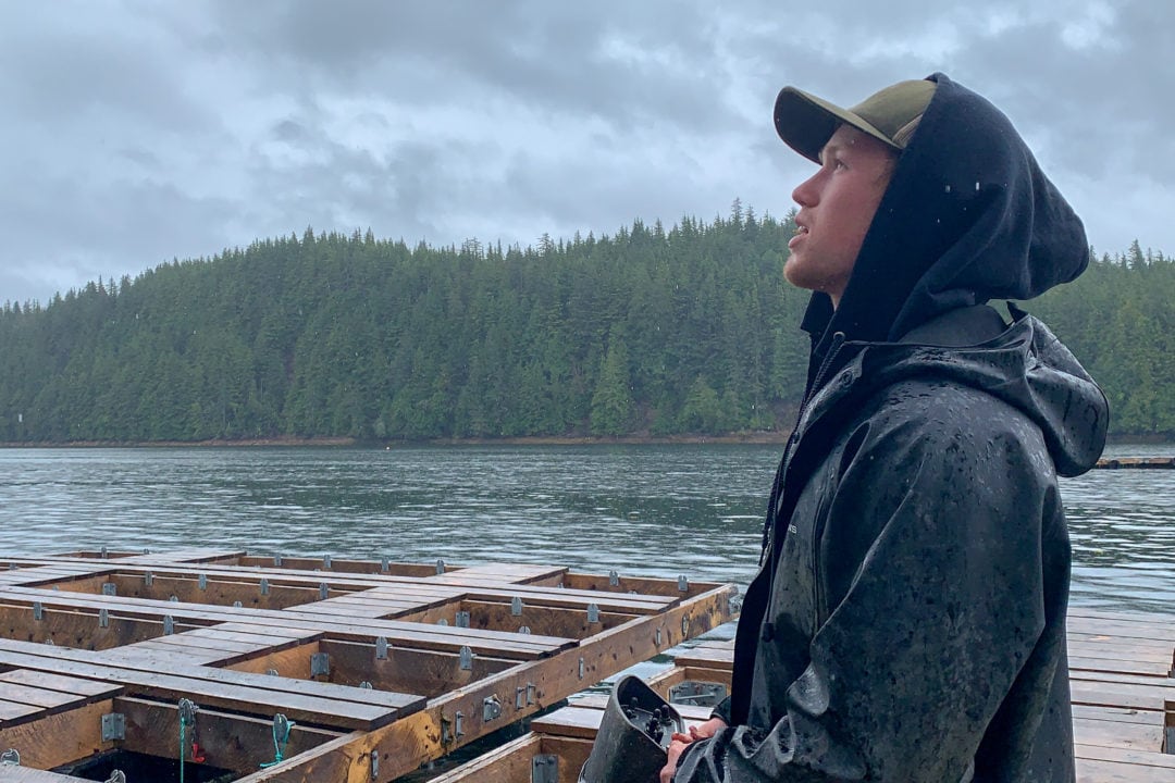
This stretch of road is also home to Hump Island Oyster Company, a growing family business that—like nearly everything else here—owes its existence to the water. Oysters aren’t native to Ketchikan, but their farmer is. They’re brought in as tiny “seeds,” explains Shawn Sande, a fourth-generation son of Alaska, as we cruise out to the floating farm in yet another boat. The oysters grow for years in specially-designed trays suspended from huge rafts. They can’t reproduce naturally in cold water, so they aren’t a threat to the ecosystem, Sande says, but the deep, nutrient-rich water results in a very singular adult shellfish.
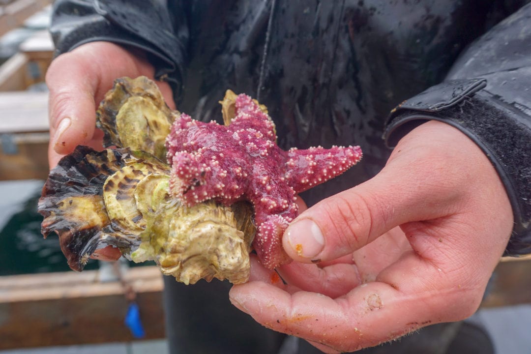
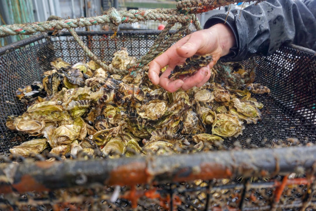
“They grow slower because the water is colder,” Sande explains. “It’s clean and full of lots of phytoplankton, so you get a deep cup [the swell in the middle of the shell] and a meaty oyster with a unique flavor.”
At the end of my tour, in the company’s brand new tasting room, I take a sip of prosecco and chase it with the single most delicious oyster I’ve ever eaten. It’s briny and almost sweet, with the clean flavor of the ocean, tinged with something rich and citrusy. They’re magic, I tell Sande—and eat 10 more.
The taste is still on my tongue as I ride a ferry back to the airport, sprinting out onto the tarmac in the driving rain to board my flight. My only luggage is a box of frozen fish. It’s less than a 90-minute flight to Seattle, but I feel as if I’ve just visited a whole new world. Ketchikan, with its 30 miles of pavement and endless inlets, passages, and channels, is like a modern-day Atlantis. It’s a wild, salty, and tempestuous place; a destination defined not by where the road can take you, but by what you can find when you leave the road behind.
Meet the Authors

- Related Articles
- Latest Articles