Designated as such by the U.S. Congress for their significance as both recreational public lands and protected wildlife areas, there are exactly 10 coastal regions preserved and administered by the National Park Service (NPS). From wild ponies and an LGBTQ+ safe haven on the East Coast, to tule elk on a Pacific Coast peninsula—and two stretches of sandy white beaches in between—here is a guide to all 10 U.S. national seashores.
Further reading...


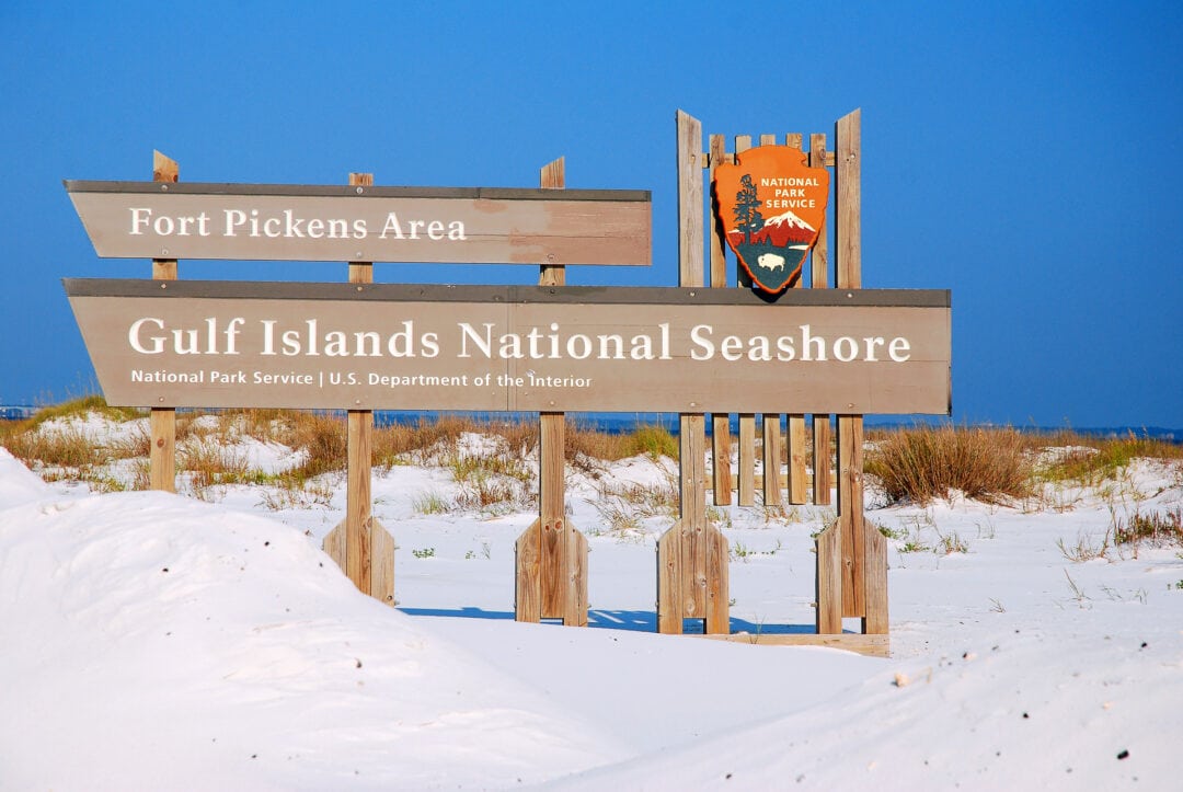
1. Gulf Islands National Seashore
Located along the Gulf of Mexico and straddling both Florida and Mississippi, Gulf Islands National Seashore beckons millions of visitors each year to its protected mainland regions and seven barrier islands. Offering white quartz sand beaches, military forts, and wildlife sanctuaries, the largest national seashore in the U.S. is a fine sight to see.
Days and hours of operation vary by location and season; check the NPS website before you go for last-minute swimming bans and closures—and note that all facilities are closed on Thanksgiving, Christmas, and New Year’s Day.
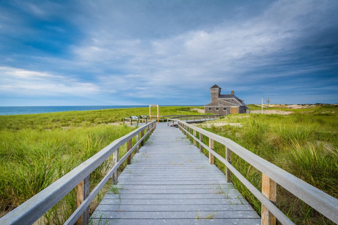
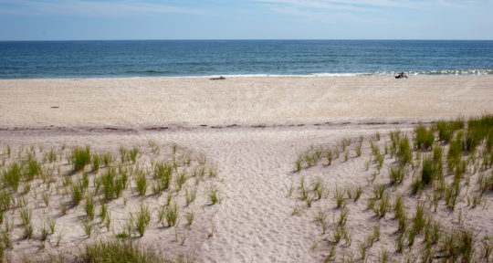
2. Cape Cod National Seashore
Created in 1961 by Massachusetts native, Cape Cod-regular, and then-President John F. Kennedy, Cape Cod National Seashore comprises more than 40,000 acres on the eastern Atlantic shore of Massachusetts. The Cape is home to a diverse array of wildlife in addition to the thousands of seasonal and year-round residents that populate the charming towns of Provincetown, Truro, Chatham, Orleans, and Wellfleet.

Depending on the season, visitors may share the area with monarch butterflies, harbor seals, loons, whales, and bald eagles. Since the 1960s, Provincetown (known as “P-Town”) has hosted myriad LGBTQ+ Pride events in June as well as a carnival in August, billed as “the biggest queer event of the year” by GayTravel.
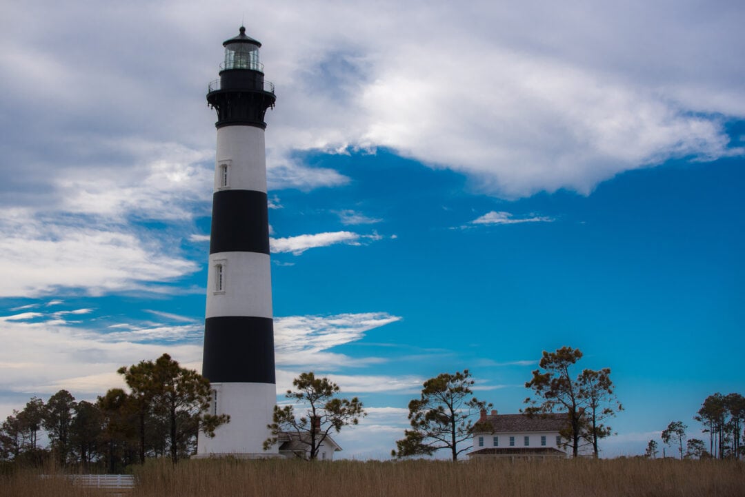
3. Cape Hatteras National Seashore
The 70-mile Cape Hatteras National Seashore encompasses lighthouses, shipwrecks, and cinematic beaches from Bodie to Ocracoke islands in an area known as the Outer Banks of North Carolina. Also known as the “Graveyard of the Atlantic,” the region is notorious for its dangerous currents, violent storms, and surfing opportunities. Those who return year after year (or live here year round) know how to weather catastrophe: in 2010 the famous Inn at Rodanthe was moved inland in an attempt to save it from the effects of erosion, and in 2022, Frisco’s famous silver UFO-shaped Futuro House was completely destroyed in a fire.
10 campgrounds along the Outer Banks Scenic Byway
The Cape Hatteras National Seashore has three visitor centers: one on Bodie Island in the north, another visitor center and museum inside the historic Double Keepers’ Quarters near Buxton’s iconic black-and-white-striped Cape Hatteras Lighthouse, and a third in Ocracoke.
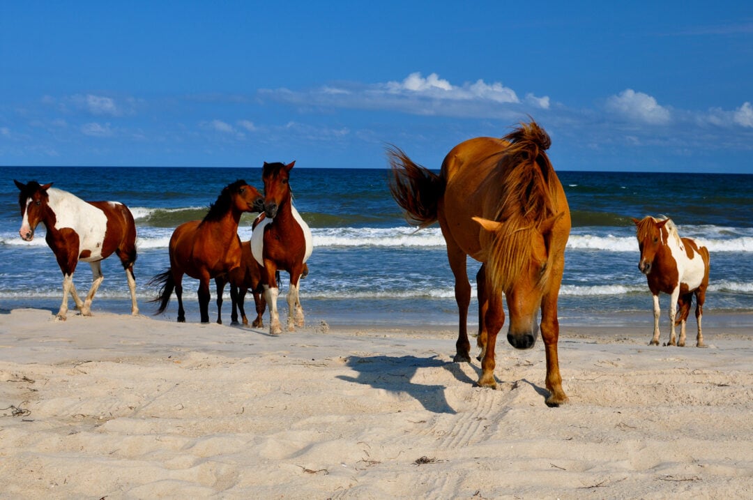
4. Assateague Island National Seashore
Located on the Atlantic Coast of Maryland and Virginia, Assateague Island National Seashore is best known for the small feral horses that roam freely on the beaches (although commonly referred to as “ponies,” the horses owe their diminutive stature to their salt-heavy diet). Every summer for nearly a century, a portion of the horses are escorted by “saltwater cowboys” as they swim to nearby Chincoteague Island during a popular event and fundraiser for the Chincoteague Volunteer Fire Company.
6 campgrounds near Assateague Island National Seashore
In addition to the horses, deer and a variety of bird species live in the salty marshes and maritime forests that dot the shore. The seashore is open year round, 24 hours a day, but all visitors must have an entrance pass obtained through the NPS.
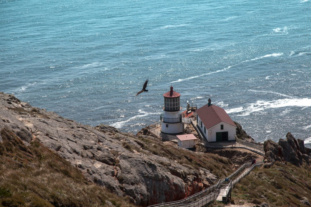
5. Point Reyes National Seashore
Established in the 1960s to prevent imminent development, the Point Reyes National Seashore in California’s Marin County is located on a peninsula in the Pacific Ocean and separated from almost all of the continental U.S. by a portion of the San Andreas Fault. Home to nearly half of North America’s bird species and almost 20 percent of California’s plant species, Point Reyes is also known for the tule elk that were once much more numerous throughout its prairies and meadows. One of only a few NPS sites that allow ranches and dairies to continue operations within its bounds, Point Reyes is also home to more than 5,000 cows.
Tule elk are at the center of an epic conservation battle on Point Reyes National Seashore

6. Canaveral National Seashore
Home to the longest stretch of undeveloped land along the Atlantic Coast of Florida, Canaveral National Seashore comprises beaches, sand dunes, and mangrove wetlands. Canaveral Seashore has been monitoring threatened or endangered sea turtles including Loggerheads and Leatherbacks (which nest in the park from April to October) since the mid-1980s.
The John F. Kennedy Space Center occupies a barrier island on the southern end of the seashore, so note that access may be restricted during launch events; the Apollo Beach Visitor Center is open year round from 9 a.m. to 5 p.m. with the exception of Christmas Day.
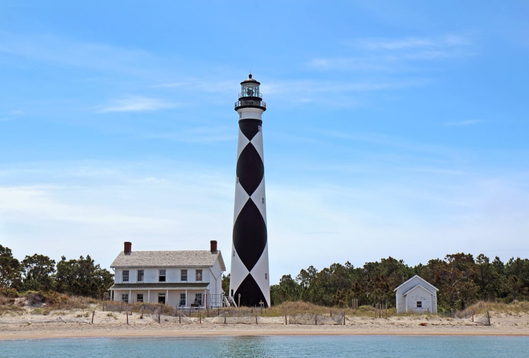
7. Cape Lookout National Seashore
South of the Cape Hatteras National Seashore is the 56-mile Cape Lookout National Seashore, comprising three North Carolina barrier islands: North and South Core Banks and Shackleford Banks. Core Banks is home to two historic villages and Shackleford is known for its population of free-roaming wild horses. Often visible from nearly 20 miles away, the black-and-white, 163-foot-tall Cape Lookout Lighthouse flashes every 15 seconds; completed in 1859, the lighthouse—one of only a few in the U.S. to shine during daylight hours—has been fully automated since the 1950s.
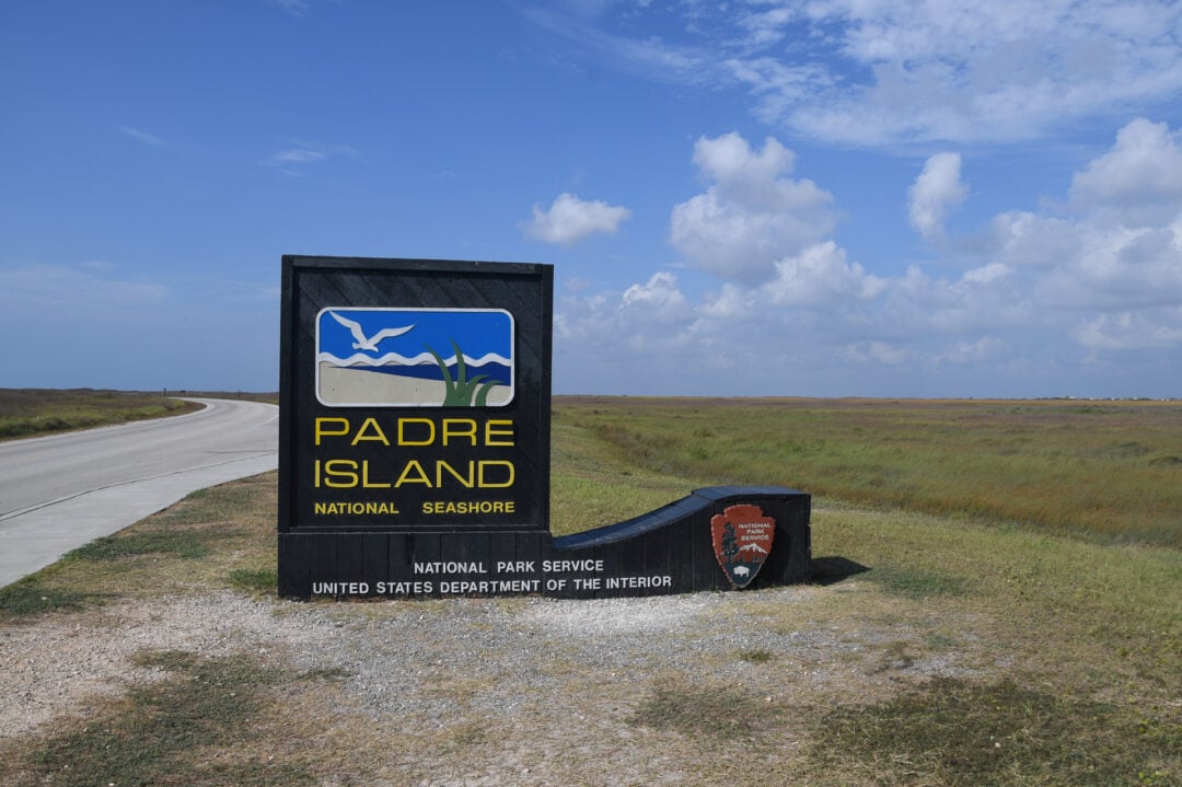
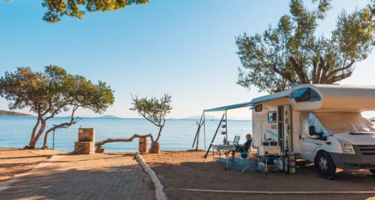
8. Padre Island National Seashore
Padre Island is one of only two national seashores not located on the East or West Coast of the U.S. The nearly 70-mile seashore is situated off the Southern coast of Texas along the Gulf of Mexico on North Padre Island, the longest undeveloped barrier island in the world. While South Padre Island is a much more developed resort community populated with hotels and shops, the national seashore is known for its stretch of pristine white sand beaches, coastal prairie habitats, and tidal mudflats—most of which are only accessible with a four-wheel drive vehicle. Camping on the island is open year round and first-come, first-served, although all campers must obtain a permit from kiosks located at campground entrances.
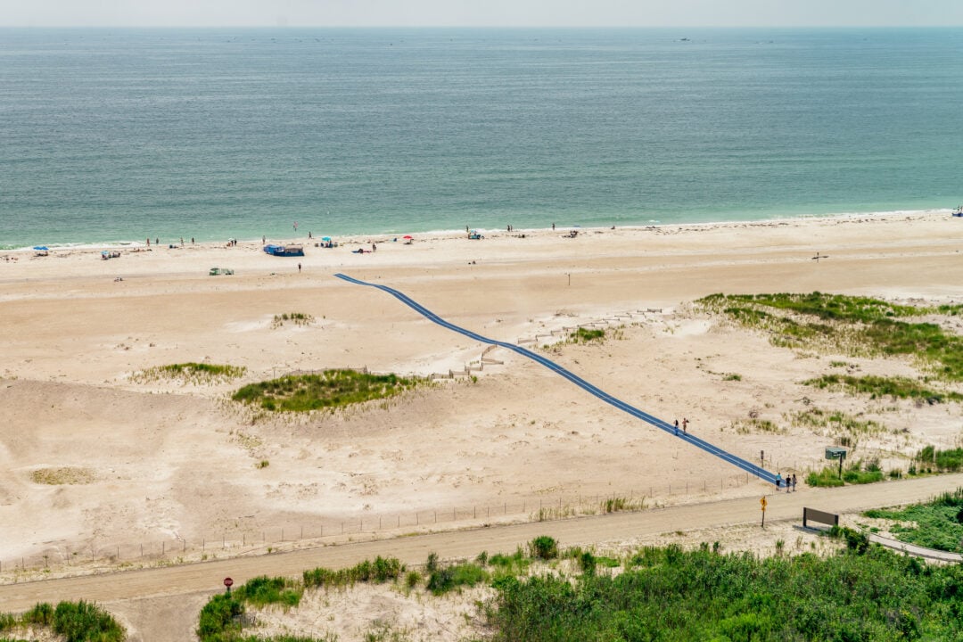
9. Fire Island National Seashore
Home to the only federally-designated U.S. Wilderness Area in New York State, Fire Island National Seashore is a popular summer getaway for residents of East Coast cities like New York City. Since the mid-1900s, two neighboring car-free Fire Island hamlets accessible by ferry—Cherry Grove and The Pines—have been popular safe havens for the LGBTQ+ community; the population swells during summer months for a variety of Pride events, including an annual Fourth of July recreation of the 1970s drag event now known as the “Fire Island Invasion.”
In addition to clubs, restaurants, and grand secluded homes, the nearly 30-mile stretch of the barrier island off the southern Atlantic Coast of Long Island is also home to protected beaches, sweeping dunes, maritime forests, the William Floyd House, and a lighthouse within Robert Moses State Park.
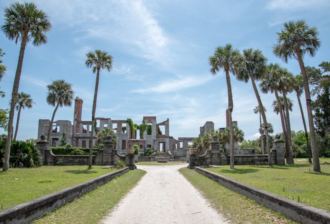
10. Cumberland Island National Seashore
Only accessible by boat and located on Georgia’s Atlantic Coast, Cumberland Island National Seashore occupies most of Cumberland Island—the largest and southernmost of the Peachtree State’s Golden Isles. Lined with beaches, dunes, marshes, and freshwater lakes, the seashore is also home to several historic sites including the Cumberland Island National Seashore Museum, the Ice House Museum, and the National Historic Districts of Plum Orchard and Dungeness. Tickets for the 45-minute Cumberland Island ferry regularly sell out and advance reservations are recommended.
History, ruins, and beaches: Spending a day on Georgia’s Cumberland Island
Take this trip
Meet the Author
- Related Articles
- Latest Articles