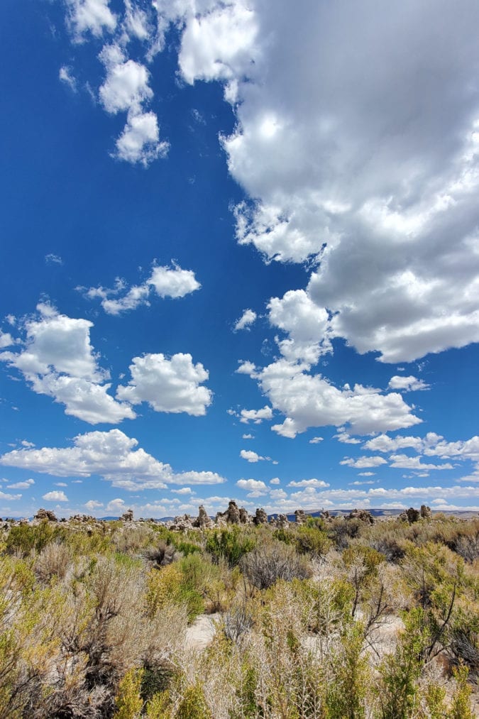
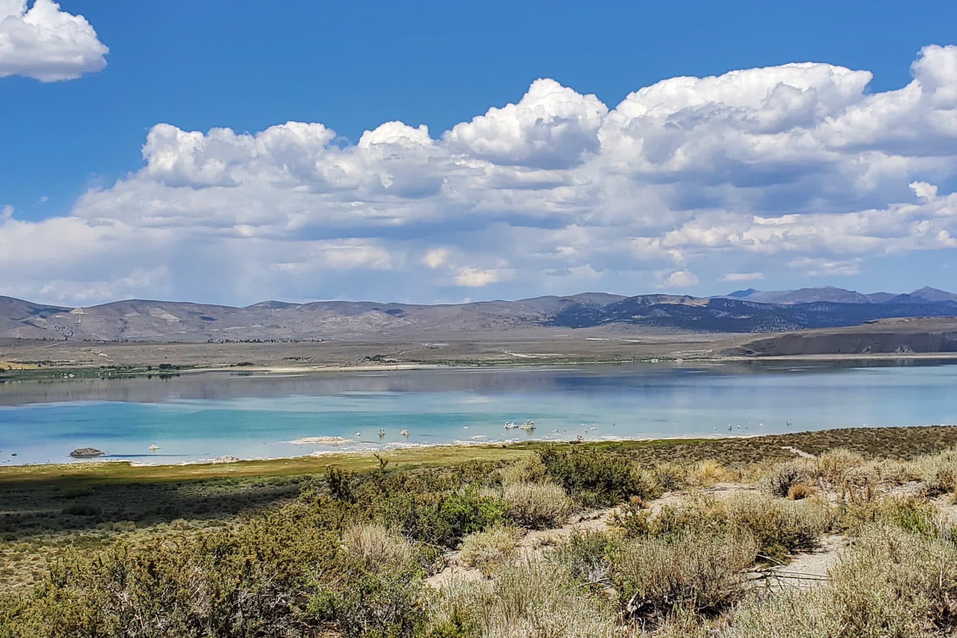
It’s a bright, sunny day, the sky laced with puffy clouds, as I turn off U.S. Route 395 toward the Mono Lake Tufa State Natural Reserve. This is a familiar journey, one that brings with it a sense of calm. I often visited Mono Lake as a child, always in awe of what is sometimes referred to as “California’s Dead Sea.” What strikes me most about the area are its contrasts; the road winds its way around hills littered with dry sagebrush and volcanic rock formations, creating a desolate, eerie landscape.
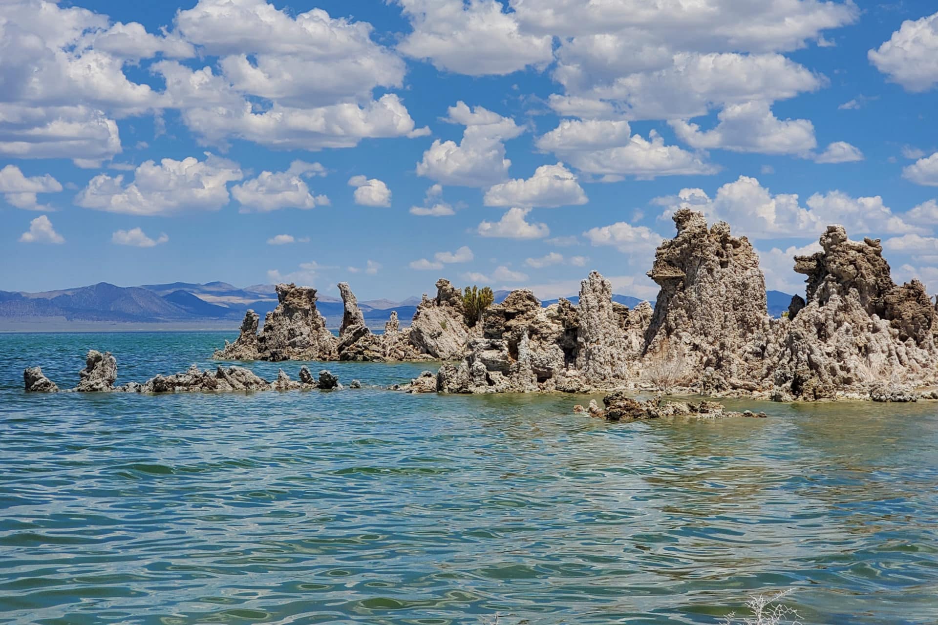
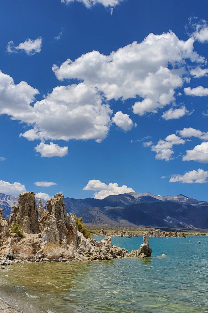
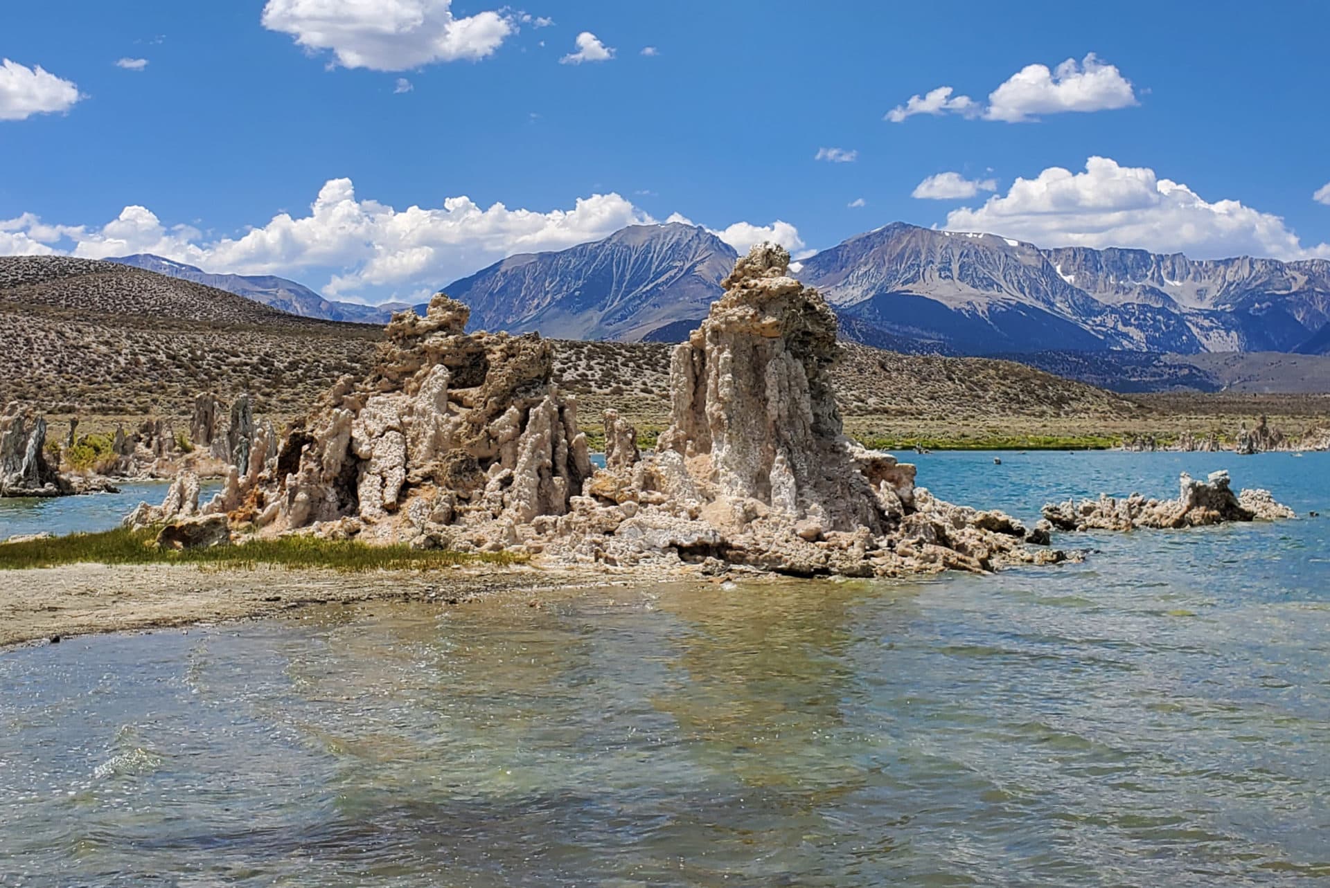
Nestled in the Mono Basin near the eastern entrance to Yosemite National Park is an unassuming lake, one that given further examination reveals an ethereal array of limestone formations (commonly known as tufas) ascending from the water like phoenixes rising from the ash. And in a sense, they did—formed from underground freshwater salt springs, the formations are the result of volcanic eruptions that occurred more than a million years ago.
I have to agree with how John Muir famously described Mono Lake: “I never beheld a place where beauty was written in plainer characters or where the tender fostering hand of the great gardener was more directly visible.”
Further reading...
Ancient origins
Arriving at the South Tufa Reserve, I walk along the wooden planks that lead to a clustering of structures along the shore. I inhale the salty air and raise my eyes toward the sky. Clouds float aimlessly by as a bird cries loudly, diving into the water in search of tiny shrimp swimming below. The tufas resemble life-size sandcastles, their alkaline arms pointing insistently in the air.
When this ancient lake was formed, an ecosystem that is unlike any other in the world evolved along with it as a result of a volcanic eruption so intense that it buried the entire area in debris. This created the Long Valley Caldera, a 20-mile-long depression, and shortly after, Mono Lake formed north of the area.
The Earth had a cooler and wetter climate at the time, and melting ice sheets from the mountains flowed into the basin. Research has revealed that at the end of the Ice Age, Mono Lake had reached its largest depth of 900 feet. As the climate began to warm, there were no more melting ice sheets, and no opportunity for outflow—just water flowing into the lake.
The lack of an outflow source for water led to the mass accumulation of salt, which created a unique ecosystem, including a tiny species of brine shrimp that feed on the algae growing on rocks and plants in the water. These shrimp are also a source of food for various species of migratory birds.
As I reach the shore, my attention is immediately drawn to the sand near the water, as a cyclone of black alkali flies swarms near my feet. These flies, also indigenous to Mono Lake, feed on algae. One of their superpowers is the ability to “breathe” underwater with the help of tiny capsules of air that the flies devour before diving below to feed or lay their eggs.
Conservation challenges
Throughout the years, Mono Lake has had its own share of challenges. In 1941, the Los Angeles Department of Water and Power—in an effort to meet the growing demands of the city located 350 miles south—extended the aqueduct to the Mono Basin and began diverting water from its streams. This had a dramatic impact on the lake’s water, which in 1982 decreased to half of its previous depth of 45 vertical feet and doubled in saline levels. This threatened the shrimp, flies, and migratory birds.
A complete ecological study of the Mono Basin was conducted in 1976, which created the impetus for saving it. According to Rose Nelson, education director of the Mono Lake Committee, the study “led to the understanding that if excessive diversions continued and Mono Lake lost more volume, this ecosystem would collapse.” The Mono Lake Committee was formed in 1978 by David Gaines, who advocated his cause to everyone he knew, including conservation clubs and legislators. As news of the organization’s mission began to spread, people rallied to help save the lake.
The fight for water rights went all the way to the California Supreme Court in 1979, when the National Audubon Society and the Mono Lake Committee filed a joint lawsuit against the city of Los Angeles. After four years of litigation, the court ruled that Mono Lake has “public trust values” that should apply to any decisions about its water, and that the state is obligated to maintain it.
Nelson credits the successful efforts to win the water rights back to four factors: science, passion, compromise, and persistence. “By the time we reached the California Supreme Court, it was a compromise that helped us win,” she says. This compromise allows water to continue to flow to Los Angeles, but also to Mono Lake.
However, some struggles still continue. In 1994, the State Water Board mandated the lake level to be set at 6,392 feet above sea level and today it is about 10 feet below that. “It was thought that Mono Lake would have reached this healthy level by now,” Nelson says. “But drought, unknown levels of evaporation, and continual diversions have stalled the success.”
A hopeful future
Departing the South Tufa Reserve, I drive down the bumpy dirt road to the highway. Just a short distance away is the Mono Lake visitor center, an attractive modern building equipped with a wraparound balcony. I park my car next to a van with a “Save Mono Lake” bumper sticker and walk toward the Lee Vining Trail, which leads down to the lake. A cotton-tailed rabbit vigilantly observes my every move, and a shorebird glides by effortlessly. Sensing my approach, squirrels scamper across my path into a patch of yellow wildflowers.
From this vantage point I can see two large islands formed by volcanic activity. Negit Island, a popular nesting ground for California Gulls, is a dark volcanic cone made up of three separate lava flows. Paoha, the larger of the two islands, derives its name from a Paiute word that refers to the spirits believed to exist in its hot springs.
Recent fires in the area have also affected access to the lake. Most recently, the Beach Fire, which was started by lightning, burned brush and a small portion of the tufas. “Fire has long been a natural process here and there was nothing unusual about this fire ecologically,” says Debra Schweizer of the Inyo National Forest Service. “However, it did burn into the exposed tufas and there is some concern that the exposure may lead to damage.”
Making my way back to the balcony, I take a seat on one of the benches and watch as the sky fades from scarlet red to burnt orange and into darkness—and then the real show begins. As the echo of thunder booms miles away, a flash of lightning permeates the sky
Nelson sums up Mono Lake’s story in two words: hope and resilience. She believes that this message is necessary now more than ever, and the efforts of the Mono Lake Committee are a testament, she says, “that every person has the ability to make positive change in this world, as it happened and continues to happen here.”
If you go
The Mono Lake Tufa State Natural Reserve is open daily from 7 a.m. to 8 p.m. The South Tufa area has been closed for the past two months due to wildfires. For more information about the status of openings, visit the Inyo National Forest website.
Meet the Authors

- Related Articles
- Latest Articles