Washington’s North Cascades mountain range includes some of the nation’s most breathtaking scenery, and the highway that runs through it was designed to showcase it all, with views of lakes, waterfalls, and high-altitude peaks. In the fall, the evergreen forest is punctuated by brilliant color—golden larches, red maples, yellow willow, and huckleberries, mountain-ash, and spirea in more shades than you can imagine. Thirty of the scenic byway’s 140 miles run straight through North Cascades National Park, which is packed with stunning views and hiking opportunities.
Key Takeaways
- Snow usually closes the North Cascades Highway in mid November, and sudden repairs can happen anytime.
- There are no services between Marblemount and Mazama, leaving a long quiet stretch on the drive.
- Glacier silt turns Diablo Lake a bright turquoise color, which looks most brilliant under high midday sun.
Further reading...


North Cascades Highway (State Route 20) Scenic Drive Overview
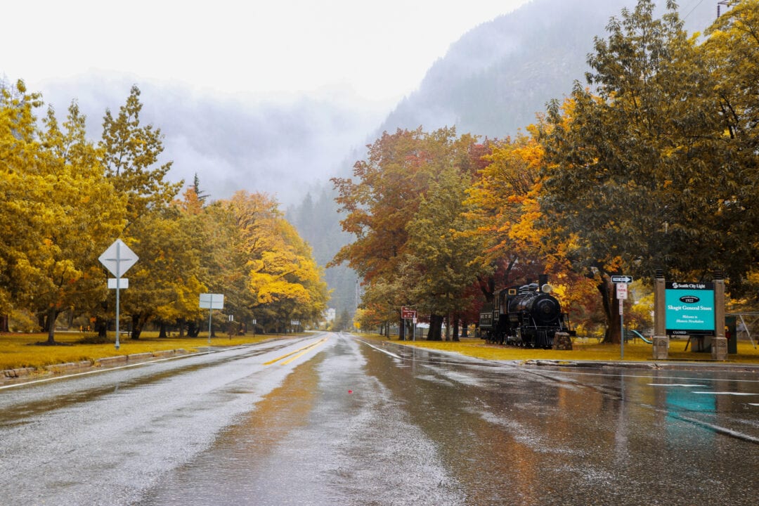
Snow usually closes the highway in mid-November, and the rugged terrain means the road may need maintenance at any time of the year, so be sure to check conditions before you go. Also, be aware that there are no services between Marblemount and Mazama, so fill your tank and stock up on any other needs before heading out. Many attractions and businesses along the route operate seasonally and may be closed in the colder months, so always check hours of operation before you visit.
Top Stops and Viewpoints on the North Cascades Highway (SR 20)
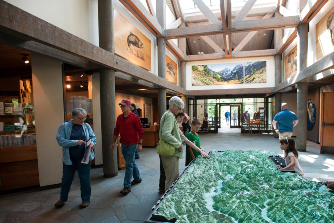
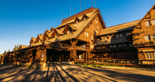
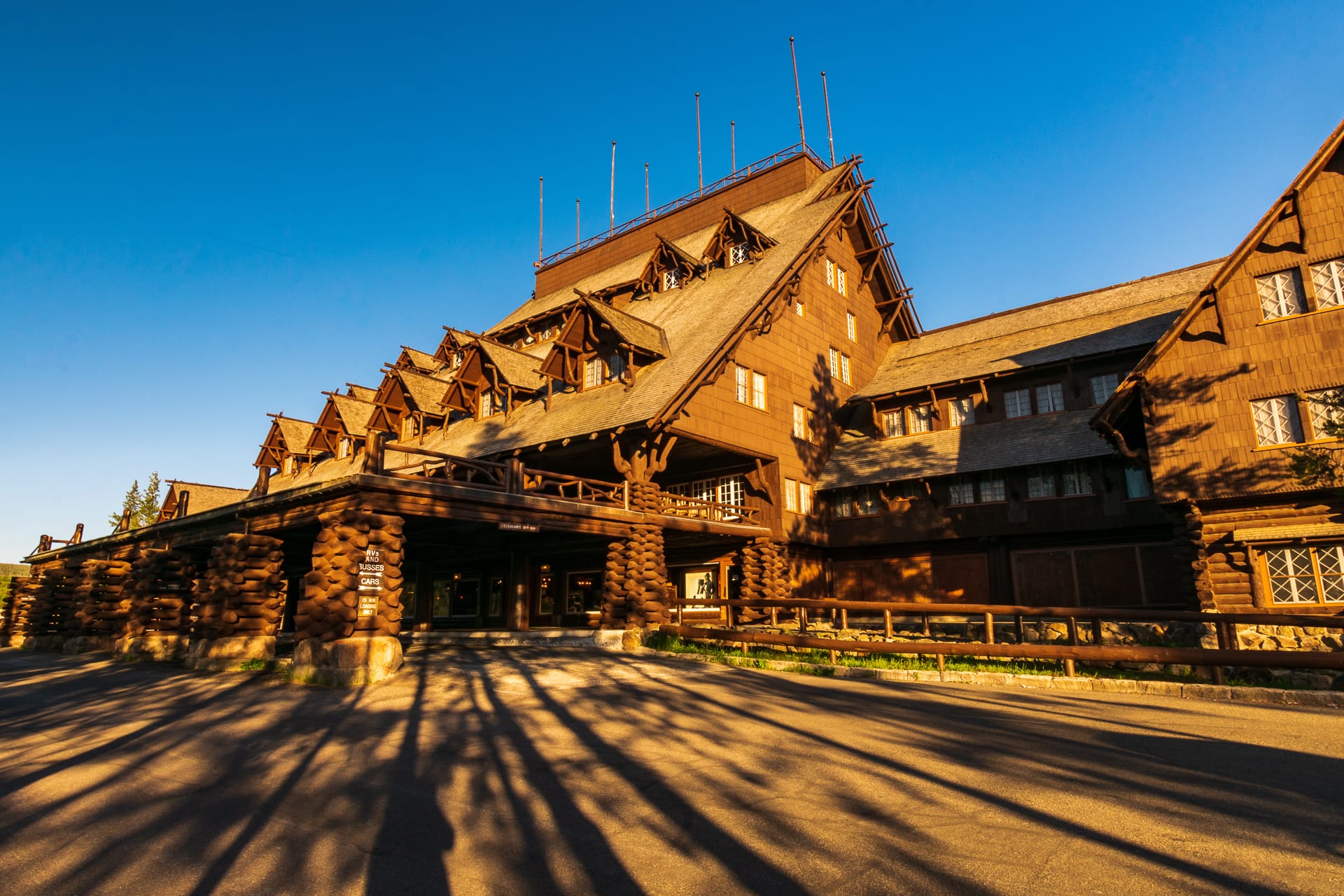
1. North Cascades Visitor Center: Maps, Exhibits, and Sterling Munro
Located within the national park portion of State Route 20, the North Cascades Visitor Center is a good place to get oriented to the North Cascades Highway. A relief map lets you see (and feel, if you like) the terrain you’re about to enter; learn details from multimedia exhibits and the information desk. A short accessible boardwalk to the Sterling Munro Viewpoint offers views of the Picket Range and the Terror Glacier—one of more than 300 glaciers in the North Cascades. For a longer walk, follow the 1.8-mile River Loop Trail through the forest to the Skagit River. Note that the visitor center is closed during the fall and winter season; check the park’s website for the most current hours and information.

2. Newhalem History and Skagit Hydroelectric Project: Easy Trails and General Store
Just east of the visitor center is Newhalem, a company town founded in the early 20th century to house workers building the Skagit Hydroelectric Project. The project includes three dams and powerhouses that continue to provide power for the city of Seattle—you can learn more at Newhalem’s visitor center. For the easiest access to the town, use the visitor parking on the northwest side of the highway. The Skagit General Store sells groceries, snacks, and homemade fudge; hours depend on staff availability. Footbridges lead to two walks on the far side of the Skagit River, where you can see the forest up close. The Trail of the Cedars is a 0.6-mile loop through the forest; the 0.4-mile Ladder Creek Falls Trail passes through exotic gardens on the way to the falls.
3. Diablo Lake Overlook: Turquoise Water Views and Geology Exhibits
Diablo is one of three lakes created by power-generating dams in the Ross Lake National Recreation Area. The lake is fed by glaciers, which grind rock into fine silt as they advance. The silt, suspended in the lake, gives the water its amazing turquoise color. The color is most brilliant on sunny days and when the sun is highest in the sky. Views from the overlook include the lake and surrounding high peaks. Interpretive signs explain the geology of the North Cascades. This is a can’t-miss stop with plenty of parking, restrooms, and picnic tables.
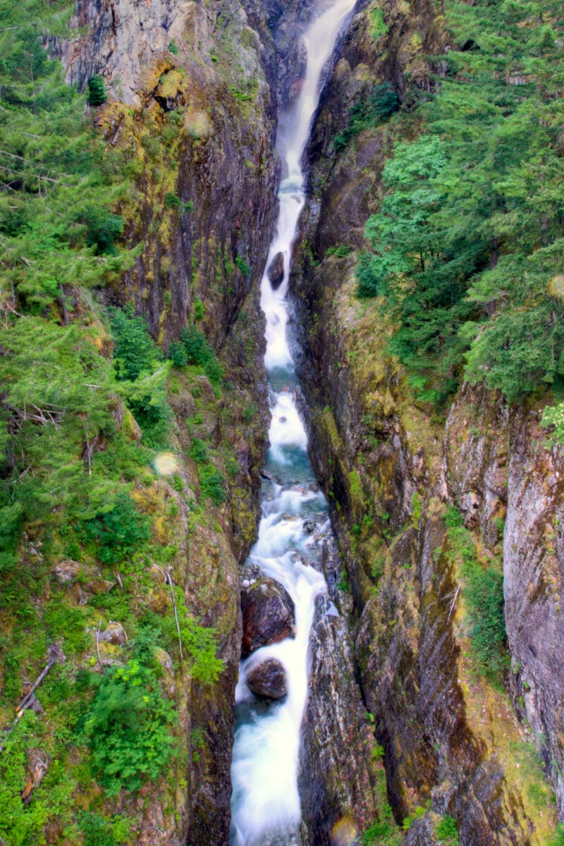
4. Gorge Creek Falls: Short Walk to Waterfall and Skagit River Gorge Views
Abundant waterfalls earned the Cascade Range its name. Gorge Creek Falls is one of the most accessible. A short paved path leads to a dramatic viewpoint next to the highway. There’s also a 0.8-mile loop trail leading to views of the Skagit River Gorge and Gorge Lake and Powerhouse. There are many other falls along the highway, from splashing torrents to seeps that support hanging gardens of delicate ferns and wildflowers. You can glimpse part of Colonial Creek Falls (the tallest waterfall recorded in the continental U.S.) from the highway just west of the Ross Lake parking lot.
5. North Cascades Environmental Learning Center: Classes, Campus, and Lakeside Access
The learning center is an outdoor-education campus tucked in the woods on the shore of Diablo Lake. Take a class, use the center as your base camp while you explore the lake and forest, or visit for an afternoon. Sustainably-built lodges and healthy homemade meals make for a comfortable stay while classrooms, labs, and an amphitheater supplement the learning opportunities provided by the natural environment. Much of the center’s current offerings are virtual and open to non-local participants.
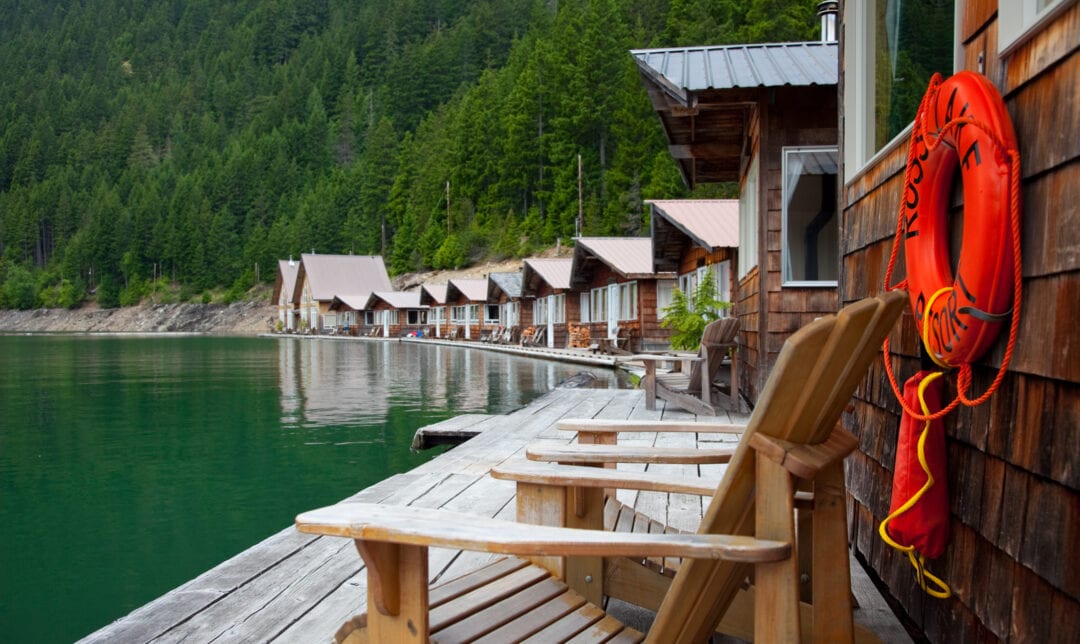
6. Ross Lake Resort: Floating Cabins, Boat Rentals, and Seasonal Access
Getting to Ross Lake Resort, open from mid-June through October, is part of the adventure. You can walk to the lake—the trail is just over a mile long, steep and rocky in places—then call for a shuttle across the water. Or take a ferry up Diablo Lake and then catch a ride to the resort. The resort’s floating cabins are a big attraction and reservations typically need to be made a year in advance. You can also camp or visit for the day. The resort rents boats and fishing rods and provides a water-taxi service to reach lakeside campgrounds and trailheads.
7. Happy Creek Forest Walk: Accessible Boardwalk and Happy Creek Falls Spur
The Happy Creek trailhead is the starting point for a 0.3-mile loop through ancient forest and alongside Happy Creek on an accessible boardwalk. For a longer walk, watch for a gate in the boardwalk railing and ascend to Happy Creek Falls, where miners used the water to power a mill in the 19th century. The trail is somewhat steep and rough in places; the falls are at their best after they’ve been replenished by autumn rains.
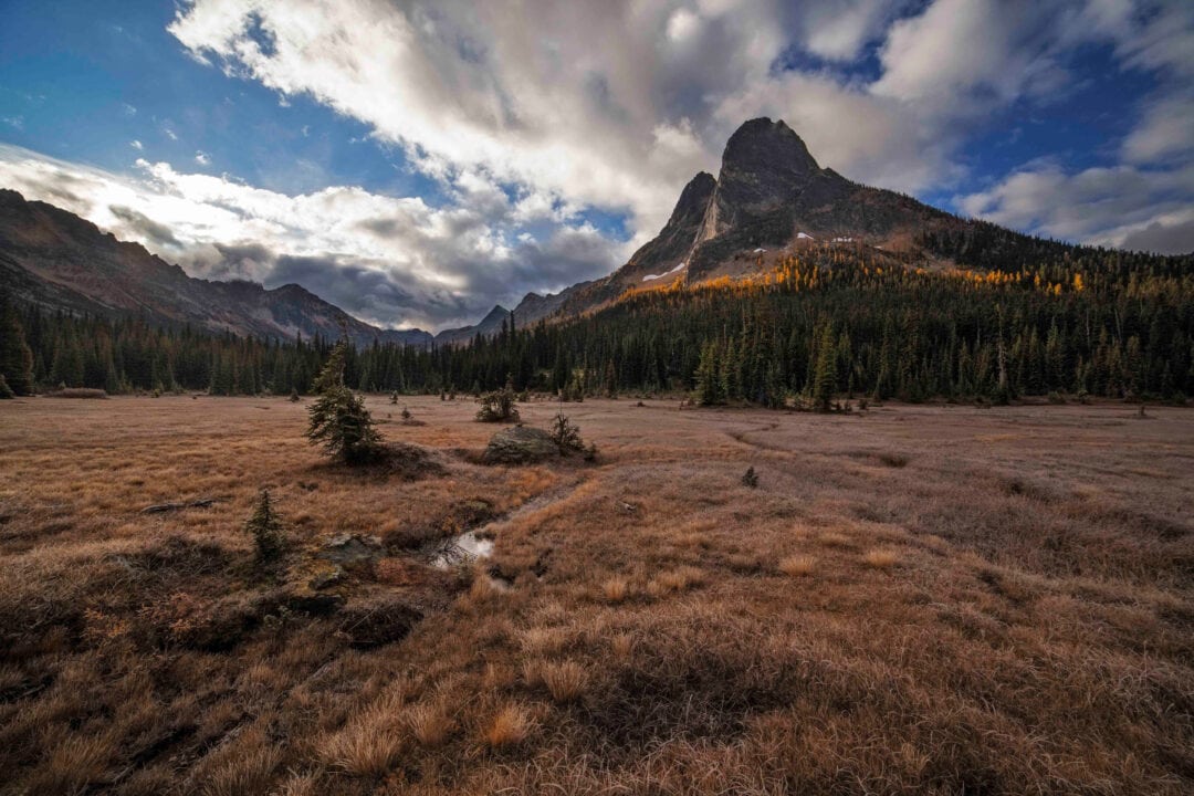
8. Washington Pass Overlook: Liberty Bell Mountain Views and Golden Larches in Fall
Views from the Washington Pass Overlook are expansive. Most obvious are Liberty Bell Mountain and the Early Winters Spires, with massive peaks that jut above Early Winters Creek and the highway. In fall, golden larches glow among the evergreens on their lower slopes, and the peaks themselves may be dusted with early snow. Huckleberry, spirea, willows, and more show their colors around the overlook and in the surrounding meadows.
9. Mazama: Trail Access, The Mazama Store, and Local Food and Gas
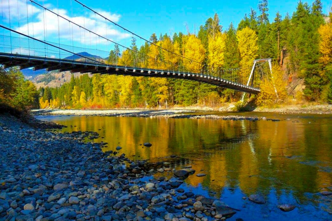
The Mazama Store, located 0.4 miles northeast of the highway, is the hub of the tiny community of Mazama, offering “a little bit of everything good.” Here you can stock up on groceries, fill your gas tank, and pick up bread, pastries, sandwiches, coffee, and much more. The new Mazama Public House, featuring local brews, opened in 2022. Mazama is a good place to sample the Methow Valley’s bike and walking trails. For a closer look at colorful stream-side vegetation, consider a 2-mile round trip walk across the Tawlks-Foster Suspension Bridge, starting 1.6 miles southwest of Mazama on Goat Creek Road.
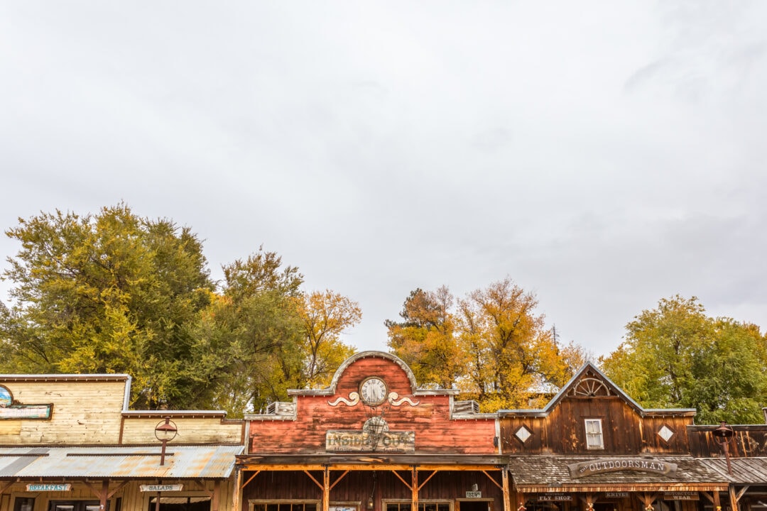
10. Winthrop: Old West Boardwalks, Tasting Rooms, and Riverfront Walking Trails
The town of Winthrop features boardwalks, false fronts, and an Old West ambience that belies its modern vibe. The highway leads right into town, where there are plenty of places to eat and sample locally-made wine, beer, and cider. Find maps, brochures, and friendly advice at the Information Station. Bridges lead to walking trails at each end of town. Follow the boardwalk north and cross the Chewuch River to reach the Sa-Teekh-Wa Trail for a 1-mile round-trip walk along the river. At the other end of downtown, the paved Susie Stephens Trail crosses the Methow River; a short detour leads to Homestream Park.
Meet the Author
- Related Articles
- Latest Articles