Whether you’re drawn to the open road for the freedom it provides or the thrill of discovery, the U.S. is home to some of the world’s most scenic and legendary road trip routes. This is the ultimate U.S. road trip map for your journey.
From historic Route 66 to the Natchez Trace Parkway, we will show you how to build your road trip map to soak in our nation’s ten most iconic routes. For each road trip route we unpack below, we also feature a pre-built trip that you can plug right into your Roadtrippers app.
Customize Your U.S. Road Trip Map With Roadtrippers
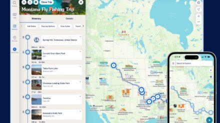
Road trips are the name of our game. That’s why we build tools and content on the reg’ to make road trips everything they should be. One of the best ways to customize a road trip map for your journey is with our Autopilot™ app.
Autopilot™ takes the heavy lifting out of trip planning by combining your input with data from 38 million real-life trips to build an interactive road trip map for you.
Because it’s interactive, you can easily fine-tune the trip that Autopilot™ builds to add extra stops you’d like to see on your map. We even have pre-built trip guides like this one for Route 66 to help you find hidden gems to add to your trip.
1. Route 66: The Mother Road
Distance: 2,448 miles
Start: Chicago, Illinois
End: Santa Monica, California
No road trip list is complete without mentioning Route 66, the “Mother Road” from Chicago to Santa Monica. Established in 1926, this historic route is baked into the American psyche because it was the main thoroughfare out West before the freeways were built.
The Ultimate Route 66 Road Trip
Today, travelers can experience small-town Americana, quirky roadside attractions, and vast desert landscapes on the route. Don’t miss iconic stops like the Cadillac Ranch in Texas, the Wigwam Motel in Arizona, and the Santa Monica Pier at the route’s western terminus.
Roadtrippers Tip: Use the app to explore lesser-known detours, like the ghost towns of Amboy and Oatman, or to find vintage diners and motels that have preserved the spirit of Route 66.
2. Pacific Coast Highway (Highway 1)
Distance: 655 miles
Start: Leggett, California
End: Dana Point, California
The Pacific Coast Highway is a jaw-dropping drive along California’s rugged coastline. Starting in the towering redwoods of Northern California and winding down to the sunny beaches of Southern California, this route offers stunning ocean views, cool coastal towns, and spectacular natural landmarks.
Key stops include the dramatic cliffs of Big Sur, the picturesque town of Carmel-by-the-Sea, and the historic Hearst Castle in San Simeon.
Roadtrippers Tip: Customize your journey by adding stops at hidden beaches, lesser-known hiking trails, and local wineries. Combine our mapping tech with our killer content to discover the hidden gems that’ll make this trip your own.
3. Blue Ridge Parkway: A Drive Through the Appalachian Mountains
Distance: 469 miles
Start: Shenandoah National Park, Virginia
End: Great Smoky Mountains National Park
The Blue Ridge Parkway is a scenic drive that meanders through the Appalachian Mountains, offering some of the most stunning fall foliage in the country.
An insider’s guide to hidden gems in Great Smoky Mountains National Park
This route offers endless opportunities to explore hiking trails, waterfalls, and panoramic overlooks. Highlights include the Peaks of Otter, Linville Gorge, and the charming town of Asheville, known for its vibrant arts scene and craft breweries.
Roadtrippers Tip: Use Autopilot™ to customize your trip around the fall season and experience the vibrant colors of the Appalachian Mountains. The Roadtrippers app can also find cozy mountain lodges, local artisans, and hidden waterfalls along the route.
4. The Great River Road: Following the Mighty Mississippi
Distance: 3,000 miles
Start: Lake Itasca, Minnesota
End: New Orleans, Louisiana
The Great River Road is a lesser-known but equally impressive trip to add to your U.S> road trip map. The route follows the course of the Mississippi River from its headwaters in Minnesota to its mouth in Louisiana.
Weave through ten states to take a deep dive into the culture, history, and natural beauty of the Mississippi River Valley. Along the way, explore historic river towns like Hannibal, Missouri (the hometown of Mark Twain), the vibrant city of Memphis, Tennessee, and the jazz-filled streets of New Orleans.
Roadtrippers Tip: Use our app to zero in on local museums, historic sites, and wildlife refuges along the way. There’s something for everyone on this journey, whether you’re a history buff, nature lover, or foodie.
5. The Overseas Highway: Island-Hopping in the Florida Keys
Distance: 113 miles
Start: Miami, Florida
End: Key West, Florida
No U.S. road trip map would be complete without an itinerary along The Overseas Highway. This mind-bending drive takes you island-hopping across the Florida Keys.
8 famous filming locations along Florida’s Overseas Highway
Starting in Miami, it’ll lead you over 42 bridges through a chain of tropical islands, ending in the colorful and lively town of Key West. This trek offers incredible ocean views, opportunities for snorkeling and fishing, and a taste of the laid-back island lifestyle.
Key highlights include the Seven Mile Bridge, Bahia Honda State Park, and the Ernest Hemingway Home in Key West.
Roadtrippers Tip: The Roadtrippers map can help you find hidden beaches, local seafood shacks, and unique roadside attractions.
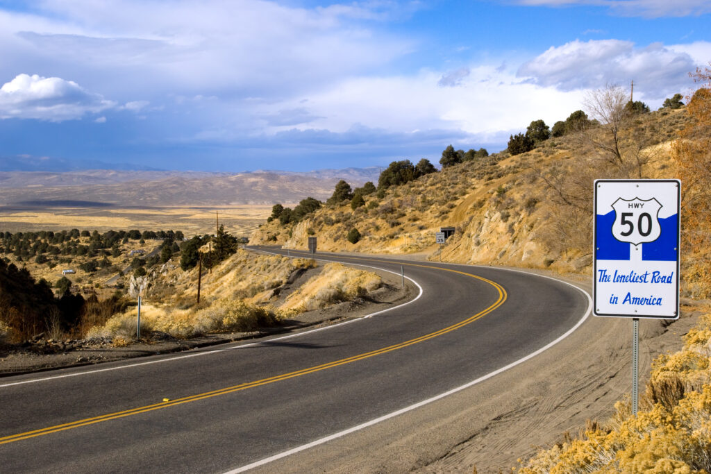
6. The Loneliest Road (U.S. Route 50): Crossing the Nevada Desert
Distance: 450 miles
Start: Sacramento, California
End: Ely, NV
Dubbed “The Loneliest Road in America,” U.S. Route 50 offers a starkly beautiful and remote drive across the Nevada desert. This route offers an opportunity to experience the vastness of the American West, with endless skies, rugged mountain ranges, and historic mining towns.

Soak in the solitude of this U.S. road trip, with long stretches of highway where you might not see another car for miles.
Roadtrippers Tip: Plan your trip with Autopilot™ to ensure you don’t miss out on the small towns, ghost towns, and natural wonders like Great Basin National Park along the way. The app can also help you locate fuel stops and accommodations on this remote route.
7. The Going-to-the-Sun Road: A Journey Through Glacier National Park
Distance: 50 miles
Start: West Glacier, Montana
End: St. Mary, Montana
The Going-to-the-Sun Road is a short but awe-inspiring drive through Glacier National Park in Montana. This route takes you over the Continental Divide, showcasing breathtaking views of snow-capped peaks, glacial lakes, and alpine meadows.
Highlights include the Weeping Wall, Logan Pass, and the crystal-clear waters of Lake McDonald. This drive is only open during the summer months, and is a must-do for anyone visiting Glacier National Park.
Roadtrippers Tip: Since this route is relatively short, use our app to add to your U.S. road trip map with nearby attractions like Whitefish, Montana, or the shimmering Flathead Lake. Our app’s mapping technology and user reviews can help you discover off-the-beaten-path hikes and scenic viewpoints.
8. The Alaska Highway: A Wilderness Adventure
Distance: 1,390 miles
Start: Dawson Creek, British Columbia
End: Delta Junction, Alaska
Don’t forget the non-continental U.S. when it comes to U.S. road trip maps. The Alaska Highway, also known as the Alcan, is a rugged and remote road trip through the wilds of Canada and Alaska.
Originally built during World War II, this route offers an unparalleled journey through pristine wilderness, with opportunities to see wildlife like bears, moose, and caribou. The drive takes you through the Canadian Rockies, past glacial rivers, and into the vast expanses of Alaska.
Key stops include Muncho Lake, the Liard River Hot Springs, and the historic town of Whitehorse.
Roadtrippers Tip: Use the app to plan your stops, including the best places for wildlife viewing, hot springs, and historic sites. Take advantage of our offline maps feature in this remote area where cell service can be spotty.
9. The Natchez Trace Parkway: A Journey Through History
Distance: 444 miles
Start: Natchez, Mississippi
End: Nashville, Tennessee
The Natchez Trace Parkway is a scenic drive that follows a historic travel corridor used by Native Americans, early European settlers, and Civil War soldiers. This peaceful route takes you through the dense forests of Mississippi, the rolling hills of Tennessee, and past numerous historic sites and landmarks. Highlights include the Emerald Mound, the second-largest Native American mound in the U.S., and the historic homes in Natchez.
Roadtrippers Tip: With Roadtrippers, you can easily find and explore the many historic sites along the Natchez Trace. Customize your trip to include stops at nature trails, scenic overlooks, and local Southern eateries.
10. The Oregon Trail: Tracing the Path of Pioneers
Distance: 2,170 miles
Start: Independence, Missouri
End: Oregon City, Oregon
The Oregon Trail is more than just a beloved computer game, it’s a road trip route that allows you to follow in the footsteps of pioneers who journeyed west in search of a better life.
This U.S. road trip starts in Independence, Missouri, taking you through the vast plains, over the Rocky Mountains, and into the lush landscapes of Oregon. Key stops include the Scotts Bluff National Monument, Fort Laramie, and the Snake River.
Roadtrippers Tip: Our app can help you find museums, historical landmarks, and authentic pioneer experiences along the way. Customize your U.S. road trip map right in the app to include modern amenities while still immersing yourself in the history of the Oregon Trail.
Planning a road trip can be a daunting task, especially when trying to make the most of iconic routes like these. That’s where the Roadtrippers crew can help.
With our interactive mapping tech, Roadtrippers allows you to easily plan your trip, discover hidden gems, and customize your journey based on your interests. Whether you’re looking for scenic viewpoints, unique accommodations, or local dining experiences, we can help you build the perfect U.S. road trip map in just a few clicks.
Try Roadtrippers Autopilot™ to start planning today.


